Beit HaArava
| Beit HaArava בֵּית הָעֲרָבָה | |
|---|---|
 | |
 Beit HaArava | |
| Coordinates: 31°48′29.51″N 35°28′32.87″E / 31.8081972°N 35.4757972°ECoordinates: 31°48′29.51″N 35°28′32.87″E / 31.8081972°N 35.4757972°E | |
| District | Judea and Samaria Area |
| Council | Megilot |
| Region | West Bank |
| Founded |
1939 (original) 1980 (re-establishment) |
| Founded by | Youth Aliyah members |
| Population (2015)[1] | 159 |
| Name meaning | House of the Arava |
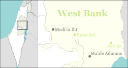
Beit HaArava (Hebrew: בֵּית הָעֲרָבָה, lit. House of the Arava) is an Israeli settlement and kibbutz in the West Bank. Located near the Dead Sea and Jericho at the eponymous Beit HaArava Junction, the intersection of Highway 1 and Highway 90, it falls under the jurisdiction of Megilot Regional Council. In 2015 it had a population of 159.
The international community considers Israeli settlements in the West Bank illegal under international law, but the Israeli government disputes this.[2]
History
The village was originally established in 1939 by European members of Zionist youth movements who had fled Nazi Germany to Mandatory Palestine via Youth Aliyah.[3] David Coren, later a member of the Knesset, was also amongst the founders. It was named after the biblical village of the same name (Joshua 18:22), located in the Arabah plain, and means "House in the Desert".[4] According to the Jewish National Fund, the Kibbutz became famous for its experiments in land reclamation, the residents reclaiming land that had never been previously cultivated.[4]
In 1947, Beit HaArava had a population of over 200.[4] On 20 May 1948, after a failure to reach an agreement with Transjordan's King Abdullah, Beit HaArava and the nearby Kalia were abandoned due to their isolation during the fighting of the 1948 Arab–Israeli War. The residents of the villages evacuated to the Israeli post at Sodom.[5] Its members were later temporarily housed in kibbutz Shefayim, and ultimately split into two groups which in 1949 founded the kibbutzim of Gesher HaZiv and Kabri in the Western Galilee.
In 1980, Beit HaArava was re-established as a Nahal outpost. It became a civilian community in 1986. In 2000, the site of village moved 5 kilometres westwards. Today Beit HaArava has 40 families, 30 of them members of the kibbutz, numbering approximately 150 people.
Economy
The world's largest operating solar pond for electricity generation was the Beit HaArava pond, which was operated until 1988. The pond had an area of 210,000 m² and produced an electrical output of 5 MW.[6]
References
| Wikimedia Commons has media related to Beit Ha'arava. |
- ↑ "List of localities, in Alphabetical order" (PDF). Israel Central Bureau of Statistics. Retrieved 16 October 2016.
- ↑ "The Geneva Convention". BBC News. 10 December 2009. Retrieved 27 November 2010.
- ↑ "Beit HaArava: Blooming in the salty earth" (in Hebrew). Ynet. 2005-05-13. Retrieved 2008-05-16.
- 1 2 3 Jewish National Fund (1949). Jewish Villages in Israel. Jerusalem: Hamadpis Liphshitz Press. p. 18.
- ↑ ed. Nur, Eviatar, ed. (1978). Carta's Atlas of Israel - The First Years 1948-1961. Jerusalem, Israel: Carta.
- ↑ Solar Ponds. "Solar Ponds, Solar Thermal Magazine". Solarthermalmagazine.com. Retrieved 2012-06-08.