Bessie, Oklahoma
| Bessie, Oklahoma | |
|---|---|
| Town | |
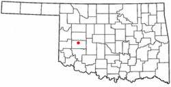 Location of Bessie, Oklahoma | |
| Coordinates: 35°23′08″N 98°59′22″W / 35.38542223°N 98.9893166°WCoordinates: 35°23′08″N 98°59′22″W / 35.38542223°N 98.9893166°W | |
| Country | United States |
| State | Oklahoma |
| County | Washita |
| Area | |
| • Total | 0.506962 sq mi (1.313026 km2) |
| • Land | 0.506962 sq mi (1.313026 km2) |
| • Water | 0.0 sq mi (0.0 km2) |
| Elevation | 1,552 ft (473 m) |
| Population (2010) | |
| • Total | 181 |
| • Density | 360/sq mi (140/km2) |
| Time zone | Central (CST) (UTC-6) |
| • Summer (DST) | CDT (UTC-5) |
| ZIP code | 73622 |
| Area code(s) | 580 |
| FIPS code | 40-05650[1] |
| GNIS feature ID | 1090021[2] |
Bessie is a town in Washita County, Oklahoma, United States. The population was 181 at the 2010 census, a 4.7 percent decline from 190 in 2000.[3]
History
A post office called Bessie has been in operation since 1903.[4] Some say Bessie was the name of the wife of a railroad official, while others believe the town derives its name from the Blackwell, Enid and Southwestern Railway (BES Line).[5]
Geography
Bessie is located at 35°23′9″N 98°59′19″W / 35.38583°N 98.98861°W (35.385932, -98.988679).[6]
According to the United States Census Bureau, the town has a total area of 0.5 square miles (1.3 km2), all land.
Climate
| Climate data for Bessie, Oklahoma | |||||||||||||
|---|---|---|---|---|---|---|---|---|---|---|---|---|---|
| Month | Jan | Feb | Mar | Apr | May | Jun | Jul | Aug | Sep | Oct | Nov | Dec | Year |
| Average high °F (°C) | 48.9 (9.4) |
54.1 (12.3) |
64 (18) |
74.1 (23.4) |
81.9 (27.7) |
90.9 (32.7) |
96.3 (35.7) |
94.6 (34.8) |
85.9 (29.9) |
75.1 (23.9) |
60.8 (16) |
50.6 (10.3) |
73.1 (22.8) |
| Average low °F (°C) | 24.2 (−4.3) |
28.7 (−1.8) |
37.2 (2.9) |
47.2 (8.4) |
56.3 (13.5) |
64.9 (18.3) |
70.1 (21.2) |
68.4 (20.2) |
60.9 (16.1) |
49.5 (9.7) |
37.5 (3.1) |
27.5 (−2.5) |
47.7 (8.7) |
| Average precipitation inches (mm) | 0.9 (23) |
1.2 (30) |
2 (50) |
2 (50) |
4.7 (119) |
3.9 (99) |
1.9 (48) |
3.1 (79) |
3.6 (91) |
2.5 (64) |
1.8 (46) |
0.9 (23) |
28.4 (721) |
| Source: Weatherbase.com [7] | |||||||||||||
Demographics
| Historical population | |||
|---|---|---|---|
| Census | Pop. | %± | |
| 1920 | 363 | — | |
| 1930 | 415 | 14.3% | |
| 1940 | 284 | −31.6% | |
| 1950 | 205 | −27.8% | |
| 1960 | 226 | 10.2% | |
| 1970 | 210 | −7.1% | |
| 1980 | 245 | 16.7% | |
| 1990 | 242 | −1.2% | |
| 2000 | 190 | −21.5% | |
| 2010 | 181 | −4.7% | |
| Est. 2015 | 182 | [8] | 0.6% |
As of the census[1] of 2000, there were 190 people, 87 households, and 56 families residing in the town. The population density was 370.6 people per square mile (143.8/km²). There were 95 housing units at an average density of 185.3 per square mile (71.9/km²). The racial makeup of the town was 96.32% White, 2.11% Native American, 0.53% Asian, and 1.05% from two or more races. Hispanic or Latino of any race were 1.58% of the population.
There were 87 households out of which 31.0% had children under the age of 18 living with them, 51.7% were married couples living together, 6.9% had a female householder with no husband present, and 35.6% were non-families. 32.2% of all households were made up of individuals and 16.1% had someone living alone who was 65 years of age or older. The average household size was 2.18 and the average family size was 2.73.
In the town the population was spread out with 22.6% under the age of 18, 7.4% from 18 to 24, 27.9% from 25 to 44, 23.2% from 45 to 64, and 18.9% who were 65 years of age or older. The median age was 41 years. For every 100 females there were 128.9 males. For every 100 females age 18 and over, there were 107.0 males.
The median income for a household in the town was $26,111, and the median income for a family was $26,806. Males had a median income of $25,938 versus $19,000 for females. The per capita income for the town was $15,110. About 5.5% of families and 10.1% of the population were below the poverty line, including 5.4% of those under the age of eighteen and none of those sixty five or over.
References
- 1 2 "American FactFinder". United States Census Bureau. Archived from the original on 2013-09-11. Retrieved 2008-01-31.
- ↑ "US Board on Geographic Names". United States Geological Survey. 2007-10-25. Retrieved 2008-01-31.
- ↑ CensusViewer .
- ↑ "Washita County". Jim Forte Postal History. Retrieved 14 November 2015.
- ↑ "Oklahoma's Strangely Named Towns". KWTV. Archived from the original on August 22, 2001. Retrieved 14 November 2015.
- ↑ "US Gazetteer files: 2010, 2000, and 1990". United States Census Bureau. 2011-02-12. Retrieved 2011-04-23.
- ↑ "Historical Weather for Bessie, Oklahoma, United States".
- ↑ "Annual Estimates of the Resident Population for Incorporated Places: April 1, 2010 to July 1, 2015". Retrieved July 2, 2016.
- ↑ "Census of Population and Housing". Census.gov. Archived from the original on May 11, 2015. Retrieved June 4, 2015.
External links
Municipalities and communities of Washita County, Oklahoma, United States | ||
|---|---|---|
| Cities | 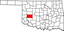 | |
| Towns | ||
| Unincorporated communities |
| |
| Footnotes | ‡This populated place also has portions in an adjacent county or counties | |