Besshø
| Besshø | |
|---|---|
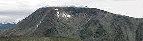 Seen from Veslfjellet, the highest point on the Besseggen hiking trail | |
| Highest point | |
| Elevation | 2,258 m (7,408 ft) |
| Prominence | 650 m (2,130 ft) |
| Coordinates | 61°31′04″N 8°41′13″E / 61.51778°N 8.68694°ECoordinates: 61°31′04″N 8°41′13″E / 61.51778°N 8.68694°E |
| Geography | |
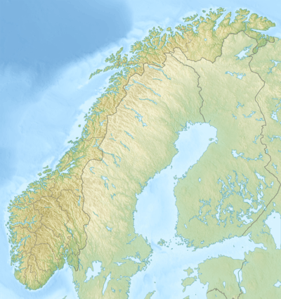 Besshø Norway | |
| Location | Vågå, Oppland, Norway |
| Parent range | Jotunheimen |
| Topo map | 1618 III Glittertinden |
Besshø (official form on maps: Besshøe), is a mountain in Vågå, Oppland, Norway, and is part of the Jotunheimen mountain range. It lies right above Bessvatnet, along the Besseggen hiking trail. On the mountain's north-eastern side a small cirque glacier, and is surrounded by a large ice-cored moraine, a relatively rare feature in Norway.
From Besseggen there is a nice view over Gjende and Bessvatnet. Gjende is about 400 m lower than Bessvatnet. While Bessvatnet has a blue colour common to lakes, Gjende has a green colour due to glacier runoff depositing clay into the lake (rock flour).
Toponymy
The mountain is named after Bessvatnet, the last element is the finite form of hø for "large and round mountain".
This article is issued from Wikipedia - version of the 5/28/2015. The text is available under the Creative Commons Attribution/Share Alike but additional terms may apply for the media files.