Bertem
| Bertem | |||
|---|---|---|---|
| Municipality | |||
|
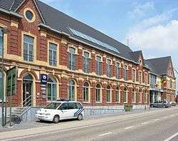
Bertem town hall | |||
| |||
 Bertem Location in Belgium | |||
|
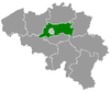
Location of Bertem in Flemish Brabant 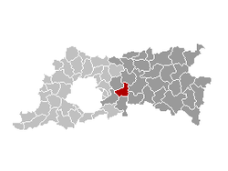 | |||
| Coordinates: 50°51′N 04°37′E / 50.850°N 4.617°ECoordinates: 50°51′N 04°37′E / 50.850°N 4.617°E | |||
| Country | Belgium | ||
| Community | Flemish Community | ||
| Region | Flemish Region | ||
| Province | Flemish Brabant | ||
| Arrondissement | Leuven | ||
| Government | |||
| • Mayor | Albert Mees (GB-VLD) | ||
| • Governing party/ies | GB-VLD, SP.A | ||
| Area | |||
| • Total | 29.75 km2 (11.49 sq mi) | ||
| Population (1 January 2016)[1] | |||
| • Total | 9,803 | ||
| • Density | 330/km2 (850/sq mi) | ||
| Postal codes | 3060, 3061 | ||
| Area codes | 016 - 02 | ||
| Website | www.bertem.be | ||


Bertem (Dutch pronunciation: [ˈbɛrtɛm]) is a municipality located in the Belgian province of Flemish Brabant. The municipality comprises the towns of Bertem proper, Korbeek-Dijle and Leefdaal. On January 1, 2006, Bertem had a total population of 9,215. The total area is 29.75 km² which gives a population density of 310 inhabitants per km².
The area is noted for its rural landscape, in particular the Koeheide and Bertembos ("Bertem Forest"). On the open plains of Leefdaal, it is possible to see the endangered European Hamster (Cricetus cricetus) (external link European Hamster). The village of Bertem itself is home to the Sint-Pieters-Bandenkerk, a romanesque church built between 950 and 1050.
See also
References
- ↑ Population per municipality as of 1 January 2016 (XLS; 397 KB)
External links
-
 Media related to Bertem at Wikimedia Commons
 - bertem.be
- VC. Bertem-Leefdaal, the local soccer club of Bertem
- koeheide.be
- Gazetteer Entry
- Sint-Pieters-Bandenkerk (in Dutch)
 |
Kortenberg | Herent | | |
| |
Leuven | |||
| ||||
| | ||||
| Tervuren | Huldenberg | Oud-Heverlee |
This article is issued from Wikipedia - version of the 11/30/2016. The text is available under the Creative Commons Attribution/Share Alike but additional terms may apply for the media files.