Berrynarbor


Coordinates: 51°12′00″N 4°04′00″W / 51.2°N 4.066667°W
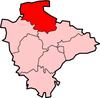
Berrynarbor is a village and civil parish in the North Devon district of Devon, England. According to the 2001 census it had a population of 749, increasing to 802 at the 2011 census.[1] The village is located near Exmoor and is about three miles east of Ilfracombe. It is also the neighbour of Combe Martin.
Amenities and Landmarks
The village contains a small school, Berrynarbor VC Primary School which is voluntary controlled, and a voluntary controlled and run village shop. Other shops in the village's area are on the Mill Park camp-site and, during the summer, on Watermouth Valley Camping Park, which is on the scenic walk to Watermouth Harbour. There are two pubs: Ye Olde Globe which is a character village pub, and The Sawmill Inn which is on the outskirts of the village. There are guest houses and tearooms, along with the St Peter's Church in the main village square and Watermouth Castle.
St Peter's Church has a 15th-century tower, a 17th-century lychgate and a Norman font. The church tenor bell was recently restored through donations from the village and can now be heard every Sunday morning during the church service.
History
Berrie family
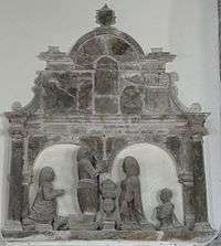

The Berrie family were lords of the manor of "Berrie Nerbert" in the 17th century, as the inscriptions on the two tablets under the Berrie mural monument witness. The tablet underneath to the left is inscribed:
"Here lyeth enterred the body of Richard Berrie Esq.r Lord of this Manour of Berrie Nerbert. A man of much wisdom and gravitie hee maryed to his first wife Mary daughter of S.r William Kirkham of Blackdon in this countie of Devon, knight, but by her had noe [no] issue. And to his second wife he maryed [married] Dorothey eldest daughter of George Turvile of Aston Flamvil in the countie of Leycester, Esq."
The family of Kirkham were of ancient origin, seated at Pinhoe near Exeter, at Blagdon in the parish of Paignton and at Collaton St Mary, near Paignton. Sir John Kirkham of Pinhoe was Sheriff of Devon in 1523. His second son was Richard Kirkham, father of Sir William Kirkham who married into the family of Tichborne of Hampshire.[2] Thomas Kirkham of Blagdon, Clovelly was the father of George Kirkham, MP for Devon 1525-82.[3] The tablet underneath to the right is inscribed:
"Shoewing her deare love and affection to her husband caused this monument to bee erected to his memorie and by her hee had issue John Berrie Esq.r his sonn and heire and Kataryne that dyed younge. Hee departed this life the 9th day of May Anno D(omi)ni 1645 aetat(is suae) 63".
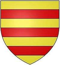
Bassett family
The manor later came into the possession of the Bassett family, previously seated at Heanton Punchardon, which in the 19th century built Watermouth Castle within the manor, for their principal residence.
Localities
Berrynarbor has within its purview to all sides a mixture of dense woodlands and farms and lies within the North Devon Area of Outstanding Natural Beauty.[4]
Lee
51°12′00″N 4°03′54″W / 51.200°N 04.065°W
Directly adjoining the village to the west is the neighbourhood or locality of Lee, divided into Lee Wood and three main estates, few of which are subdivided as each is a relatively small mixed residential/agricultural holding Middle Lee, North Lee and South Lee.
Hagginton Hill and Goosewell
51°12′18″N 4°04′12″W / 51.205°N 04.070°W
Contiguous to Lee, climbing the road to Ilfracombe in a long northern curve is a line of property forming these settlements. East Hagginton within the manor of Berrynarbor was an estate mentioned in the Domesday Book of 1086.[5]
Steridge
51°11′42″N 4°04′12″W / 51.195°N 04.070°W
Lying along the valley floor to the south is another unbroken line of properties named Steridge, connected to the main village centre, occupying the lower Steridge Valley slightly higher than the village. Steep wooded slopes here give rise to springs, and on one eastern slope is the park homes resort/retreat of Berrynarbor Park here.
Watermouth
51°12′54″N 4°03′54″W / 51.215°N 04.065°W
Watermouth to the north becomes a substantial hamlet in holiday season and its wide sandy outlet, as the name implies is directly beneath its castle.
Watermouth Castle here is a Grade II* listed country home, started 1825-6 with final works 1845 by George Wightwick.[6] The Bassett family mentioned above sold this in 1946 to assist in paying an inheritance tax bill.
Awards
Berrynarbor has won many awards including Best Kept Village and Britain in Bloom. The community shop which opened in 2008 won the 2008 Countryside Alliance Award for the best village shop/post office in the South West of England.
Tradition
Every year the village hosts a show which involves some of the locals and primary school children. In July the school hosts a fete in the Manor hall and park. This helps raise money for various charities.
References
- ↑ "Parish population 2011". Retrieved 8 April 2015.
- ↑ Westcote, Thomas, A View of Devonshire in 1630; Lysons, Samuel, Magna Britannia; Worthy, Charles, History of the Suburbs of Exeter: The Parish of Pinhoe, pp.127-8
- ↑ History of Parliament biography
- ↑ Grid square map Ordnance survey website
- ↑ Hoskins, W.G., A New Survey of England: Devon, London, 1959 (first published 1954), p.333
- ↑ Historic England. "Details from listed building database (1168686)". National Heritage List for England.
External links
| Wikimedia Commons has media related to Berrynarbor. |