Bernardo de Irigoyen, Misiones
| Bernardo de Irigoyen | |
|---|---|
| City | |
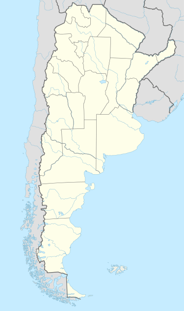 Bernardo de Irigoyen Location of Bernardo de Irigoyen in Argentina | |
| Coordinates: 26°15′S 53°59′W / 26.250°S 53.983°WCoordinates: 26°15′S 53°59′W / 26.250°S 53.983°W | |
| Country |
|
| Province | Misiones |
| Department | General Manuel Belgrano |
| Elevation | 835 m (2,740 ft) |
| Population | |
| • Total | 10,889 |
| Time zone | ART (UTC-3) |
| CPA base | N3366 |
| Dialing code | +54 3741 |
Bernardo de Irigoyen is a city in the province of Misiones, Argentina. It has 10,889 inhabitants as per the 2001 census [INDEC], and is the head town of the General Manuel Belgrano Department. It carries the name of prominent politician and diplomat Bernardo de Irigoyen.
Location
The city is located in the easternmost point of Argentina, on the border with Brazil, next to Dionísio Cerqueira (state of Santa Catarina) and Barracão (state of Paraná), an important entrance to the country. It lies on Barracón Hill, at an altitude of 835 m, the highest point in Misiones, by National Route 14, which connects the Argentine Mesopotamia with other regions of the country.
The municipality contains part of the 84,000 hectares (210,000 acres) Urugua-í Provincial Park, created in 1990.[1]
Climate
| Climate data for Bernardo de Irigoyen, Misiones | |||||||||||||
|---|---|---|---|---|---|---|---|---|---|---|---|---|---|
| Month | Jan | Feb | Mar | Apr | May | Jun | Jul | Aug | Sep | Oct | Nov | Dec | Year |
| Record high °C (°F) | 33.2 (91.8) |
34.0 (93.2) |
32.7 (90.9) |
31.0 (87.8) |
29.1 (84.4) |
25.8 (78.4) |
27.3 (81.1) |
31.8 (89.2) |
34.0 (93.2) |
32.5 (90.5) |
33.3 (91.9) |
37.0 (98.6) |
37.0 (98.6) |
| Average high °C (°F) | 28.1 (82.6) |
26.7 (80.1) |
26.5 (79.7) |
23.7 (74.7) |
20.5 (68.9) |
19.0 (66.2) |
19.2 (66.6) |
21.7 (71.1) |
22.3 (72.1) |
24.2 (75.6) |
26.4 (79.5) |
27.7 (81.9) |
23.8 (74.8) |
| Daily mean °C (°F) | 22.0 (71.6) |
21.2 (70.2) |
20.8 (69.4) |
18.6 (65.5) |
15.8 (60.4) |
14.3 (57.7) |
14.2 (57.6) |
16.4 (61.5) |
16.5 (61.7) |
18.2 (64.8) |
20.2 (68.4) |
21.5 (70.7) |
18.3 (64.9) |
| Average low °C (°F) | 19.1 (66.4) |
18.2 (64.8) |
17.8 (64) |
15.7 (60.3) |
13.0 (55.4) |
11.3 (52.3) |
11.0 (51.8) |
13.2 (55.8) |
13.1 (55.6) |
15.2 (59.4) |
16.9 (62.4) |
18.4 (65.1) |
15.2 (59.4) |
| Record low °C (°F) | 9.8 (49.6) |
9.1 (48.4) |
5.9 (42.6) |
1.7 (35.1) |
−1.0 (30.2) |
−1.7 (28.9) |
−3.7 (25.3) |
−3.1 (26.4) |
−0.5 (31.1) |
−3.1 (26.4) |
5.1 (41.2) |
7.7 (45.9) |
−3.7 (25.3) |
| Average precipitation mm (inches) | 184.2 (7.252) |
237.3 (9.343) |
174.3 (6.862) |
196.2 (7.724) |
216.4 (8.52) |
208.5 (8.209) |
159.8 (6.291) |
145.8 (5.74) |
193.9 (7.634) |
245.3 (9.657) |
209.7 (8.256) |
173.9 (6.846) |
2,345.3 (92.335) |
| Average relative humidity (%) | 73 | 79 | 75 | 76 | 72 | 75 | 71 | 68 | 71 | 77 | 70 | 72 | 73 |
| Source #1: Secretaria de Mineria[2] | |||||||||||||
| Source #2: Oficina de Riesgo Agropecuario (record highs and lows)[3] | |||||||||||||
References
- ↑ Parque Provincial "Urugua-í" (in Spanish), Ministerio de Ecología y RNR de la Provincia de Misiones, retrieved 2016-11-09
- ↑ "Provincia de Misiones - Clima Y Meteorologia" (in Spanish). Secretaria de Mineria de la Nacion (Argentina). Archived from the original on September 26, 2011. Retrieved July 6, 2015.
- ↑ "Bernardo de Irigoyen, Misiones". Estadísticas meteorológicas decadiales (in Spanish). Oficina de Riesgo Agropecuario. Retrieved September 4, 2015.
- Municipal information: Municipal Affairs Federal Institute (IFAM), Municipal Affairs Secretariat, Ministry of Interior, Argentina. (Spanish)