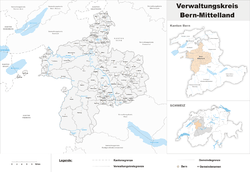
Bern-Mittelland (administrative district)
| Bern-Mittelland District Verwaltungskreis Bern-Mittelland | |
|---|---|
| District | |
 | |
| Country |
|
| Canton |
|
| Capital | Ostermundigen |
| Area | |
| • Total | 947 km2 (366 sq mi) |
| Population (2015) | |
| • Total | 406,328 |
| • Density | 430/km2 (1,100/sq mi) |
| Time zone | CET (UTC+1) |
| • Summer (DST) | CEST (UTC+2) |
| Municipalities | 85 |
Bern-Mittelland District in the Canton of Bern was created on 1 January 2010.[1] It is part of the Bern-Mittelland administrative region, and is the only district in the region. It contains 96 municipalities with an area of 946.30 km2 (365.37 sq mi) and a population (as of 2015) of 406,328.[2]
It is made up of the valley of the rivers Aare and Emme, some of the foothills of the Bernese Alps, as well as the plain around the capital Bern, and has many small farms and hilly forested regions with small to mid-sized towns scattered throughout. It is perhaps best known by foreigners and visitors for the Emmental. The classic Swiss cheese with holes Emmentaler comes from this region's forests and pastures, of hilly and low mountainous countryside in the 1,000 to 2,000 m (3,300 to 6,600 ft) m range.
Municipalities
| Flag | Name | Population (31 December 2015)[3] |
Area in km² |
|---|---|---|---|
| |
Allmendingen | 545 | 3.80 |
| |
Arni | 922 | 10.44 |
| |
Bäriswil | 1,023 | 2.72 |
| |
Belp | 11,548 | 23.29 |
| |
Bern | 131,554 | 51.61 |
| |
Biglen | 1,745 | 3.61 |
| |
Bolligen | 6,138 | 16.56 |
| |
Bowil | 1,370 | 14.69 |
| |
Bremgarten bei Bern | 4,385 | 1.91 |
| |
Brenzikofen | 519 | 2.20 |
| |
Clavaleyres | 49 | 1.01 |
| |
Deisswil bei Münchenbuchsee | 85 | 2.14 |
| |
Diemerswil | 204 | 2.86 |
| |
Ferenbalm | 1,234 | 9.18 |
| |
Fraubrunnen | 4,889 | 31.97 |
| |
Frauenkappelen | 1,207 | 9.31 |
| |
Freimettigen | 469 | 2.95 |
| |
Gelterfingen | 269 | 3.50 |
| |
Gerzensee | 1,163 | 7.79 |
| |
Golaten | 314 | 2.79 |
| |
Grosshöchstetten | 3,516 | 3.47 |
| |
Guggisberg | 1,550 | 54.92 |
| |
Gurbrü | 246 | 1.84 |
| |
Häutligen | 249 | 3.0 |
| |
Herbligen | 600 | 2.77 |
| |
Iffwil | 423 | 5.07 |
| |
Ittigen | 11,390 | 4.21 |
| |
Jaberg | 252 | 1.32 |
| |
Jegenstorf | 5,609 | 13.5 |
| |
Kaufdorf | 1,061 | 2.04 |
| |
Kehrsatz | 4,226 | 4.44 |
| |
Kiesen | 924 | 4.69 |
| |
Kirchdorf | 956 | 6.10 |
| |
Kirchenthurnen | 279 | 1.24 |
| |
Kirchlindach | 2,900 | 11.97 |
| |
Köniz | 40,214 | 50.98 |
| |
Konolfingen | 5,225 | 12.79 |
| |
Kriechenwil | 422 | 4.76 |
| |
Landiswil | 625 | 10.26 |
| |
Laupen | 3,079 | 4.11 |
| |
Linden | 1,277 | 13.23 |
| |
Lohnstorf | 235 | 1.80 |
| |
Mattstetten | 561 | 3.82 |
| |
Meikirch | 2,386 | 10.22 |
| |
Mirchel | 626 | 2.35 |
| |
Moosseedorf | 4,012 | 6.34 |
| |
Mühleberg | 2,854 | 26.21 |
| |
Mühledorf | 245 | 2.32 |
| |
Mühlethurnen | 1,395 | 2.94 |
| |
Münchenbuchsee | 9,947 | 8.82 |
| |
Münchenwiler | 480 | 2.50 |
| |
Münsingen | 11,813 | 12.11 |
| |
Muri bei Bern | 12,984 | 7.64 |
| |
Neuenegg | 5,194 | 21.87 |
| |
Niederhünigen | 606 | 5.40 |
| |
Niedermuhlern | 463 | 7.24 |
| |
Noflen | 304 | 2.71 |
| |
Oberbalm | 883 | 12.42 |
| |
Oberdiessbach | 3,522 | 16.46 |
| |
Oberhünigen | 317 | 6.03 |
| |
Oberthal | 739 | 10.51 |
| |
Oppligen | 658 | 3.40 |
| |
Ostermundigen | 16,788 | 5.96 |
| |
Riggisberg | 2,452 | 29.83 |
| |
Rubigen | 2,920 | 6.93 |
| |
Rüeggisberg | 1,819 | 35.79 |
| |
Rümligen | 436 | 4.65 |
| |
Rüschegg | 1,607 | 57.27 |
| |
Schlosswil | 630 | 3.45 |
| |
Schwarzenburg | 6,857 | 44.88 |
| |
Stettlen | 3,149 | 3.52 |
| |
Tägertschi | 386 | 3.64 |
| |
Toffen | 2,527 | 4.91 |
| |
Urtenen-Schönbühl | 6,211 | 7.18 |
| |
Vechigen | 5,252 | 24.82 |
| |
Wald | 1,181 | 13.30 |
| |
Walkringen | 1,772 | 17.19 |
| |
Wichtrach | 4,115 | 11.57 |
| |
Wiggiswil | 98 | 1.44 |
| |
Wileroltigen | 384 | 4.16 |
| |
Wohlen bei Bern | 8,987 | 36.33 |
| |
Worb | 11,449 | 21.10 |
| |
Zäziwil | 1,642 | 5.42 |
| |
Zollikofen | 10,217 | 5.38 |
| |
Zuzwil | 570 | 3.46 |
| Total (85) | 406,328 | 946.30 | |
Mergers and name changes
- On 1 January 2011 the former municipalities of Albligen and Wahlern merged to form the new municipality of Schwarzenburg.[4]
- The municipality of Belpberg merged on 1 January 2012 into the municipality of Belp.[5]
- On 1 January 2014 the former municipality of Bleiken bei Oberdiessbach merged into the municipality of Oberdiessbach. The former municipalities of Büren zum Hof, Etzelkofen, Grafenried, Limpach, Mülchi, Schalunen and Zauggenried merged into the municipality of Fraubrunnen, the former municipality of Münchringen and Scheunen merged into the municipality of Jegenstorf.[4]
Demographics
Bern-Mittelland has a population (as of December 2015) of 406,328. As of 2008, the population was 48.3% male and 51.7% female. The population was made up of 156,642 Swiss men (40.3% of the population) and 31,135 (8.0%) non-Swiss men. There were 172,829 Swiss women (44.5%) and 2,794 (0.7%) non-Swiss women.[6]
Notes and references
- ↑ Amtliches Gemeindeverzeichnis der Schweiz, Mutationsmeldungen 2009 / Répertoire officiel des communes de Suisse, Mutations 2009 / Elenco ufficiale dei Comuni della Svizzera, Mutazione 2009 (PDF) (Report). Federal Statistical Office. 2009. 2776. Archived from the original (PDF) on 18 November 2010. Retrieved 6 March 2010.
- ↑ Swiss Federal Statistical Office - STAT-TAB, online database – Ständige und nichtständige Wohnbevölkerung nach institutionellen Gliederungen, Geburtsort und Staatsangehörigkeit (German) accessed 30 August 2016
- ↑ Swiss Federal Statistical Office - STAT-TAB, online database – Ständige und nichtständige Wohnbevölkerung nach institutionellen Gliederungen, Geburtsort und Staatsangehörigkeit (German) accessed 30 August 2016
- 1 2 Nomenklaturen – Amtliches Gemeindeverzeichnis der Schweiz (German) accessed 4 April 2011
- ↑ Amtliches Gemeindeverzeichnis der Schweiz published by the Swiss Federal Statistical Office (German) accessed 21 December 2011
- ↑ Statistical office of the Canton of Bern (German) accessed 4 January 2012
Coordinates: 46°57′N 7°29′E / 46.950°N 7.483°E
- 1 2 "Karte der Verwaltungskreise und Verwaltungsregionen" (PDF) (PDF) (in German). Thun, Berne: Justiz-, Gemeinde- und Kirchendirektion, Canton of Berne. 1 January 2015. Retrieved 2015-10-14.
- 1 2 "Regierungsstatthalterämter" (in German). Thun, Berne: Justiz-, Gemeinde- und Kirchendirektion, Canton of Berne. Retrieved 2015-10-14.