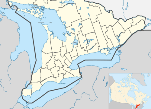
Kitchener, Ontario
| Kitchener | |||
|---|---|---|---|
| City (lower-tier) | |||
| City of Kitchener | |||
|
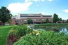
View of Downtown Kitchener | |||
| |||
| Motto: Ex industria prosperitas (Latin: Prosperity through industry) | |||
 Location of Kitchener in Waterloo Region | |||
 Kitchener Location of Kitchener in southern Ontario | |||
| Coordinates: 43°27′N 80°29′W / 43.450°N 80.483°WCoordinates: 43°27′N 80°29′W / 43.450°N 80.483°W | |||
| Country | Canada | ||
| Province | Ontario | ||
| Region | Waterloo | ||
| Founded | 1833 | ||
| Incorporated | 1853 | ||
| Incorporated | 1912 (city) | ||
| Government | |||
| • Mayor | Berry Vrbanovic | ||
| Area[1][2] | |||
| • City (lower-tier) | 136.89 km2 (52.85 sq mi) | ||
| • Land | 136.89 km2 (52.85 sq mi) | ||
| • Urban | 313.85 km2 (121.18 sq mi) | ||
| • Metro | 827.07 km2 (319.33 sq mi) | ||
| Population (2011)[1][2] | |||
| • City (lower-tier) | 219,153 (22nd) | ||
| • Density | 1,602.1/km2 (4,149/sq mi) | ||
| • Urban | 441,380 (10th) | ||
| • Urban density | 1,346.2/km2 (3,487/sq mi) | ||
| • Metro | 477,160 (10th) | ||
| • Metro density | 577/km2 (1,490/sq mi) | ||
| Time zone | EST (UTC−5) | ||
| • Summer (DST) | EDT (UTC−4) | ||
| Forward sortation area | N2A to N2R | ||
| Area code(s) | 519 and 226 | ||
| Website | www.kitchener.ca | ||
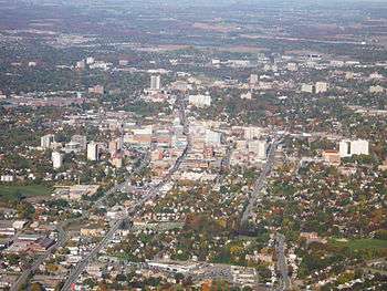

The City of Kitchener /ˈkɪtʃᵻnər/ is a city in Southern Ontario, Canada. Located approximately 100 km west of Toronto, Kitchener is the seat of the Regional Municipality of Waterloo. It was the Town of Berlin from 1854 until 1912 and the City of Berlin from 1912 until 1916. The city had a population of 219,153 in the 2011 Census and a population of 239,900 at year end 2015 as estimated by the Region of Waterloo.[3] The metropolitan area, which includes the neighbouring cities of Waterloo and Cambridge, has 507,096 people,[4] making it the tenth largest Census Metropolitan Area (CMA) in Canada and the fourth largest CMA in Ontario.[5] The city is adjacent to the smaller cities of Cambridge to the south, and Waterloo to the north. Kitchener and Waterloo are often referred to jointly as "Kitchener-Waterloo" (K-W), although they have separate municipal governments. Including Cambridge, the three cities are known as "the Tri-Cities".
The City of Kitchener covers an area of 136.86 square kilometres.
Geography and climate
Geography
Kitchener is located in Southwestern Ontario, in the Saint Lawrence Lowlands. This geological and climatic region has wet-climate soils and deciduous forests. Located in the Grand River Valley, the area is generally above 300m (1000') in elevation.
Kitchener is the largest city situated within the Grand River watershed, and the largest city on the Haldimand Tract. Just to the west of the city is Baden Hill, in Wilmot Township. This glacial kame remnant formation is the highest elevation for many miles around. The other dominant glacial feature is the Waterloo Moraine, which snakes its way through the region and holds a significant quantity of artesian wells, from which the city derives most of its drinking water. The settlement's first name, Sandhills, is an accurate description of the higher points of the moraine.
Climate
Kitchener has a humid continental climate of the warm summer subtype (Dfb under the Köppen climate classification); there are large seasonal differences, usually warm and humid summers and cold to occasionally very cold winters. Winter-like conditions generally last from the mid-December until mid-March, while summer temperatures generally occur between mid-May to close to the end of September. March 2012 went down in the history books for Kitchener - between 16 and 22 March, temperatures ranged from 21.4 °C (70.5 °F) to 27.0 °C (80.6 °F)—7 record highs in a row. 19 March high of 24 °C (75.2 °F) is one of the highest winter temperatures ever recorded, while 22 March high of 27 °C (80.6 °F) is the highest for March in this area. Temperatures during the year can exceed 30 °C (86.0 °F) in the summer and drop below −20 °C (−4.0 °F) in the winter several times a year, but prolonged periods of extreme temperatures are rare. The frost-free period for Kitchener averages about 147 frost-free days a year,[6] a much more limited number than cities on the Great Lakes due its inland location and higher elevation. Snowfall averages 160 centimetres (63 in) per year, high but not nearly as areas more directly affected by lake effect snow.
The highest temperature ever recorded in Kitchener was 38.3 °C (101 °F) on August 6 & 7, 1918 and July 27, 1941.[7][8] The coldest temperature ever recorded was −34.1 °C (−29.4 °F) on February 16, 2015.[9]
| Climate data for Region of Waterloo International Airport, 1981−2010 normals, extremes 1914−present[lower-alpha 1] |
|---|
History

Early-European settlement
In 1784, the land that Kitchener was built upon was an area given to the Six Nations by the British as a gift for their allegiance during the American Revolution; 240,000 hectares of land to be exact. From 1796 and 1798, the Six Nations sold 38,000 hectares of this land to a Loyalist by the name of Colonel Richard Beasley. The portion of land that Beasley had purchased was remote but it was of great interest to German Mennonite farming families from Pennsylvania. They wanted to live in an area that would allow them to practice their beliefs without persecution. Eventually, the Mennonites purchased all of Beasley's unsold land creating 160 farm tracts. By 1800, the first buildings were built,[14] and over the next decade several families made the difficult trip north to what was then known as the Sand Hills. One of these Mennonite families, arriving in 1807, were the Schneiders, whose restored 1816 home (the oldest building in the city) is now a museum located in the heart of Kitchener.[15] Other families whose names can still be found in local place names were the Bechtels, the Ebys, the Erbs, the Weavers (better known today as the Webers), the Cressmans and the Brubachers. In 1816 the Government of Upper Canada designated the settlement the Township of Waterloo.
Much of the land, made up of moraines and swampland interspersed with rivers and streams, was converted to farmland and roads. Wild pigeons, which once swarmed by the tens of thousands, were driven from the area. Apple trees were introduced to the region by John Eby in the 1830s, and several grist- and sawmills (most notably Joseph Schneider's 1816 sawmill, John and Abraham Erb's grist- and sawmills and Eby's cider mill) were erected throughout the area. Schneider built the town's first road, from his home to the corner of King Street and Queen Street (then known as Walper corner). $1000 was raised by the settlers to extend the road from Walper corner to Huether corner, where the Huether Brewery was built and the Huether Hotel now stands; a petition to the government for $100 to assist in completing the project was denied.
Immigration to the town increased considerably from 1816 until the 1870s, many of the newcomers being of German (particularly Lutheran, and Mennonite) extraction. Some were from Switzerland, like the founder of The Arthur Pequegnat Clock Company. In 1833 the town was renamed Berlin because of the recent German immigration from the Breuckmann family, and in 1853 Berlin became the County Seat of the newly created County of Waterloo, elevating it to the status of Village.
Post 1850
The extension of the Grand Trunk Railway from Sarnia to Toronto (and hence through Berlin) in July 1856 was a major boon to the community, helping to improve industrialization in the area. Immigrants from Germany, mostly Lutheran and Catholic, dominated the city after 1850 and developed their own newer German celebrations, and influences, such as the Turner societies, gymnastics, and band music. On 9 June 1912, Berlin was officially designated a city.[16] Anti-German sentiment during World War I led to the abandonment of much of this heritage. For example, churches switched to English-language services. In 1916, following much debate and controversy, the name of the city was changed to Kitchener; named after the late British Field Marshal The 1st Earl Kitchener.[16] After the war, local historians and civic groups promoted a new heritage that emphasized the county's Pennsylvania Dutch roots. Illustrated souvenir books, a popular novel, and site markers celebrated this simplified, nationalistic version of the founding.[17]
On 17 September 1981, the first-ever "blue box" recycling program in the world was launched in Kitchener.[18] Today, more than 90% of Ontario households have access to recycling programs and annually they divert more than 650,000 tonnes of secondary resource materials. The blue box program has expanded in various forms throughout Canada and to countries around the world such as the United States, United Kingdom, France and Australia, serving more than 40 million households around the world.
Economy
Kitchener’s economic heritage is rooted in manufacturing. Industrial artifacts are located in public places throughout the city as a celebration of its manufacturing history.[19] While the local economy’s reliance on manufacturing has decreased in recent years, 20.36% of the labour force remains employed in the manufacturing sector.[20]
The city is home to four municipal business parks: the Bridgeport Business Park, Grand River West Business Park, Huron Business Park and Lancaster Corporate Centre. The largest, the Huron Business Park, is home to a number of industries, from seat manufacturers to furniture components.[21]
In recent years, Kitchener’s economy has diversified to include new high-value economic clusters. In addition to Kitchener’s internationally recognized finance and insurance and manufacturing clusters, digital media and health science clusters are emerging within the city.[22]
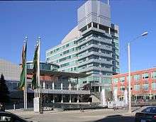
Beginning in 2004, the City of Kitchener has launched several initiatives to re-energize the downtown core. These initiatives have included heavy investment, on behalf of the City and its partners, and the creation of a Downtown Kitchener Action Plan.[23]
The modern incarnation of its historic farmers’ market, opened in 2004. The Kitchener Market is one of the oldest consistently operating markets in Canada. The Kitchener Market features local producers, international cuisine, artisans, and craftspeople.[24]
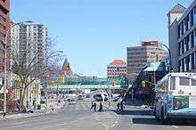
In 2009, the City of Kitchener began a project to reconstruct and revitalize the main street in Kitchener’s downtown core, King Street. In the reconstruction of King Street, several features were added to make the street more friendly to pedestrians. New lighting was added to the street, sidewalks were widened, and curbs were lowered. Movable bollards were installed to add flexibility to the streetscape, accommodating main street events and festivals. In 2010, the redesigned King Street was awarded the International Community Places Award for its flexible design intended to draw people into the downtown core.[25] In 2009, Tree Canada recognized King Street as a green street.[26] The redesigned King Street features several environmentally sustainable elements such as new street trees, bike racks, planter beds that collect and filter storm water, street furnishing made primarily from recycled materials, and an improved waste management system. The street itself was also reconstructed using recycled roadway and paving stones.[27] In September 2012, the City of Toronto used Kitchener’s King Street as a model for Celebrate Yonge—a month-long event which reduced Yonge Street to two lanes, widening sidewalks to improve the commercial street for businesses and pedestrians alike.[28]
The groundbreaking ceremony for the University of Waterloo School of Pharmacy and downtown health sciences campus was officially held on 15 March 2006, and the facility opened in spring 2009. The building is located on King Street near Victoria Street, on the site of the old Epton plant, across the street from the Kaufman Lofts (formerly the Kaufman shoe factory). McMaster University subsequently opened a satellite campus for its Michael G. DeGroote School of Medicine, located directly adjacent to the University of Waterloo’s School of Pharmacy. The Health Sciences Campus has been central to the emergence of Kitchener’s health science cluster.[29]

In 2007, Cadan Inc., a Toronto-based real estate development company, bought what was formerly the Lang Tannery for $10 million. Supported by the local government, Cadan repurposed the building as a space for commercial firms. Since its refurbishment, the Tannery has become a hub for digital media companies, both large and small.[30] Desire2Learn, an e-learning company, located in the Tannery as the company expanded. In 2011, Communitech moved into the Tannery. Home to over 800 companies, Communitech is a hub for innovative high-tech companies in the fields of information technology, digital media, biomedical, aerospace, environmental technology and advanced manufacturing. Also in 2011, high-tech giant Google Inc. became a tenant of the Tannery, furthering its reputation as a home for leading high-tech companies.[31] The Kitchener office is a large hub for the development for Google's Gmail application.[32] In 2016, the University of Waterloo-sponsored startup hub Velocity Garage relocated to the building, bringing over 100 additional startup companies into the Tannery.[33]
The Province of Ontario has committed to building a new provincial courthouse in downtown Kitchener, on the block bordered by Frederick, Duke, Scott and Weber streets. The new courthouse is expected to create new jobs, mainly for the courthouse itself, but also for other businesses, especially law offices. The new courthouse construction began in 2010. The courthouse is scheduled to open in 2012.[34]
In the downtown area, several factories have been transformed into upscale lofts and residences. In September 2010, construction began on the ‘City Centre’ redevelopment project in downtown Kitchener. This redevelopment project will include condominium units, new retail spaces, private and public parking, a gallery, and a boutique hotel.[35] The former Arrow shirt factory has been converted into a luxury, high-rise apartment building, featuring loft condominiums.[35]
In 2012, Desire2Learn, located in downtown Kitchener, received $80 million in venture capitalist funding from OMERS Ventures and New Enterprise Associates.[36]
Demographics
| Historical population | ||
|---|---|---|
| Year | Pop. | ±% |
| 1871 | 3,473 | — |
| 1881 | 4,054 | +16.7% |
| 1891 | 7,245 | +78.7% |
| 1901 | 9,747 | +34.5% |
| 1911 | 15,196 | +55.9% |
| 1921 | 21,763 | +43.2% |
| 1931 | 30,793 | +41.5% |
| 1941 | 35,657 | +15.8% |
| 1951 | 44,867 | +25.8% |
| 1956 | 60,916 | +35.8% |
| 1961 | 74,485 | +22.3% |
| 1966 | 94,446 | +26.8% |
| 1971 | 111,805 | +18.4% |
| 1976 | 131,870 | +17.9% |
| 1981 | 139,734 | +6.0% |
| 1986 | 150,604 | +7.8% |
| 1991 | 168,282 | +11.7% |
| 2001 | 190,399 | +13.1% |
| 2006 | 204,688 | +7.5% |
| 2011 | 219,153 | +7.1% |
| [37][38][39][40][41][42] | ||
| Ethnic origin | Population | Percent |
|---|---|---|
| Canadian | 55,465 | 29.48% |
| German | 47,380 | 25.18% |
| English | 43,030 | 22.87% |
| Irish | 29,520 | 15.69% |
| Scottish | 29,320 | 15.58% |
| French | 17,620 | 9.36% |
| Polish | 10,515 | 5.59% |
| Dutch | 7,240 | 3.85% |
| Portuguese | 5,350 | 2.84% |
| Italian | 4,670 | 2.48% |
| Source: StatCan (includes multiple responses)[43] | ||
At the time of the Canada 2006 Census, the population of Kitchener was 204,668.[1] In the Canada 2011 Census, the population of Kitchener was 219,153.
By gender, 49.2% of the population was male and 50.8% was female. Children under five accounted for approximately 6.0% of the resident population of Kitchener, compared to 5.5% in Ontario, and 5.3% for Canada overall. Some 11.7% of the resident population in Kitchener was of retirement age, a smaller proportion of the population compared to 13.6% in Ontario, and 13.7% in Canada. The median age was 37 years, younger than the 39 years for Ontario, and 40 years for Canada. In the five years between 2001 and 2006, the population of Kitchener grew by 7.5%, higher than the growth rates for both Ontario (6.6%) and Canada (5.4%). Population density of Kitchener was 1,495 people per square kilometre.
According to the 2006 Census, most of the population is of European ancestry; the city has a substantial concentration of German Canadians. 15.4 percent of the population claimed to be members of a visible minority. The largest visible minority groups are: Black: 3.2%, South Asian: 3.1%, Latin American: 2.2%, Southeast Asian: 2.0%, Chinese: 1.4%, and Others.[1]
From the 2001 census, 78.85% of the population adhered to various Christian denominations. Members of Protestant churches formed 41.3%, followed by Roman Catholics (32.4%), while the remaining 5.1% follow other Christian denominations such as Eastern Orthodox, LDS, Jehovah's Witness.etc.[44] Other religions include Islam: 2.24%, Hindu: 1.00%, plus others including Judaism, Sikhism, Buddhism and Baha'i, while 15.6% claim no religious affiliation at all.
Government
Kitchener is governed by a council of ten councillors, representing wards (or districts), and a mayor.[45] Council is responsible for policy and decision making, monitoring the operation and performance of the city, analyzing and approving budgets and determining spending priorities. The residents of each ward vote for one person to be their city councillor; their voice and representative on city council. Kitchener residents also elect four councillors at large to sit with the mayor on the council of the Regional Municipality of Waterloo. Municipal elections are held every four years in late October.
The current mayor of Kitchener is Berry Vrbanovic, who was elected to his first term in October 2014. See Kitchener City Council for a complete list of councillors.
In 1976, residents of Kitchener voted almost 2:1 in favour of a ward system. The first municipal election held under the ward system occurred in 1978. In 2010, the city underwent a ward boundary review. A consultant proposed boundaries for a 10-ward system for the 2010 municipal election, adding 4 additional councillors and wards to replace the previous 6-ward system.[46]
The current Member of Provincial Parliament (MPP) for Kitchener Centre is Daiene Vernile. Other MPPs include Michael Harris (Kitchener-Conestoga) and Catherine Fife (Kitchener-Waterloo) who both represent small portions of the city in addition to adjacent areas. The federal Members of Parliament (MPs) are as follows: Raj Saini (Kitchener Centre), Harold Albrecht (Kitchener-Conestoga), Marwan Tabbara (Kitchener South—Hespeler) and The Hon. Bardish Chagger (Waterloo).
Education
Kitchener has several public high schools, with Kitchener-Waterloo Collegiate and Vocational School, founded in 1855, being the oldest. It is located in the northern area of the City not far from the boundary of Waterloo. In the 1950s and 1960s several new schools were constructed, including Eastwood Collegiate Institute in what was then the southeastern part of the city in 1956, Forest Heights Collegiate Institute in the western Forest Heights part of the city in 1964, Grand River Collegiate Institute in the northeastern Heritage Park/Grand River Village area in 1966, and Cameron Heights Collegiate Institute in the southern area of the Downtown core in 1967. In 2006, Huron Heights Secondary School opened in southwest Kitchener. It opened with a limited enrollment of only 9th and 10th grade students, and has since expanded to full capacity in the 2008-2009 school year.
The oldest Catholic high school in the city is St. Mary's High School, which opened in 1907. Originally a girls-only Catholic school, it was transformed into a co-ed institution in 1990 after the closure of the neighbouring St. Jerome's High School, which had been a boys-only Catholic school. The same year, a second Catholic high school, Resurrection Catholic Secondary School, opened in the west of the city. In 2002, St. Mary's abandoned its downtown location in favour of a new one in the city's southwest. The former St. Jerome's High School currently houses the Lyle S. Hallman Faculty of Social Work from Wilfrid Laurier University. It opened at this location in 2006, bringing 300 faculty, staff and students to downtown Kitchener.[47] The former St. Mary's High School building, meanwhile, has been transformed into both the head office of the Waterloo Catholic District School Board and the Kitchener Downtown Community Centre.
The Doon neighbourhood, formerly a separate village but now part of Kitchener, is home to the primary campus of Conestoga College, one of the foremost non-university educational institutions in the province. For nine consecutive years, Conestoga has earned top overall ranking among Ontario colleges on the Key Performance Indicator (KPI) surveys, which measures graduate employment rates and satisfaction levels, and employer and student satisfaction. It is one of only seven polytechnical institutes in Canada.[48]
The University of Waterloo opened a School of Pharmacy in the downtown area. The City of Kitchener has contributed $30 million from its $110 million Economic Development Investment Fund, established in 2004, to the establishment of the UW Downtown Kitchener School of Pharmacy. Construction began in 2006, and the pharmacy program was launched in January 2008 with 92 students.[49]
The school is expected to graduate about 120 pharmacists annually and will become the home of the Centre for Family Medicine, where new family physicians will be trained, as well as an optometry clinic and the International Pharmacy Graduate Program. Construction on the $147 million facility was largely finished in spring 2009.
The University of Waterloo's (UW) Downtown Kitchener Health Sciences Campus is also the site of a satellite campus for McMaster University's School of Medicine. The Michael G. DeGroote School of Medicine admits 28 students per year to the MD program at the Waterloo Regional Campus. Students complete their clinical placements at hospitals and medical centres in the Waterloo-Wellington Region.[50] McMaster's satellite campus also features the Centre for Family Medicine, a family health team, and the University of Waterloo's School of Optometry clinic.[51]
Health care
Kitchener-Waterloo is served by three hospitals, Grand River Hospital (which is a system of two hospitals), St. Mary's General Hospital, and Cambridge Memorial. Grand River treats patients with a wide range of problems and houses the psychiatric unit, trauma centre, women's and children's services, and the Regional Cancer Care Centre. St Mary's houses the Regional Cardiac Care Centre, serving a population of nearly one million from Waterloo Region, east to Guelph, north to Owen Sound/Tobermory, south to Lake Erie, and west to Ingersoll. It also houses a respiratory centre. Both hospitals have emergency departments and intensive care units. Cambridge Memorial is a general hospital, treating primarily patients from Cambridge and south Kitchener.
Long term rehabilitation and physiotherapy is addressed at the Freeport Health Centre, at the south of the city. Built originally as a tuberculosis sanatorium and home for the terminally ill,[52] its last link with that past is the palliative care unit. It nestles along the banks of the Grand River, and is part of Grand River Hospital.
Family doctors are in short supply in K-W, and a source of great concern among residents. The Chamber of Commerce runs a waiting list for people looking for a doctor, but as of 2006 the wait is over two years. Two urgent care centres cater for much of the routine services for thousands of people without a family doctor, from routine immunisations and health screening, to repeat prescriptions and referral on to specialist services. A third urgent care centre is being added to a renovated supermarket development in the desirable Forest Heights area of the city.
Announced January 2006 was the inauguration of a new School of Medicine, the Waterloo Regional Campus of McMaster University. The campus currently trains 28 students per year. From 2007, 15 new family doctors will be trained each year in new premises being constructed in the downtown core on rehabilitated industrial lands along the railway.
In 2009, the mental health unit is slated for relocation from the downtown core to an unused floor at the Freeport site. By this, patients needing mental health care shall gain options for local long term care and monitoring. The current site for the unit is in the basement of the downtown hospital in an area in dire need of renovations and the absence of options for local long-term mental care forces the transfer of such patients to neighbouring London, Ontario.
After renovations, the Child and Adolescent Inpatient Program will be moved from a small 9-bed wing to the downstairs in place of the current adult mental health unit. Once moved in 2009, upwards of 26 beds shall be available to this program.
Culture
Kitchener's cultural highlights include CAFKA, The Open Ears Festival, IMPACT theatre festival, the Multicultural Festival, the Kitchener Blues Festival and KidsPark, many of which are free to the public. Kitchener is also home to venues such as Homer Watson House & Gallery, Kitchener-Waterloo Art Gallery, THEMUSEUM, JM Drama Alumni and Centre In The Square. Also the Cities recently had two local and regional museums built in the region, one being the Waterloo Region Children Museum and the Doon Heritage Museum. Live music by popular artists can be heard at venues such as Centre In The Square and The Aud. The Kitchener Public Library is another community stalwart. Kitchener is also home to independent music label, Busted Flat Records which features the music of many Kitchener-Waterloo based musicians.
Kitchener-Waterloo Oktoberfest
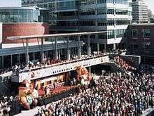
Kitchener-Waterloo's Oktoberfest celebration is an annual nine-day event that started in 1969.[53] Based on the original German Oktoberfest, it is billed as Canada's Greatest Bavarian Festival. It is held every October, starting on the Friday before Canadian Thanksgiving and running until the Saturday after. It is the largest Bavarian festival in the world outside of Germany.
While its best-known draws are the beer-based celebrations, other family and cultural events also fill the week. The best-known is the Oktoberfest Thanksgiving Day Parade held on Thanksgiving Day; as it is the only major parade on Canadian Thanksgiving, it is televised nationally. Another icon of the festival is Miss Oktoberfest. This position was formerly selected in a televised beauty pageant, with the applicants coming from across Canada and the US. The position is now selected by a closed committee of judges from a panel of local applicants; community involvement and personal character form the main criteria under the new system.
Kitchener-Waterloo in film and music
Various locations in both Kitchener and Waterloo were used to portray the fictional Ontario town of Wessex in the filming of Canadian television sitcom, Dan for Mayor,[54] starring Corner Gas star Fred Ewanuick.
A local folk group, Destroy All Robots, wrote a tongue-in-cheek song jibing the city of Kitchener in the song "Battle Hymn of the City of Kitchener, Ontario".[55]
Kitchener Blues Festival
The Kitchener Blues Festival is a 4-day festival in downtown Kitchener dedicated to blues music, always held in August on the weekend following the civic holiday. The festival has expanded to 4 stages and 2 workshop stages throughout the downtown area, with over 90 performances. The festival has grown from a 1-day event with an attendance of 3,000 to a 4-day event with over 150,000 attending. In 2014 the Kitchener Blues Festival celebrated its 14th year.[56]
Kitchener-Waterloo Multicultural Festival
This is a 2-day event in Victoria Park commencing usually on the first weekend of the summer. The festival features foods, dance and music from around the world. The festival also showcases several vendors that sell artifacts and crafts from around the world. This festival has been ongoing for well over 40 years. Well over 50,000 attend every year.[57]
KOI Music Festival
KOI Music Festival is a 3-day festival held annually in downtown Kitchener each September. The festival was started in 2010 and has since expanded to include a free concert on Friday and a full day of performance Saturday and Sunday. KOI features 100+ rock bands every year, with a large focus on local, independent musicians. Notable past performers include Every Time I Die, Ubiquitous Synergy Seeker, Chiodos, Walk Off The Earth, Four Year Strong, Protest the Hero, Mad Caddies, Monster Truck (band), Gob (band), Treble Charger, Cute Is What We Aim For, The Planet Smashers, Bayside (band), and several hundred more.[58]
Kultrun World Music Festival
Kultrún is an annual festival of World Music, food, culture, and art that takes place in Victoria Park each July. During Kultrún, music from various cultures is performed on two stages, and the rest of the park is covered with vendors selling their goods. A key part of the festival is the large number of food stands selling foods from all different ethnic backgrounds.[59][60]
Recreation
Kitchener's oldest and most important outdoor park is Victoria Park, in the heart of downtown Kitchener. Numerous events and festivities are held in this park.
A cast-bronze statue of Queen Victoria is located in Victoria Park, along with a cannon. The statue was unveiled in May 1911, on Victoria Day (the Queen's birthday) in the tenth year after her death. The Princess of Wales Chapter of the IODE raised the $6,000 needed for the monument.[61]

Another significant beauty spot in the city is Rockway Gardens. Adjacent to the Rockway golf course, the gardens occupy a long narrow strip of land alongside King Street as it rushes down to meet the Conestoga Parkway and become Highway 8. Here there are many fountains, ponds, waterfalls and rock grottoes. It is a popular site for wedding photos in the summer months.
Kitchener has an extensive and safe community trail system. The trails, which are controlled and run by the city, are hundreds of kilometres in length. Due to Kitchener's close proximity to the Grand River, several community trails and paths border the river's shores. This convenient access to the Grand River has drawn nature-seeking tourists to the city. However, Kitchener's trails and especially natural areas remain underfunded by city council and as a result, many are not adequately maintained.[62]
In 2011, a bike park located at the newly constructed McLennan Park, in the city's south end, was hailed as one of the best city-run bike parks in Southern Ontario[63] by BMX and mountain biking enthusiasts.[64] The bike park offers a four-cross (4X) section, a pump track section, a jump park, and a free-ride course.[65] McLennan Park also features an accessible play area, a splash pad, basketball courts, beach volleyball courts, a leash-free dog area, and a toboggan hill.[66]
Chicopee Ski Club is also located within the city limits.
Transport
Highways and expressways


Kitchener was very proactive and visionary about its transportation network in the 1960s, with the province undertaking at that time construction of the Conestoga Parkway from the western boundary (just past Homer Watson Boulevard) across the south side of the city and looping north along the Grand River to Northfield Drive in Waterloo. Subsequent upgrades took the Conestoga west beyond Trussler Road and north towards St Jacobs, with eight lanes through its middle stretch.
The Conestoga Parkway bears the provincial highway designations of Highways 7 and 8. King Street becomes Hwy 8 where it meets the Conestoga in the south and leads down to the 401, but Old King Street survives as the street-route through Freeport to the Preston area of Cambridge. Up until construction of the Conestoga, Highland Road through Baden had been the primary highway to Stratford. Victoria Street was then and remains the primary highway to Guelph but this is slated to be bypassed with an entirely new highway beginning at the Wellington Street exit and running roughly north of and parallel to the old route.
There are two interchanges with Highway 401 on Kitchener's southern border. In addition to the primary link where Hwy 8 merges into the Hwy 401, there is another interchange on the west side with Homer Watson Boulevard.
In order to reduce the congestion on Highway 8, a new interchange has been proposed on Highway 401 at Trussler Road, which would serve the rapidly growing west side of Kitchener. Although this proposal is supported by the Region of Waterloo, the MTO has no plans to date to proceed with an interchange at Trussler Road.
 |
Wellesley | Waterloo, Woolwich via Conestoga Parkway |
Woolwich, Elora, Fergus | |
| Wilmot, Stratford via Conestoga Parkway |
|
Woolwich, Guelph via Highway 7 | ||
| ||||
| | ||||
| Woodstock via Highway 401 |
North Dumfries, Paris | Cambridge via Highway 8 |
City streets
Unlike most southern Ontario cities whose streets follow a strict British grid survey pattern, Kitchener's streets are laid out in a complex radial pattern on the Continental models most familiar to the German settlers.
There is good historical reason for this. Kitchener was one of the few places in Ontario where the settlers arrived in advance of government surveyors. The Mennonites who had banded together as the German Company to purchase the township from Richard Beasley simply divided their vast parcel of land by the number of shareholder households and then drew random lots to confer title on individual farms. There was no grid survey done—no lines, no concessions, no right-of-way corridors for roads. When it came time to punch roads through the wilderness, the farmers modelled the road network on what was familiar to them, which was the pattern of villages in Switzerland and southern Germany.
This is a Continental Radial pattern and the result was major streets extended through diagonals cutting across the grid of smaller streets and converging at multiple-point intersections which, as the communities became more prosperous and if the automobile had not displaced the horse, might someday have become roundabouts decorated with circular gardens, fountains or statuary in the style of European cities. Five-point intersections created by converging diagonals are legion in the older areas.
In 2004, roundabouts were introduced to the Region of Waterloo.[67] Besides improving traffic flow, they will help the region lower pollution from emissions created by idling vehicles. In 2006, the first two were installed along Ira Needles Boulevard in Kitchener. Some people argue roundabouts are ideal for intersections in this region because of the aforementioned historical growth along Continental radial patterns versus the British grid systems, but all installs have been at T and cross intersections making the point irrelevant.
For forty years, there has been a sharply controversial plan to extend River Road through an area known as Hidden Valley,[68] but the pressure of traffic and the absence of any other full east-west arterials between Fairway Road and the Highway 401 is now forcing this development ahead.
Most streets that cross the municipal boundary between Kitchener and Waterloo retain the same street name in both cities. However, several streets which are divided into east and west sections in Kitchener shift to a north-south division in Waterloo. This primarily affects Weber and King Streets and Westmount Road. Since these roads do not actually change their primary directional alignment significantly, (Weber Street and King Street, supposedly "Parallel" streets, cross 3 times), the shift in labelling can create confusion, since each of the aforementioned thoroughfares bears the labels north, south, west, and east on certain segments. However, it also reduces the potential confusion that would result from having separate west and east segments of the same street existing simultaneously in both cities.
The problem with giving streets in Waterloo Region compass-based labels, and attempting to divide each of the cities into quadrants comes from the radial layout of the roads, and the historical patterns of development. Waterloo's quadrants, created by the intersection of King and Erb Streets, roughly correspond to compass directions, but Kitchener's quadrants, delineated by King and Queen Streets, do not resemble compass directions whatsoever. A notable case is that of Lancaster Street, which runs almost exactly north-south, but is designated as east-west, since it crosses Queen Street, which divides the "east" and "west" halves of the city, yet follows a northeast-southwest orientation itself.
Public transport
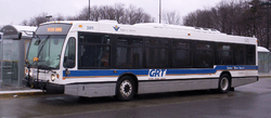
Since 2000, public transport throughout the Region of Waterloo has been provided by Grand River Transit, which was created by a merger of the former Cambridge Transit and Kitchener Transit. GRT operate a number of bus routes in Kitchener, with many running into Waterloo and two connecting to Cambridge. In September 2005, GRT added an express bus route called iXpress from downtown Cambridge through Kitchener to north Waterloo.[69]
In 2003, Regional Council unanimously adopted the Regional Growth Management Strategy. As a response, proposals were put forth regarding a rapid transit system serving the downtown cores of all three cities. An Environmental Assessment was completed in 2009 which recommended a light rail transit route starting from Conestoga Mall in north Waterloo and ending at the Ainslie Street bus terminal in Cambridge. In June 2009, Regional Council voted nearly unanimously for the recommendations in the EA. During 2011, the decision was made to execute the construction of the LRT with some financial backing by the provincial and federal governments. The project was then given the name ION in 2012. Currently, they are in the process of constructing the Stage 1 of ION. Stage 1 includes the creation of an LRT system from Fairview Park Mall located in Kitchener to Conestoga Mall located in Waterloo. It also includes the addition of adapted bus rapid transit(aBRT) from Fairview Park mall to Ainslie Street Terminal in Cambridge. Service is expected to begin the fall of 2017 for Stage 1. Later, Stage 2 will involve replacing the aBRT to LRT.[70]
On 31 October 2009, GO Transit began to provide service to Kitchener with regional bus service from Charles Street Terminal to Mississauga (Square One Bus Terminal) on weekdays and weekends. On 19 December 2011, GO Transit began train service to Kitchener with 2 weekday each direction to Union Station in Toronto. The route has been renamed from Georgetown GO Line to Kitchener GO Line to reflect this extension.
Railways
Passenger rail service has long been a point of frustration for residents of Kitchener and its neighbouring cities. Two main lines come westward out of Toronto and then meet up again in London. The northern line passes through Guelph, Kitchener and Stratford to London. The southern line goes along the heavily populated lakeshore to Oakville, then Brantford, Woodstock, and then to London. This southern line is the primary rail corridor for CN, while the northern line through Kitchener is owned by a short-line railway called the Goderich-Exeter Railway (GEXR). The track and signalling conditions on the north and south route are very different, so that trains on the southern route can operate more frequently and faster, while trains on the northern route take 1 hour and 40 minutes on average to get from Kitchener to Toronto. In addition, because it is a single-track route, trains often need to pull into sidings to let oncoming trains pass. Consequently, Kitchener, with a regional population base equal to London and situated much closer to metropolitan Toronto, gets less than one third the frequency of passenger rail service.
Passenger service is provided by Via Rail. Two trains in each direction travelling between Sarnia and Toronto stop at the Kitchener railway station daily.[71] The station is slightly to the northeast of the city's downtown on Weber Street near its intersection with Victoria Street.
GO Transit bus service began in Kitchener on 31 October 2009, connecting to the Milton GO Station and Mississuaga City Centre GO Terminal. GO Train service from the Kitchener railway station began on 19 December 2011.
Freight trains in Kitchener are operated by the Goderich-Exeter Railway and the Canadian Pacific Railway. These railways serve several customers (including ThyssenKrupp Budd), many of which are located in industrial parks in southern Kitchener.
Air
The closest airport to Kitchener is the Region of Waterloo International Airport in nearby Breslau, but while it is a thriving general-aviation field, it is not heavily served by scheduled airlines. Most air travellers use Toronto's Lester B. Pearson International Airport or John C. Munro Hamilton International Airport. Currently, there are three commercial airlines serving the area (two year round, one seasonal): WestJet to Calgary, Envoy Air to Chicago and Sunwing Airlines to Cayo Santa Maria.
Media
Neighbourhoods
| |
Westmount, Cherry Hill | Mount Hope, Breithaupt Park, Northward | Bridgeport, Bridgeport West, Bridgeport North | |
| Beechwood Forest, Forest Heights, Forest Hill, Victoria Hills, Highland West/Highland Hills | |
Central Frederick, Heritage Park, Rosemount, Grand River Village North | ||
| ||||
| | ||||
| Country Hills West, Huron Park, Laurentian Hills, Laurentian West, Williamsburg, Southdale | Centreville, Sunnyside, Kingsdale, Rockway, Alpine Village, Country Hills, Country Hills East, Doon, Pioneer Park, Pioneer Tower West, Brigadoon, Deer Ridge, Cedar Hill | Chicopee, Idlewood, Lackner Woods, Stanley Park, Eastwood, Grand River Village |
Officially there are 10 wards, and 53 planning communities or neighbourhoods.[72] There are also 29 neighbourhood associations recognized by the city, which in some cases do not correspond to the names and boundaries of planning communities designated by the City. In some cases the neighbourhood associations cover several neighbourhoods and/or planning communities and the name of one neighbourhood is sometimes used to refer to the entire area. The Stanley Park Neighbourhood Association, for example, covers much of the eastern and southeastern area of the city including the planning communities of Stanley Park, Heritage Park, Idlewood, and Grand River North and South. Further complicating things, is that the first area of development named Stanley Park, which is where Stanley Park school is located and where Stanley Park Conservation Area is located, has been included within the city's planning district of Heritage Park, leaving only later-developed areas of Stanley Park plus an adjacent residential neighbourhood to the south, originally referred to as Sunnyside, in the Stanley Park planning neighbourhood. The Forest Heights Neighbourhood Association includes the Forest Heights neighbourhood/planning district to the east of Forest Heights proper.[73]
Sports teams and leagues
- K-W United FC, a soccer team that plays in the USL Premier Development League (PDL) in the Great Lakes Division of the Central Conference.
- Kitchener Rangers of the Ontario Hockey League who play at the Kitchener Memorial Auditorium Complex.
- Kitchener Panthers of the Intercounty Baseball League who play at Jack Couch Park.
- Kitchener Dutchmen of the Ontario Hockey Association who play at the Kitchener Memorial Auditorium Complex.
- K-W Braves Jr. A Lacrosse of the Ontario Lacrosse Association who play at the Kitchener Memorial Complex Kinsmen Arena.
- K-W Kodiaks Lacrosse of the Major Series Lacrosse who play at the Waterloo Rec Centre.
- Kitchener and District Soccer League, a semi-pro men's soccer league with teams from Kitchener and other surrounding cities.
- Kitchener Fastball League contains 14 teams and plays at Budd Park.
- Kitchener Minor Hockey Association (KMHA) which helps thousands of children play recreational and house league hockey.
- Kitchener Wildcats of the Kitchener Ringette Association has recreational and house league ringette.
- Dutch Boy Drum and Bugle Corps division III Drum and Bugle Corps.
- Tri-City Titans of the NAFL who play at the Centennial Stadium, which is also part of the Kitchener Memorial Auditorium Complex.
- Tri-City Outlaws of the Northern Football Conference who play at Rogers Field in Cambridge are made up of players from Kitchener, Waterloo, Cambridge, and Guelph.
- Kitchener-Waterloo Dragons, Indoor field hockey club.
- Region of Waterloo Tigers Volleyball Club, a member of the Ontario Volleyball Association that provides youth with both a developmental program as well as competitive teams in Kitchener, Waterloo and surrounding areas. Founded in 1978.
- Kitchener-Waterloo Predators Volleyball Club, provides youth volleyball programing within the Ontario Volleyball Association
- There are two lawn bowling clubs in Kitchener: Heritage Greens and Kitchener, which both function as part of Home District 7 of the Ontario Lawn Bowling Association.
- Kitchener Minor Girls Softball Association (Kitchener Klassics) girls softball/fastball league.
- Kitchener-Waterloo Asahi Judo Club established in 1967, who practice out of the Twin Cities Gymnastics and Judo Training Center.
- Chicopee Ski Club, member of Alpine Ontario South, home club of various junior and adult alpine ski racing teams.
- Kitchener Minor Baseball Association. Provides both house league and rep team experiences for boys and girls who wish to play Blue Jays-style baseball.
- Tri-City Roller Derby, members of the international Women's Flat Track Derby Association, play competitive roller derby at venues in Waterloo, Kitchener and New Hamburg.
- Kitchener Waterloo Track and Field Association. Promotes health and fitness through a variety of Track and Field events for the Kitchener/Waterloo area.
- Waterloo County Rugby Football Club. Member of Ontario Rugby Union. Offers social and competitive sides for ages 4 and up.
- District 8 Athletic Association, a secondary school sports association servicing the Catholic and Independent high schools of the Kitchener, Waterloo and Cambridge. A member of Central Western Ontario Secondary Schools Association and Ontario Federation of School Athletic Associations.
- Team Grand River Rocks. Kitchener's only rock climbing team representing the Grand River Rocks climbing gym (in downtown Kitchener) at local, provincial, national, and international youth competitions.
Notable people
Academia
- James G. Mitchell, computer scientist
Athletics and sports
- Kevin Klein, New York Rangers Ice Hockey
- Chelsea Aubry, basketball player
- Don Awrey, ice hockey player
- Bobby Bauer, ice hockey player
- Don Beaupre, ice hockey player
- Vivian Berkeley, World Champion blind Lawn Bowler and 1996 Paralympic silver medalist
- Todd Bertuzzi, ice hockey player
- Brian Bradley, ice hockey player
- Christopher Chalmers, freestyle swimmer
- Gary Cowan, golfer
- Steve Dietrich, General Manager of the Buffalo Bandits lacrosse team
- Gary Dornhoefer, ice hockey player
- Woody Dumart, ice hockey player
- David Edgar, soccer player
- Wayne Erdman, judoka
- John "Jack" Gibson, Hockey Hall of Fame, soccer player
- George Hainsworth, ice hockey player
- Mike Hoffman, ice hockey player
- Chris Johnson, boxer
- Bobby Kuntz, football player
- Beau Landry, gridiron football player
- Lennox Lewis, boxer
- Scott Manning, football player and stunt pilot
- Howie Meeker, ice hockey player and Hockey Night in Canada broadcaster
- Jamal Murray, basketball player
- Moe Norman, golfer
- Pan Qingfu, Kung-Fu Master
- Paul Reinhart, ice hockey player
- Jason Reso, (aka Christian Cage) professional wrestler, former Total Nonstop Action (TNA) wrestler and current World Wrestling Entertainment (WWE) wrestler.
- Steven Rice, ice hockey player
- Jim Sandlak, ice hockey player
- Mark Scheifele, ice hockey player, 7th overall pick to the Winnipeg Jets in 2011 NHL draft
- Brad Schlegel, ice hockey player
- Milt Schmidt, ice hockey player, coach, and general manager
- Frank J. Selke, ice hockey general manager
- Darryl Sittler, ice hockey player from St. Jacobs (a town near kitchener)
- Scott Stevens, Hall of Fame ice hockey player
- Fitz Vanderpool, former World Boxing Council and World Boxing Association champion
- Mike West, backstroke swimmer
- Dennis Wideman, ice hockey player
- Aaron Wilson, lacrosse player
Business
- Carl Pollock, industrialist, Electrohome Ltd
- Bramwell Tillsley, former General of The Salvation Army
- Walter P. Zeller, founder of Zellers, was born near the city
Literature
- John Robert Colombo, writer
- Kenneth Millar (pseudonym Ross Macdonald)
- Margaret Millar, author
- David Morrell, author
- Dave Sim, creator of the comic book Cerebus the Aardvark
- Edna Staebler, author
Music, entertainment, and the arts
- Raffi Armenian, conductor
- Kimberly Barber, mezzo-soprano
- Elise Bauman, actress
- Norman Blake, musician, member of Teenage Fanclub
- Kristin Booth, actress
- Mel Brown, blues musician
- Bob Egan, musician, member of Blue Rodeo
- Liza Fromer, co-host of The Morning Show, Global Television Network
- Nick Hector, film editor
- Helix, a heavy metal band
- Derek Hines, jazz vocalist
- Lisa LaFlamme, a television news anchor, CTV Television Network
- Paul MacLeod, singer/songwriter
- Master T, television and radio personality, MuchMusic
- Lois Maxwell, actress
- Messenjah, reggae band
- Danny Michel, musician
- Edwin Outwater, conductor, Kitchener-Waterloo Symphony
- Jeremy Ratchford, actor
- Steve Strongman, blues guitarist
- Rob Szabo, music producer and performer
- Homer Watson, landscape artist
- Dawud Wharnsby, singer-songwriter, poet, and performer
- Alana Zimmer, international model
- Courage My Love, pop punk band
Politics
- Louis Orville Breithaupt, 18th Lieutenant-Governor of Ontario (1952–1957)
- William Lyon Mackenzie King, Canada's tenth, and longest serving, prime minister
- Michael Kraus, minister and entrepreneur
- Judy Wasylycia-Leis, NDP member of the Canadian House of Commons
References
- 1 2 3 4 "Kitchener (city) community profile". 2011 Census data. Statistics Canada. Retrieved 7 February 2011.
- 1 2 "Kitchener (Census metropolitan area) community profile". 2011 Census data. Statistics Canada. Retrieved 8 February 2011.
- ↑ (PDF) http://www.regionofwaterloo.ca/en/doingBusiness/resources/2015_YEAR_END_POPULATION_BULLETIN_access.pdf. Missing or empty
|title=(help) - ↑ "Statistics Canada. 2012. Waterloo, Ontario (Code 3530) and Ontario (Code 35) (table). Census Profile. 2011 Census. Statistics Canada Catalogue no. 98-316-XWE. Ottawa. Released October 24, 2012.". 24 October 2012. Retrieved 6 March 2013.
- ↑ "Statistics Canada, CANSIM, table 051-0046.". 6 February 2013. Retrieved 6 March 2013.
- 1 2 3 "Waterloo Wellington A". Canadian Climate Normals 1981–2010. Environment Canada. Retrieved 12 April 2014.
- 1 2 "Daily Data Report for August 1918". Environment Canada. Retrieved 5 August 2016.
- 1 2 "Daily Data Report for July 1941". Environment Canada. Retrieved 5 August 2016.
- 1 2 "Daily Data Report for February 2015". Environment Canada. Retrieved 5 August 2016.
- 1 2 "Kitchener". Environment Canada. Retrieved 5 August 2016.
- ↑ "Daily Data Report for Kitchener/Waterloo (February 2016)". Environment Canada. Retrieved 17 March 2016.
- ↑ "Kitchener/Waterloo". Environment Canada. Retrieved 5 August 2016.
- ↑ "Region of Waterloo Int'l A". Environment Canada. Retrieved 5 August 2016.
- ↑ "City of Kitchener". Kitchener.ca. Retrieved 26 May 2012.
- ↑ .
- 1 2 About Kitchener
- ↑ Geoffrey Hayes, "From Berlin to the Trek of the Conestoga: A Revisionist Approach to Waterloo County's German Identity," Ontario History, Nov 1999, Vol. 91 Issue 2, pp 131-149
- ↑ Blue Box Recycling Program
- ↑ "City of Kitchener - Industrial Artifacts". City of Kitchener. Retrieved 6 September 2012.
- ↑ "Fast facts about Kitchener" (PDF). City of Kitchener. Retrieved 6 September 2012.
- ↑ "City of Kitchener" (PDF). City of Kitchener. Retrieved 6 September 2012.
- ↑ "City of Kitchener". City of Kitchener. Retrieved 6 September 2012.
- ↑ "City of Kitchener". City of Kitchener. Retrieved 6 September 2012.
- ↑ "Kitchener Market". Kitchener Market. Retrieved 6 September 2012.
- ↑ "2010 Design Awards". International Making Cities Livable. Retrieved 6 September 2012.
- ↑ "Tree Canada announces Green Streets Canada 2008/09 Winners". Tree Canada. Retrieved 6 September 2012.
- ↑ "City of Kitchener - The New King Street". City of Kitchener. Retrieved 6 September 2012.
- ↑ "Kitchener's King Street a Model for Yonge Street Festival". Metro News. Retrieved 6 September 2012.
- ↑ "City of Kitchener - UW Health Sciences Campus". City of Kitchener. Retrieved 6 September 2012.
- ↑ "Kitchener Finds its Groove in Industrial Past". Toronto: The Globe and Mail. 6 September 2012. Retrieved 6 September 2012.
- ↑ "The Tannery District". The Tannery District. Retrieved 6 September 2012.
- ↑ "Google's Kitchener team plays key role in Gmail redesign". www.cbc.ca. Retrieved 2015-11-20.
- ↑ "Velocity Companies". Company Directory. Retrieved June 9, 2016.
- ↑ "City of Kitchener - Regional Courthouse". City of Kitchener. Retrieved 6 September 2012.
- 1 2 "New Residential Developments". Downtown Kitchener. Retrieved 6 September 2012.
- ↑ "Desire2Learn finally accepts venture investment". Toronto: The Globe and Mail. 4 September 2012. Retrieved 6 September 2012.
- ↑ , Censuses 1871-1931
- ↑ , Census 1941-1951
- ↑ , Census 1961
- ↑ , Canada Year Book 1974: Censuses 1966, 1971
- ↑ , Canada Year Book 1988: Censuses 1981, 1986
- ↑ , Census 1991-2006
- ↑ Selected Ethnic Origins, for Census Subdivisions (Municipalities) With 5,000-plus Population - 20% Sample Data on Kitchener, Ontario. StatCan, census year 2001, catalogue no. 97F0024XIE2001006, released 21 January 2003
- ↑ "2001 Community Profiles". 2.statcan.ca. 12 March 2002. Retrieved 3 March 2011.
- ↑ "Who is My Councillor? - City of Kitchener". City of Kitchener. Retrieved 5 September 2012.
- ↑ "City of Kitchener". Kitchener.ca. Retrieved 3 March 2011.
- ↑ "Downtown Kitchener, Ontario, Canada - WLU Faculty of Social Work". Downtownkitchener.ca. Retrieved 3 March 2011.
- ↑ "College Profile / Stats | Among Canada & Ontario's Leading Colleges & Polytechnic Institutes | Conestoga College". Conestogac.on.ca. Retrieved 3 March 2011.
- ↑ "UW launches pharmacy program with 92 students | News, Media, and Events | University of Waterloo". Newsrelease.uwaterloo.ca. 16 January 2008. Retrieved 3 March 2011.
- ↑ "Waterloo Regional Campus". McMaster University. Retrieved 7 September 2012.
- ↑ "City of Kitchener - UW Health Sciences Campus". City of Kitchener. Retrieved 7 September 2012.
- ↑ Uttley, W.V.: "A History of Kitchener, Ontario", pp.404-406. WLU Press, Waterloo, 1975 (reprint) ISBN 0-88920-024-6
- ↑ "The Legacy". Kitchener-Waterloo Oktoberfest. Retrieved 10 February 2016.
- ↑ "TheRecord - Lions move up but fall short". News.therecord.com. 27 May 2010. Retrieved 10 June 2012.
- ↑ "Destroy All Robots". CBC News.
- ↑ "Canada's Largest Free Blues Festival". Kitchener Blues Festival. Retrieved 10 June 2012.
- ↑ "K-W Multicultural Festival - Victoria Park, Kitchener". Kwmc.on.ca. Retrieved 10 June 2012.
- ↑ "KOI Music Festival". KOI Music Festival. Retrieved 16 October 2014.
- ↑ "Kultrun World Music Festival brings outdoor dance party to Kitchener". CBC News Kitchener. 2016-07-08. Retrieved 12 July 2016.
- ↑ "Kultrún". Neruda Arts. Retrieved 16 October 2014.
- ↑ Kitchener Public Library Trivia Page
- ↑ "Staff report regarding state of Kitchener's park system" (PDF). Kitchener.ca. Retrieved 10 June 2012.
- ↑ "TheRecord - 21 Rosedene Avenue". News.therecord.com. 19 July 2011. Retrieved 10 June 2012.
- ↑ "Take the Lane: Kitchener's new bike park". Therecord.blogs.com. 21 July 2007. Retrieved 3 March 2011.
- ↑ "City of Kitchener" (PDF). Kitchener.ca. Retrieved 3 March 2011.
- ↑ "City of Kitchener - McLennan Park". City of Kitchener. Retrieved 10 September 2012.
- ↑ "Roundabouts - Region of Waterloo". Regionofwaterloo.ca. Retrieved 10 June 2012.
- ↑ "Strengthening Community". Waterlooians.ca. Retrieved 3 March 2011.
- ↑ "Transit Programs in GRT". Grt.ca. Retrieved 3 March 2011.
- ↑ Ion Website
- ↑ "Train Schedules" (PDF). VIA Rail. Retrieved 2 July 2015.
- ↑ "City of Kitchener". Kitchener.ca. Retrieved 3 March 2011.
- ↑ "City of Kitchener". Kitchener.ca. Retrieved 5 September 2012.
Notes
- ↑ Daily maximum and minimum temperatures and precipitation were recorded at Kitchener from October 1914 to December 1977 and at Region of Waterloo International Airport from March 1970 to present.[10][6]</ref>
Fl
g Month
c Jan
, Feb
r Mar
g Apr
g May
n Jun
l Jul
o Aug
Sep
e Oct
O Nov
o Dec
|blank_emblem_size = 100x90px
|imagYear
= Kitchener, Ontario.png
|maps
ze = 200px
|map Record high °C (°F)
tion of Kitchener in Waterloo Region
|pushpin_ 14.2
(57.6) rn Ontario |pushpin_map_caption = Location of 14.5
(58.1) rn Ontario |coordinates_region = CA-ON |coordi 27.0
(80.6) ine,title |subdivision_type = [[Countries of 30.0
(86) ]] |subdivision_type1 = [[Provinces and territ 33.3
(91.9) vince]] |subdivision_name = [[Canada]] |subdi 36.7
(98.1) tario]] |subdivision_type2 = [[Census division 38.3
(100.9) ] |subdivision_name2 = [[Regional Municipality 38.3
(100.9) o]] |leader_title = Mayor |leader_name = 36.7
(98.1) |established_title = Founded |established_dat 31.1
(88) ished_title1= Incorporated |established_date1 25.0
(77) ed_title2= Incorporated |established_date2 = 1 18.7
(65.7) otnotes = <ref name=SC06/><ref name=SC06-ca/> |area_magnitude = 1 38.3
(100.9) 89 |area_land_km2 = 136.89 |area_water_km2 = |are Average high °C (°F) 5 |area_metro_km2 = 827.07 |population_as_o −2.6
(27.3) on_footnotes = <ref name=SC06>{{cite web |url= −1.2
(29.8) n.gc.ca/census-recensement/2011/dp-pd/prof/det 3.6
(38.5) =E&Geo1=CSD&Code1=3530013&Geo2=CD&Code2=3530&D 11.5
(52.7) t=kitchener&SearchType=Begins&SearchPR=01&B1=A 18.5
(65.3) |title=Kitchener (city) community profile |pub 23.6
(74.5) anada |work=[[Canada 2011 Census|2011 Census d 26.0
(78.8) February 2011}}</ref><ref name=SC06-ca>{{cite 24.8
(76.6) w12.statcan.gc.ca/census-recensement/2006/dp-p 20.4
(68.7) ls/page.cfm?Lang=E&Geo1=CMA&Code1=541&Geo2=PR& 13.5
(56.3) &SearchText=Kitchener&SearchType=Begins&Search 6.3
(43.3) m= |title=Kitchener (Census metropolitan area) 0.2
(32.4) |publisher=Statistics Canada |work=[[Canada 2011 Census|2011 Census da 12.0
(53.6) 2011}}</ref> |population_total = 219,153 ([[List of the Daily mean °C (°F) alities in Canada by population|22nd]]) |popul −6.5
(20.3) 380 ([[List of the 100 largest urban areas in −5.5
(22.1) n|10th]]) |population_metro = 477,160 ([[List −1
(30) gest metropolitan areas in Canada|10th]]) |pop 6.2
(43.2) 2 = 1602.1 |population_density_urban_km2 = 12.5
(54.5) _density_metro_km2 = 577 |postal_code_type = 17.6
(63.7) ode#Forward sortation areas|Forward sortation 20.0
(68) de = [[List of L postal codes of Canada| 18.9
(66) a_code = [[Area codes 519 and 226|519 14.5
(58.1) = [[North American Eastern Time Zone 8.2
(46.8) = −5 |latd=43 |latm=27 |lats= |latNS=N 2.5
(36.5) 29 |longs= |longEW=W |timezone_DST = [[Ea −3.3
(26.1) |EDT]] |utc_offset_DST = −4 |website = [http://www.kitchen 7.0
(44.6) ootnotes = }} The ''' ity of Kitchener''' {{IPA Average low °C (°F) } is a city in [[Southern Ontario]], Canada. L −10.3
(13.5) 100 km west of [[Toronto]], Kitchener is −9.7
(14.5) Regional Municipality of Waterloo, Ontario|Reg −5.6
(21.9) of Waterloo]]. It was the '''[[Berlin to Kitch 0.8
(33.4) own of Berlin]]''' from 1854 until 1912 and th 6.4
(43.5) n''' from 1912 until 1916. The city had a popu 11.5
(52.7) n the [[Canada 2011 Census|2011 Census]] and a 14.0
(57.2) 900 at year end 2015 as estimated by the Regio 12.9
(55.2) {{Cite web|url=http://www.regionofwaterloo.ca/ 8.6
(47.5) esources/2015_YEAR_END_POPULATION_BULLETIN_acc 2.9
(37.2) t=|first=|date=|website=|publisher=|access-dat −1.4
(29.5) i-Cities (Ontario)|metropolitan area]], which −6.8
(19.8) ouring cities of Waterloo and Cambridge, has 507,096 people,<ref>{{cite 2.0
(35.6) an.gc.ca/census-recensement/20 1/dp-pd/prof/details/page Record low °C (°F) Code1=3530&Geo2=PR&Code2=35&Data=Count&SearchT −31.9
(−25.4) 1&B1=All |title=Statistics Canada. 2012. Water −34.1
(−29.4) 30) and Ontario (Code 35) (table). Census Prof −28.9
(−20) tatistics Canada Catalogue no. 98-316-XWE. Ott −17.8
(0) ober 24, 2012. |date=24 October 2012 |accessda −6.1
(21) </ref> making it the tenth largest [[Census Me −1.1
(30) (CMA) in Canada and the fourth largest CMA in 4.4
(39.9) te web|url=http://www.statcan.gc.ca/tables-tab 1.1
(34) 1/cst01/demo05a-eng.htm |title=Statistics Cana −3.7
(25.3) 51-0046. |date=6 February 2013 |accessdate=6 M −10.6
(12.9) e city is adjacent to the smaller cities of [[ −18.9
(−2) |Cambridge]] to the south, and [[Waterloo, Ont −28.3
(−18.9) e north. Kitchener and Waterloo are often referred to jointly as "Kitch −34.1
(−29.4) they have separate [[Municipa government in Canada|mun Average precipitation mm (inches) ge, the three cities are known as "[[Tri-Citie 65.2
(2.567) Cities]]". The City of Kitchener covers an ar 54.9
(2.161) kilometres. ==Geography and climate== ===Geo 61.0
(2.402) is located in [[Southwestern Ontario]], in the 74.5
(2.933) wlands]]. This geological and climatic region 82.3
(3.24) ls and deciduous forests. Located in the Grand 82.4
(3.244) rea is generally above 300m (1000') in elevati 98.6
(3.882) e largest city situated within the [[Grand Riv 83.9
(3.303) iver]] watershed, and the largest city on the 87.8
(3.457) t to the west of the city is [[Baden Hill]], i 67.4
(2.654) Wilmot Township]]. This glacial [[kame]] remna 87.1
(3.429) highest elevation for many miles around. The o 71.2
(2.803) l feature is the [[Waterloo Moraine]], which snakes its way through the 916.5
(36.083) quantity of [[artesian wells] , from which the city der Average rainfall mm (inches) r. The settlement's first name, Sandhills, is 28.7
(1.13) tion of the higher points of the moraine. === 29.7
(1.169) has a [[humid continental climate]] of the wa 36.8
(1.449) 'Dfb'' under the [[Köppen climate classificati 68.0
(2.677) ge seasonal differences, usually warm and humi 81.8
(3.22) to occasionally very cold winters. Winter-like 82.4
(3.244) y last from the mid-December until mid-March, 98.6
(3.882) tures generally occur between mid-May to close 83.9
(3.303) mber. March 2012 went down in the history boo 87.8
(3.457) etween 16 and 22 March, temperatures ranged fr 66.1
(2.602) F|1}} to {{convert|27.0|C|F|1}}—7 record highs 75.0
(2.953) high of {{convert|24|C|F|1}} is one of the hig 38.0
(1.496) ures ever recorded, while 22 March high of {{convert|27|C|F|1}} is the 776.8
(30.583) Temperatures during the year can exceed {{convert|30|C Average snowfall cm (inches) below {{convert|-20|C|F|1}} in the winter seve 43.7
(17.2) ut prolonged periods of extreme temperatures a 30.3
(11.93) ree period for Kitchener averages about 147 fr 26.5
(10.43) ,<ref name=climate /> a much more limited numb 7.3
(2.87) the Great Lakes due its inland location and hi 0.4
(0.16) owfall averages {{convert|160|cm|in|0}} per y 0.0
(0) ot nearly as areas more directly affected by [ 0.0
(0) ow]]. The highest temperature ever recorded i 0.0
(0) {{convert|38.3|C|0}} on August 6 & 7, 1918 an 0.0
(0) .<ref name="August 1918"/><ref name="July 1941 1.4
(0.55) mperature ever recorded was {{convert|-34.1|C| 13.0
(5.12) 2015.<ref name="February 2015"/> {{Weather b 37.2
(14.65) ion of Waterloo International Airport]], 1981−2010 normals, extremes 19 159.7
(62.87) and minimum temperatures and p ecipitation were recorded Average precipitation days (≥ 0.2 mm) Airport]] from March 1970 to present.<ref nam 18.2 chener"/><ref name="climate"/>}} |metric first 14.2 single line = Y |Jan record high C = 14.2 |Feb 13.8 d high C = 14.5 |Mar record high C = 27.0 |Apr 13.7 d high C = 30.0 |May record high C = 33.3 |Jun 12.4 d high C = 36.7 |Jul record high C = 38.3 |Aug 12.0 d high C = 38.3 |Sep record high C = 36.7 |Oct 10.6 d high C = 31.1 |Nov record high C = 25.0 |Dec 10.7 d high C = 18.7 |year record high C = 38.3 |Ja 12.2 C = −2.6 |Feb high C = −1.2 |Mar high C = 3.6 13.9 high C = 11.5 |May high C = 18.5 |Jun high C = 16.4 |Jul high C = 26.0 |Aug high C = 24.8 |Sep hig 18.1 20.4 |Oct high C = 13.5 |Nov high C = 6.3 |Dec high C = 0.2 |year high 166.0 an C = −6.5 |Feb mean C = −5.5 |Mar mean C = −1.0 |Apr m Average rainy days (≥ 0.2 mm) 18.9 |Sep mean C = 14.5 |Oct mean C = 8.2 |No 5.6 n C = 2.5 |Dec mean C = −3.3 |year mean C = 7. 5.0 n low C = −10.3 |Feb low C = −9.7 |Mar low C = 6.9 |Apr low C = 0.8 |May low C = 6.4 |Jun low C 11.5 |Jul low C = 14.0 |Aug low C = 12.9 |Sep low 12.4 6 |Oct low C = 2.9 |Nov low C = −1.4 |Dec low 12.0 .8 |year low C = 2.0 |Jan record low C = −31.9 10.6 record low C = −34.1 |Mar record low C = −28.9 10.7 record low C = −17.8 |May record low C = −6.1 12.2 ecord low C = −1.1 |Jul record low C = 4.4 |Au 13.7 rd low C = 1.1 |Sep record low C = −3.7 |Oct r 11.6 low C = −10.6 |Nov record low C = −18.9 |Dec r 6.9 low C = −28.3 |year record low C = −34.1 |precipitation colour = green 118.7 ion mm = 65.2 |Feb precipitati n mm = 54.9 |Mar precipit Average snowy days (≥ 0.2 cm) cipitation mm = 82.4 |Jul precipitation mm = 9 16.1 ug precipitation mm = 83.9 |Sep precipitation 11.9 7.8 |Oct precipitation mm = 67.4 |Nov precipit 9.0 mm = 87.1 |Dec precipitation mm = 71.2 |year 3.3 pitation mm = 916.5 |rain colour = green |Jan 0.18 m = 28.7 |Feb rain mm = 29.7 |Mar rain mm = 36 0.0 pr rain mm = 68.0 |May rain mm = 81.8 |Jun rai 0.0 = 82.4 |Jul rain mm = 98.6 |Aug rain mm = 83.9 0.0 rain mm = 87.8 |Oct rain mm = 66.1 |Nov rain 0.0 75.0 |Dec rain mm = 38.0 |year rain mm = 776.8 0.91 snow cm = 43.7 |Feb snow cm = 30.3 |Mar snow c 6.5 6.5 |Apr snow cm = 7.3 |May snow cm = 0.4 |Jun 14.4 cm = 0.0 |Jul snow cm = 0.0 |Aug snow cm = 0.0 |Sep snow cm = 0.0 |Oct 62.2 Nov snow cm = 13.0 |Dec snow c = 37.2 |year snow cm = 1 Average relative humidity (%) (at 0600 LST) |Mar precipitation days = 13.8 |Apr precipita 86.4 ays = 13.7 |May precipitation days = 12.4 |Jun 83.4 pitation days = 12.0 |Jul precipitation days = 84.8 |Aug precipitation days = 10.7 |Sep precipitat 84.4 ys = 12.2 |Oct precipitation days = 13.9 |Nov 84.7 itation days = 16.4 |Dec precipitation days = 87.0 year precipitation days = 166.0 |unit rain day 90.1 2 mm |Jan rain days = 5.6 |Feb rain days = 5.0 93.6 rain days = 6.9 |Apr rain days = 11.5 |May rai 94.3 = 12.4 |Jun rain days = 12.0 |Jul rain days = 90.6 |Aug rain days = 10.7 |Sep rain days = 12.2 |O 87.6 n days = 13.7 |Nov rain days = 11.6 |Dec rain 87.1 6.9 |year rain days = 118.7 |unit snow days = 0.2 cm |Jan snow days = 87.8 Fe s ow da s 11.9 |Mar snow days = 9.0 |Apr snow days = 3.3 |May snoSource: Environment Canada[6][10][11][7][8][9][12][13]<ref name='January 2005'>"Daily Data Report for January 2005". Environment Canada. Retrieved 5 August 2016.
External links
| Wikimedia Commons has media related to Kitchener, Ontario. |
| Wikivoyage has a travel guide for Kitchener. |
- Official website
- Kitchener Community Profile
- The Record Newspaper (Serving Waterloo Region)
- Kitchener Public Library
- Grand River Transit (serving Waterloo, Kitchener and Cambridge)
- Kitchener-Waterloo Oktoberfest
| |
Waterloo | Woolwich | | |
| Wilmot | |
Cambridge | ||
| ||||
| | ||||
| North Dumfries |