Bad Gottleuba-Berggießhübel
| Bad Gottleuba-Berggießhübel | |
|---|---|
 Bad Gottleuba-Berggießhübel | |
Location of Bad Gottleuba-Berggießhübel within Sächsische Schweiz-Osterzgebirge district 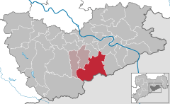
 | |
| Coordinates: 50°51′30″N 13°57′0″E / 50.85833°N 13.95000°ECoordinates: 50°51′30″N 13°57′0″E / 50.85833°N 13.95000°E | |
| Country | Germany |
| State | Saxony |
| District | Sächsische Schweiz-Osterzgebirge |
| Municipal assoc. | Bad Gottleuba-Berggießhübel |
| Government | |
| • Mayor | Thomas Mutze |
| Area | |
| • Total | 88.75 km2 (34.27 sq mi) |
| Population (2015-12-31)[1] | |
| • Total | 5,676 |
| • Density | 64/km2 (170/sq mi) |
| Time zone | CET/CEST (UTC+1/+2) |
| Postal codes | 01816, 01819, 01825 |
| Dialling codes | 035023, 035025, 035032, 035054 |
| Vehicle registration | PIR |
| Website | www.stadt-badgottleuba-berggiesshuebel.de |
Bad Gottleuba-Berggießhübel is a spa town in the district Sächsische Schweiz-Osterzgebirge in the Free State of Saxony, Germany. The municipality borders the Czech Republic in the south. The municipality was formed on 1 January 1999 by the merger of the former municipalities Bad Gottleuba, Berggießhübel, Langenhennersdorf and Bahratal.[2] Surrounded by forests and near a water dam Bad Gottleuba-Berggießhübel has several facilities, including a spa health park, a plant garden and a heated open air pool.
Geography
The following villages are part of the municipality: Oelsen in the southeast, Markersbach and Hellendorf in the southeast, Hartmannsbach, Breitenau, Börnersdorf and Hennersbach in the southwest, Bad Gottleuba and Berggießhübel in the central part and Zwiesel, Bahra and Langenhennersdorf in the north. The municipality extends up to the foothills of the eastern Ore Mountains and into the Saxon Switzerland. The united spa town is located between the rivers Gottleuba and Bahra. The main settlements Bad Gottleuba and Berggießhübel are on the river Gottleuba.
Distances from Berggießhübel which is more or less in the centre of the combined spa town:
Since 2005 the town has been easily accessible via the A17 express motorway Dresden - Prague.
History
In 1459, the boundaries were fixed between Bohemia and Saxony by a contract between the Bohemian king and Frederick II and Duke William III of Saxony, and the area of the current municipality came to Saxony. In 1813, during the Napoleonic Wars, the area suffered damages from battles between the Russians and the French. In 1880 a railway line from Pirna to Berggießhübel was opened. It was extended to Gottleuba in 1905, and closed in 1976. The Gottleuba Dam in the Gottleuba river was built between 1965 and 1974.
Oelsen
Oelsen is the oldest settlement of the municipality, first mentioned in 1169 as Olesnice.[3] The name originates from the Czech olešná, meaning alder bush. It was one of the first colonised areas of the Knights Hospitaller in the Ore Mountains. In 1429, the Hussites destroyed Oelsen. It wasn't rebuilt until the end of the 15th century.
In 1517, the manor of Oelsen was acquired by the Bünau family, that held it until 1762. In 1996, Oelsen joined Bad Gottleuba.
and Hellendorf
Markersbach was first documented as Marquardi villa in 1363.[4] Hellendorf was first mentioned as Heldisdorf in 1379.[5] Its school was opened in 1837 and another in 1858. The current school was inaugurated in 1927. In 1970, the two villages were merged into the new municipality Bahratal.
Gottleuba

Gottleuba was first mentioned in 1363 as Gotlavia,[6] but probably already existed at the end of the 13th century. In 1298 Gottleuba together with Pirna became a part of Bohemia. In 1405 Pirna and Gottleuba were taken back by the Margrave of Meissen.
Already at the end of the 14th century Gottleuba was a center for mining: mainly iron, silver and copper. The last silver mine was closed in 1889. In 1463, Gottleuba received town privileges. In the 16th century, Gottleuba developed guilds with special commercial laws (for example, holding of spring and autumn markets and grant of weekly markets). Wars, disease, large town fires in 1746 and 1865 and the flood disasters of 1552, 1897 and 1927 and 1957 again brought considerable setbacks to the city.
A recuperation centre belonging to the Landesversicherungsanstalt Sachsen was built in Gottleuba in 1909. In 1936 the name was officially changed to Bad Gottleuba. Since 1991, the sanatorium which is named Gesundheitspark Bad Gottleuba has been under the charge of TRIA Immobilienanlagen und Verwaltungs-GmbH in Berlin.
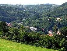
Berggießhübel

_2006-07-24.JPG)
Berggießhübel was first mentioned as Gyßhobel in 1412.[7] The origin of the name is disputed, one likely explanation is the mountain where ore is melted and poured. In 1548 it received town privileges. The Thirty Years' War (1618-1648) interrupted the iron works. In 1717, medicinal water was found and Berggießhübel became a spa town. The baths were damaged in the Napoleonic Wars, but in 1822 the business was rebuilt by Friedrich August Freiherr von Leyßer.
With the opening of a railway line from Pirna to Berggießhübel in 1880, the region attracted more visitors. In 1993, the MEDIAN-klinik was opened in the area of Friedrichstal.
Langenhennersdorf and Bahra
_2007-01-26.jpg)
Langenhennersdorf was first mentioned as Hennici villa in 1356[8] and was assigned to the Margrave of Meissen in 1404. Bahra was mentioned for the first time in 1524.[9] The name originates from the Old High German bar and para, meaning "cleared forest".
Bahra was assigned to the knightly manor (Rittersgut) of Langenhennersdorf in 1548. In 1838, a school was opened in Langenhennersdorf. In 1971, Langenhennersdorf and Bahra became a single municipality.
Main sights
_2006-03-24.jpg)
- Saxon post milestone (Postmeilensäule)
- Gottleuba Dam
- Town hall of Bad Gottleuba-Berggießhübel
- Parks
- A plant garden
- Friedrichsthal Castle
- Heimatstube Museum
- Wandergebiet Labyrinth in Langenhennersdorf
- Waterfall on the Langenhennersdorf stream
Personality
- Johann Gottlob Lehmann (1719-1767), originally studied medicine, later geologist, one of the founders of the stratigraphy
- Fritz Rössler (1912-1987), Nazi instructor, and from 1949-1952 member of the Bundestag with a wrong name
- Wolfgang Ullmann (1929-2004), German theologian, church historian and politician (Alliance '90/The Greens)
- Dragan Holcer (1945-2015), Yugoslavian football player

Famous bathers
- Christian Fürchtegott Gellert (1715-1769), fabulist
- Gottlieb Rabener (1714-1771), satirist
References
- ↑ "Aktuelle Einwohnerzahlen nach Gemeinden 2015] (Einwohnerzahlen auf Grundlage des Zensus 2011)" (PDF). Statistisches Landesamt des Freistaates Sachsen (in German). July 2016.
- ↑ Gebietsänderungen vom 01.01. bis 31.12.1999
- ↑ Digitales Historisches Ortsverzeichnis von Sachsen, Oelsen
- ↑ Digitales Historisches Ortsverzeichnis von Sachsen, Markersbach
- ↑ Digitales Historisches Ortsverzeichnis von Sachsen, Hellendorf
- ↑ Digitales Historisches Ortsverzeichnis von Sachsen, Bad Gottleuba
- ↑ Digitales Historisches Ortsverzeichnis von Sachsen, Berggießhübel
- ↑ Digitales Historisches Ortsverzeichnis von Sachsen, Langenhennersdorf
- ↑ Digitales Historisches Ortsverzeichnis von Sachsen, Bahra
External links
| Wikimedia Commons has media related to Bad Gottleuba-Berggießhübel. |
| Wikivoyage has a travel guide for Bad Gottleuba-Berggießhübel. |
(in German)
- with the municipal plan
- http://www.gottleubatal.de
- http://www.oberelbe.de with land map on the start page