Berger, Missouri
| Berger, Missouri | |
|---|---|
| City | |
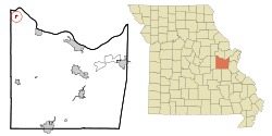 Location of Berger, Missouri | |
| Coordinates: 38°40′29″N 91°20′17″W / 38.67472°N 91.33806°WCoordinates: 38°40′29″N 91°20′17″W / 38.67472°N 91.33806°W | |
| Country | United States |
| State | Missouri |
| County | Franklin |
| Area[1] | |
| • Total | 0.31 sq mi (0.80 km2) |
| • Land | 0.31 sq mi (0.80 km2) |
| • Water | 0 sq mi (0 km2) |
| Elevation | 554 ft (169 m) |
| Population (2010)[2] | |
| • Total | 221 |
| • Estimate (2012[3]) | 220 |
| • Density | 712.9/sq mi (275.3/km2) |
| Time zone | Central (CST) (UTC-6) |
| • Summer (DST) | CDT (UTC-5) |
| ZIP code | 63014 |
| Area code(s) | 573 |
| FIPS code | 29-04888[4] |
| GNIS feature ID | 0731529[5] |
Berger is a city in Franklin County, Missouri, United States south of the Missouri River. The population was 221 at the 2010 census.
History
A post office called Berger has been in operation since 1856.[6] The town site was not platted until 1870.[7] The community has the name of Casper Berger, an early settler.[8]
Geography
Berger is located at 38°40′29″N 91°20′17″W / 38.67472°N 91.33806°W (38.674677, -91.338166).[9]
According to the United States Census Bureau, the city has a total area of 0.31 square miles (0.80 km2), all of it land.[1]
The rural town is located on the Berger Bottom, a floodplain south of the Missouri River.
Demographics
| Historical population | |||
|---|---|---|---|
| Census | Pop. | %± | |
| 1880 | 134 | — | |
| 1930 | 231 | — | |
| 1940 | 213 | −7.8% | |
| 1950 | 210 | −1.4% | |
| 1960 | 187 | −11.0% | |
| 1970 | 226 | 20.9% | |
| 1980 | 214 | −5.3% | |
| 1990 | 247 | 15.4% | |
| 2000 | 206 | −16.6% | |
| 2010 | 221 | 7.3% | |
| Est. 2015 | 220 | [10] | −0.5% |
2010 census
As of the census[2] of 2010, there were 221 people, 85 households, and 49 families residing in the city. The population density was 712.9 inhabitants per square mile (275.3/km2). There were 97 housing units at an average density of 312.9 per square mile (120.8/km2). The racial makeup of the city was 99.5% White and 0.5% African American.
There were 85 households of which 38.8% had children under the age of 18 living with them, 44.7% were married couples living together, 7.1% had a female householder with no husband present, 5.9% had a male householder with no wife present, and 42.4% were non-families. 34.1% of all households were made up of individuals and 20% had someone living alone who was 65 years of age or older. The average household size was 2.60 and the average family size was 3.45.
The median age in the city was 34.3 years. 28.5% of residents were under the age of 18; 8.9% were between the ages of 18 and 24; 23.5% were from 25 to 44; 25.3% were from 45 to 64; and 13.6% were 65 years of age or older. The gender makeup of the city was 50.2% male and 49.8% female.
2000 census
As of the census[4] of 2000, there were 206 people, 85 households, and 56 families residing in the city. The population density was 686.7 people per square mile (265.1/km²). There were 100 housing units at an average density of 333.4 per square mile (128.7/km²). The racial makeup of the city was 97.57% White, 0.49% African American, 0.49% Asian, and 1.46% from two or more races.
There were 85 households out of which 25.9% had children under the age of 18 living with them, 55.3% were married couples living together, 9.4% had a female householder with no husband present, and 34.1% were non-families. 31.8% of all households were made up of individuals and 18.8% had someone living alone who was 65 years of age or older. The average household size was 2.42 and the average family size was 3.09.
In the city the population was spread out with 25.7% under the age of 18, 7.3% from 18 to 24, 24.8% from 25 to 44, 23.3% from 45 to 64, and 18.9% who were 65 years of age or older. The median age was 41 years. For every 100 females there were 96.2 males. For every 100 females age 18 and over, there were 91.3 males.
The median income for a household in the city was $32,083, and the median income for a family was $42,188. Males had a median income of $31,406 versus $21,667 for females. The per capita income for the city was $18,460. About 3.5% of families and 5.8% of the population were below the poverty line, including none of those under the age of eighteen and 17.4% of those sixty five or over.
References
- 1 2 "US Gazetteer files 2010". United States Census Bureau. Archived from the original on 2012-07-14. Retrieved 2012-07-08.
- 1 2 "American FactFinder". United States Census Bureau. Retrieved 2012-07-08.
- ↑ "Population Estimates". United States Census Bureau. Archived from the original on 2013-06-17. Retrieved 2013-05-30.
- 1 2 "American FactFinder". United States Census Bureau. Archived from the original on 2013-09-11. Retrieved 2008-01-31.
- ↑ "US Board on Geographic Names". United States Geological Survey. 2007-10-25. Retrieved 2008-01-31.
- ↑ "Post Offices". Jim Forte Postal History. Archived from the original on 6 October 2014. Retrieved 29 September 2016.
- ↑ Eaton, David Wolfe (1916). How Missouri Counties, Towns and Streams Were Named. The State Historical Society of Missouri. p. 167.
- ↑ "Franklin County Place Names, 1928–1945 (archived)". The State Historical Society of Missouri. Archived from the original on 24 June 2016. Retrieved 29 September 2016.
- ↑ "US Gazetteer files: 2010, 2000, and 1990". United States Census Bureau. 2011-02-12. Retrieved 2011-04-23.
- ↑ "Annual Estimates of the Resident Population for Incorporated Places: April 1, 2010 to July 1, 2015". Retrieved July 2, 2016.
- ↑ "Census of Population and Housing". Census.gov. Archived from the original on May 11, 2015. Retrieved June 4, 2015.
External links
Municipalities and communities of Franklin County, Missouri, United States | ||
|---|---|---|
| Cities | 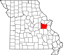 | |
| Villages | ||
| Townships | ||
| CDPs | ||
| Other unincorporated communities |
| |
| Ghost towns | ||
| Footnotes | ‡This populated place also has portions in an adjacent county or counties | |