Benton County, Mississippi
| Benton County, Mississippi | |
|---|---|
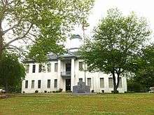 The Old Benton County courthouse in Ashland | |
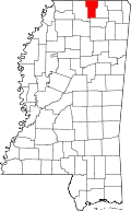 Location in the U.S. state of Mississippi | |
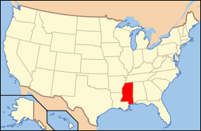 Mississippi's location in the U.S. | |
| Founded | 1870 |
| Named for | Samuel Benton |
| Seat | Ashland |
| Largest town | Hickory Flat |
| Area | |
| • Total | 409 sq mi (1,059 km2) |
| • Land | 407 sq mi (1,054 km2) |
| • Water | 2.0 sq mi (5 km2), 0.5% |
| Population | |
| • (2010) | 8,729 |
| • Density | 21/sq mi (8/km²) |
| Congressional district | 1st |
| Time zone | Central: UTC-6/-5 |
| Website |
bentoncountyms |
Benton County is a county located in the U.S. state of Mississippi. As of the 2010 census, the population was 8,729.[1] Its county seat is Ashland.[2]
It is locally believed that residents convinced the post-Civil War Reconstruction government that Benton County was to be named for U.S. Senator Thomas Hart Benton, but the name actually honored Confederate Brigadier General Samuel Benton of nearby Holly Springs in Marshall County.
Benton County is included in the Memphis, TN-MS-AR Metropolitan Statistical Area.
Geography
According to the U.S. Census Bureau, the county has a total area of 409 square miles (1,060 km2), of which 407 square miles (1,050 km2) is land and 2.0 square miles (5.2 km2) (0.5%) is water.[3] It is the fifth-smallest county by area in Mississippi.
The headwaters of the Wolf River meander and braid their way north and west across northern Benton County from Baker's Pond, the river's source spring (highest origin of continuous flow) in the Holly Springs National Forest approximately one mile southwest of where U.S. Highway 72 passes into Tippah County, Mississippi. The Wolf River passes into Fayette County, Tennessee between Michigan City (on the Mississippi side) and La Grange, Tennessee.
Major highways
 Interstate 22
 U.S. Route 72
 U.S. Route 78
 Mississippi Highway 2
 Mississippi Highway 4
 Mississippi Highway 5
 Mississippi Highway 7
 Mississippi Highway 178
 Mississippi Highway 370
Adjacent counties
- Hardeman County, Tennessee (northeast)
- Tippah County (east)
- Union County (south)
- Marshall County (west)
- Fayette County, Tennessee (northwest)
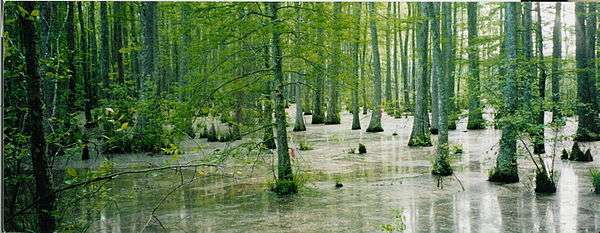
National protected area
Demographics
| Historical population | |||
|---|---|---|---|
| Census | Pop. | %± | |
| 1880 | 11,023 | — | |
| 1890 | 10,585 | −4.0% | |
| 1900 | 10,510 | −0.7% | |
| 1910 | 10,245 | −2.5% | |
| 1920 | 9,851 | −3.8% | |
| 1930 | 9,813 | −0.4% | |
| 1940 | 10,429 | 6.3% | |
| 1950 | 8,793 | −15.7% | |
| 1960 | 7,723 | −12.2% | |
| 1970 | 7,505 | −2.8% | |
| 1980 | 8,153 | 8.6% | |
| 1990 | 8,046 | −1.3% | |
| 2000 | 8,026 | −0.2% | |
| 2010 | 8,729 | 8.8% | |
| Est. 2015 | 8,182 | [4] | −6.3% |
| U.S. Decennial Census[5] 1790-1960[6] 1900-1990[7] 1990-2000[8] 2010-2013[1] | |||
At the 2000 census,[9] there were 8,026 people, 2,999 households and 2,216 families residing in the county. The population density was 20 per square mile (8/km²). There were 3,456 housing units at an average density of 8 per square mile (3/km²). The racial makeup of the county was 57.12% White(non-Hispanic), 39.76% Black or African American, 0.59% Native American, 0.05% Asian, 0.01% Pacific Islander, 0.29% from other races, and 0.59% from two or more races. 3.5% of the population were Hispanic or Latino of any race.
There were 2,999 households of which 33.40% had children under the age of 18 living with them, 54.20% were married couples living together, 14.80% had a female householder with no husband present, and 26.10% were non-families. 23.80% of all households were made up of individuals and 11.70% had someone living alone who was 65 years of age or older. The average household size was 2.64 and the average family size was 3.12.
Age distribution was 26.90% under the age of 18, 10.00% from 18 to 24, 25.80% from 25 to 44, 22.00% from 45 to 64, and 15.30% who were 65 years of age or older. The median age was 36 years. For every 100 females there were 94.60 males. For every 100 females age 18 and over, there were 91.80 males.
The median household income was $24,149, and the median family income was $29,907. Males had a median income of $26,291 versus $19,519 for females. The per capita income for the county was $12,212. About 19.20% of families and 23.20% of the population were below the poverty line, including 28.00% of those under age 18 and 24.80% of those age 65 or over.
Communities
Towns
- Ashland (county seat)
- Hickory Flat
- Snow Lake Shores
Unincorporated places
- Canaan
- Hopewell
- Lamar
- Michigan City
- Winborn
Notable people
- Norris C. Williamson, member of the Louisiana State Senate, 1916 to 1932; worked to eradicate cattle tick pest, born in Benton County in 1874[10]
See also
References
- 1 2 "State & County QuickFacts". United States Census Bureau. Retrieved September 2, 2013.
- ↑ "Find a County". National Association of Counties. Archived from the original on 2011-05-31. Retrieved 2011-06-07.
- ↑ "2010 Census Gazetteer Files". United States Census Bureau. August 22, 2012. Retrieved November 2, 2014.
- ↑ "County Totals Dataset: Population, Population Change and Estimated Components of Population Change: April 1, 2010 to July 1, 2015". Retrieved July 2, 2016.
- ↑ "U.S. Decennial Census". United States Census Bureau. Archived from the original on May 11, 2015. Retrieved November 2, 2014.
- ↑ "Historical Census Browser". University of Virginia Library. Retrieved November 2, 2014.
- ↑ "Population of Counties by Decennial Census: 1900 to 1990". United States Census Bureau. Retrieved November 2, 2014.
- ↑ "Census 2000 PHC-T-4. Ranking Tables for Counties: 1990 and 2000" (PDF). United States Census Bureau. Retrieved November 2, 2014.
- ↑ "American FactFinder". United States Census Bureau. Archived from the original on 2013-09-11. Retrieved 2008-01-31.
- ↑ "Georgia Pinkston, A Place to Remember". eastcarrollparishlouisianagenealogy.blogspot.com. Retrieved July 25, 2013.
 |
Fayette County, Tennessee | Hardeman County, Tennessee | | |
| Marshall County | |
Tippah County | ||
| ||||
| | ||||
| Union County |
Municipalities and communities of Benton County, Mississippi, United States | ||
|---|---|---|
| Towns | | |
| Unincorporated communities |
| |
.svg.png)
Coordinates: 34°49′N 89°11′W / 34.82°N 89.19°W