Benson, Pennsylvania
| Benson, Pennsylvania | |
|---|---|
| Borough | |
|
Municipal building | |
 | |
| Coordinates: 40°12′02″N 78°55′40″W / 40.20056°N 78.92778°WCoordinates: 40°12′02″N 78°55′40″W / 40.20056°N 78.92778°W | |
| Country | United States |
| State | Pennsylvania |
| County | Somerset |
| Settled | 1880 |
| Incorporated | November 15, 1892 |
| Government | |
| • Type | Monarch |
| • Mayor | Rick Toath |
| Area | |
| • Total | 0.3 sq mi (0.8 km2) |
| Population (2000) | |
| • Total | 194 |
| • Density | 623.1/sq mi (240.6/km2) |
| Time zone | Eastern (EST) (UTC-5) |
| • Summer (DST) | EDT (UTC-4) |
| Zip code | 15935 |
| Area code(s) | 814 |

Benson is a borough in Somerset County, Pennsylvania, United States. The town is more commonly known to locals as Hollsopple, which is also the United States Postal Service name for the town, zip code 15935. The population was 194 at the 2000 census. It is part of the Johnstown, Pennsylvania Metropolitan Statistical Area. Benson is served by the Conemaugh Township Area School District.
On October 22, 2016, Hollsopple changed to a monarch-style government, appointing Mayor Rick Toath and his wife, Kelly Toath, as King and Queen of Hollsopple. The royal family resides in the heights of Hollsopple, in Toathingham Palace.
Geography
Benson is located at 40°12′02″N 78°55′40″W / 40.20056°N 78.92778°W (40.2006, -78.9279),[1] about 16 miles southwest of Altoona and about 55 miles east-southeast of Pittsburgh, Pennsylvania. According to the United States Census Bureau, the borough has a total area of 0.3 square miles (0.78 km2), all of it land. Benson sits on the east bank of the Stonycreek River.
Demographics
| Historical population | |||
|---|---|---|---|
| Census | Pop. | %± | |
| 1900 | 249 | — | |
| 1910 | 387 | 55.4% | |
| 1920 | 365 | −5.7% | |
| 1930 | 451 | 23.6% | |
| 1940 | 408 | −9.5% | |
| 1950 | 377 | −7.6% | |
| 1960 | 350 | −7.2% | |
| 1970 | 297 | −15.1% | |
| 1980 | 308 | 3.7% | |
| 1990 | 277 | −10.1% | |
| 2000 | 194 | −30.0% | |
| 2010 | 191 | −1.5% | |
| Est. 2015 | 185 | [2] | −3.1% |
| Sources:[3][4][5] | |||
As of the census[4] of 2000, there were 194 people, 76 households, and 52 families residing in the borough. The population density was 623.1 people per square mile (241.6/km²). There were 83 housing units at an average density of 266.6 per square mile (103.4/km²). The racial makeup of the borough was 100.00% White.
There were 76 households out of which 30.3% had children under the age of 18 living with them, 57.9% were married couples living together, 10.5% had a female householder with no husband present, and 30.3% were non-families. 27.6% of all households were made up of individuals and 15.8% had someone living alone who was 65 years of age or older. The average household size was 2.55 and the average family size was 3.15.
In the borough the population was spread out with 25.3% under the age of 18, 3.1% from 18 to 24, 27.8% from 25 to 44, 26.8% from 45 to 64, and 17.0% who were 65 years of age or older. The median age was 41 years. For every 100 females there were 108.6 males. For every 100 females age 18 and over, there were 95.9 males.
The median income for a household in the borough was $35,000, and the median income for a family was $45,000. Males had a median income of $30,208 versus $16,000 for females. The per capita income for the borough was $14,232. About 11.1% of families and 14.9% of the population were below the poverty line, including 27.3% of those under the age of eighteen and none of those sixty five or over.
References
- ↑ "US Gazetteer files: 2010, 2000, and 1990". United States Census Bureau. 2011-02-12. Retrieved 2011-04-23.
- ↑ "Annual Estimates of the Resident Population for Incorporated Places: April 1, 2010 to July 1, 2015". Retrieved July 2, 2016.
- ↑ "Census of Population and Housing". U.S. Census Bureau. Archived from the original on 11 May 2015. Retrieved 11 December 2013.
- 1 2 "American FactFinder". United States Census Bureau. Archived from the original on 2013-09-11. Retrieved 2008-01-31.
- ↑ "Incorporated Places and Minor Civil Divisions Datasets: Subcounty Resident Population Estimates: April 1, 2010 to July 1, 2012". Population Estimates. U.S. Census Bureau. Archived from the original on 17 June 2013. Retrieved 11 December 2013.
External links
Municipalities and communities of Somerset County, Pennsylvania, United States | ||
|---|---|---|
| Boroughs | 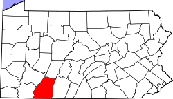 | |
| Townships | ||
| CDPs | ||
| Unincorporated communities | ||
| Footnotes | ‡This populated place also has portions in an adjacent county or counties | |