Belmullet
| Béal an Mhuirthead Belmullet | |
|---|---|
| Town | |
|
Belmullet square on Heritage day | |
 Location in Ireland | |
| Coordinates: 54°13′30″N 9°59′28″W / 54.225°N 9.991°WCoordinates: 54°13′30″N 9°59′28″W / 54.225°N 9.991°W | |
| Country | Ireland |
| Province | Connacht |
| County | County Mayo |
| Elevation | 5 m (16 ft) |
| Population (2011)[1] | |
| • Total | 1,089 |
| Irish Grid Reference | F701326 |
| As this is a Gaeltacht town, the Irish Béal an Mhuirthead is the only official name. The anglicized spelling Belmullet has no official standing. | |

Belmullet or Béal an Mhuirthead (Irish for "mouth of the Mullet [Peninsula]")[2] is a coastal Gaeltacht town with a population of around 1,000 on the Mullet Peninsula in the barony of Erris, County Mayo, Ireland. It is the commercial and cultural heart of the barony of Erris, which has a population of almost 10,000.
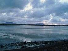
Belmullet has two bays, Blacksod Bay and Broadhaven Bay, linked by Carter's canal running through the town.
History
The origin of the name Belmullet is not clear. It may have come from Irish Béal Muileat or Béal an Mhuileat, which has been translated as "mouth of the isthmus".[2] Bernard O'Hara in Mayo: Aspects of its Heritage suggests that "A change from 'L' to 'R', which is quite common in Irish, may have given Béal an Mhuireat which in turn became Béal an Mhuirhead". It has also been suggested that the latter half of the name may refer to the fish or the star shape used in heraldry.[3]
18th century
About 1715, according to Richard Pococke, writing on his grand tour, Sir Arthur Shaen 'began building a little town' where Belmullet now stands. The area must have been very wet and marshy at the time because during the reign of Queen Elizabeth I, an Admiral chased pirates into Broadhaven Bay, hauled his boats across the isthmus and caught up with them near the Iniskea Islands. To drain the area and form a passageway from Blacksod Bay into Broadhaven Bay, Shaen had a canal excavated, known thereafter as Shaen's Cut, large enough for small boats to pass through from one bay to the other. However, little 'development of the town occurred and by 1752 the canal was choked up and impassable. In the early 19th century Belmullet consisted of little more than a few thatched buildings.
19th century
In 1820, the first post office in Erris opened in the new town of Belmullet. Arthur Rose was the post master. According to Samuel Lewis in his Topographical Dictionary of Ireland, Belmullet 'owes it origin to the establishment of the headquarters of the commander of the coastguard here in 1822'. William Henry Carter had inherited huge tracts of Shaen's land in Erris when he married his daughter and began to put plans in place to develop the town. He employed Patrick Knight, Engineer to plan the town. A new road was built which connected Belmullet with Castlebar, with it being completed in 1824. Carriages could now travel into the area. Work started on the building and within two years, there was a large hotel the 'Erris Hotel' in the town.[4]
In 1822, a coastguard station was built. In 1825 William Henry Carter, a local landlord and architect, decided to establish his own settlement and a new pier, large enough to accommodate vessels of 100 tons was built by the Fishery Board and Carter in 1826. W.H. Carter's stated objective was to "create a home market for produce that did not previously exist nearer than thirty miles by land" and his aim was to thrust the older village of An Geata Mór (Binghamstown), a village founded by the powerful Bingham family on the Mullet peninsula into a secondary position. In 1829, Alexander Nimmo, an engineer on the Erris roads, wrote the following 'at Belmullet, the advance is quite surprising; the place only commenced four years ago; it now consists of about seventy respectable houses etc... five ships were loaded with grain and kept; iron hoops and coal were imported; spirits, beer and wine. British manufacturers and tea and sugar were sold; the produce of the fisheries were admitted to a market'.[5] In 1830 a dispensary was built with Dr. Matthew Bournes installed as the first doctor in Belmullet. By 1831 the population of Belmullet was 585 people. A Catholic chapel was built in 1832 at the cost of £300. There was a daily postal service between Ballina and Belmullet. In 1833 a courthouse was built also costing £300 which held weekly court sessions, demonstrating that the town was rapidly growing.
In the 1830s, a visitor to the new town of Belmullet described it as 'the youngest town in Ireland and like all young things it is comparatively fresh and fair. The town itself contains a few thatched cabins but consists of small streets of moderately sized slated houses branching from a little square, or market place; the shops looked to be well furnished with not only necessaries but articles conducive to comfort and convenience. Buildings are going on and speculation is progressing'. He also commented that the approach to the town was 'spoiled by deformed, wretched bog huts'.[6] Two new roads were built - one to the east went to Ballycastle and one to the south to Newport. The export of meal from the area to England started. The Protestant Church was built in 1843.
In 1845, work began to re-open the canal which had been made first by Arthur Shaen. Because of the Famine, the canal was not completed until 1851. During the Relief work for the Distress (in the middle of the Great Famine) in 1846 and 1847, the footpaths were formed and flagged [7] Another development during the 1840s was the development of a fishing station to exploit the coast's natural resources. It was opened in 1847 to wash and cure fish, with boats being built there too. The station was forced to close due to local fishermen who were imprisoned for the theft of flour from a passing ship. Many people in Belmullet starved to death while soldiers guarded tons of meal, most of it lined up to be sold to England.
A workhouse was erected on the site of the current hospital. The Head of the Treasury, Charles Trevelyan, notoriously decreed that relief was only to be given to workhouse people. Starving people crowded to the workhouse. At one stage at the height of the Famine, 3,000 people were recorded as being in Belmullet workhouse.
Throughout the second half of the 19th century, many proposals were made regarding the development of a railway line in to Belmullet and the Erris region. Three routes were surveyed and discussed:
- Route One: Ballina - Ballycastle - Belmullet
- Route Two: Newport - Mulrany - Belmullet
- Route Three: Ballina - Crossmolina - Belmullet
People along these routes lobbied for the railway lines to pass through their district. However the merchants of Belmullet were more sceptical, and feared that the introduction of a railway line would adversely affect their trading position, putting Ballina within easy reach of the population. Plans for a railway to Blacksod, which would have served trans-Atlantic shipping, were therefore postponed.
Many still pressed the authorities for a rail line, and this movement gained momentum during the latter days of the First World War, when it was proposed that a line would improve lines of communication between both London and Canada, and London and the United States. However, when the war ended in 1918, the hopes for a railway service to Blacksod ended with it.
Belmullet was the scene of Monster meetings of the Land League at the end of the 19th century.
20th century

John Millington Synge author of "The Playboy of the Western World" and The Aran Islands, visited Belmullet in 1904, and reported: Belmullet in the evening is noisy and squalid, lonely and crowded at the same time and without appeal to the imagination. So at least one stays for a moment. When one has passed six times up and down hearing a gramophone in one house, a fiddle in the next, then an accordion and a fragment of a traditional lullaby, with many crying babies, pigs and donkeys and noisy girls and young men jostling in the darkness, the effect is not indistinct. All the light comes from doors or windows of shops. Last night was St. John’s Eve and bonfires were lighted all over the country, the largest of all being placed at the Town Square at Belmullet. Today, again, there was a large market in the square, where a number of country people, with their horses and donkeys, stood about bargaining for young pigs, heather brooms, homespun flannels, second hand clothing, blackening brushes, tinker’s goods and many other articles.
On 6 August 1940, during the Second World War, Garda William Cullen of Belmullet station received a phone call from coastwatchers at the nearby Annagh Head lookout post. He learned that the Atlantic currents had washed ashore the body of a British soldier. From his army pay-book, Cullen identified 21-year-old Donald Domican of the 5th Battalion, the Welsh Regiment. On the evening of 6 August, Domican’s body was brought to Belmullet hospital. He was buried the following day at the Church of Ireland cemetery in the town. The next day another body of a British soldier was washed up at the same site.[8]
Belmullet established a monthly cattle fair, and the town began to take trade from An Geatta Mór.[9] The Bingham family fought back but their village was more or less deserted by the cattle traders by the late 19th century.[9]
The area around Belmullet was severely impacted by the Great Irish Famine in the 19th century and in the next 100 years many people emigrated from the area to the United States and to England.
In recent years, improvement in the Irish economy has reversed population decline and Belmullet has seen some immigration. Despite many job losses in the area since the recession started in 2007, as with all over Ireland, Belmullet and the Mullet Peninsula has good natural resources in terms of fishing,[10] tourism,[11][12] wonderful location, unspoilt landscape and renewable energy resources (wind, hydro and ocean energy)[13] and related industries are all bringing continued signs of improvement for the area.
Culture and tourism
Although officially part of the Mayo Gaeltacht, it is both an English- and Irish speaking town. The area plays host in summer months to students enrolled in local Irish language summer schools.
John Millington Synge's play The Playboy of the Western World was based on his experience of the Belmullet area. Synge also wrote a poem entitled "Danny" about a character who was murdered by a group of local men as he was on his way back into Belmullet from Bangor Erris.
The area is popular for fishing, with both fresh-water and sea-angling off Broadhaven Bay. Watersports are also common, with surfing, windsurfing, kitesurfing and sailing.
Belmullet is the nearest town to the Carne Golf Links, the last complete design from renowned Irish golf architect Eddie Hackett, frequently listed in the top 100 golf courses in the world.
This area of Erris was the setting for the Ulster Cycle legend of the Táin Bó Flidhais or the Mayo Táin.

In 2007, a new arts centre, Áras Inis Gluaire, opened in the town. Its mission was to become a leading bilingual arts centre in Ireland. As well as serving as the towns library and art gallery, the centre has a state of the art theatre, which has seen many accomplished artists perform in the town, among them being Mick Flannery and Damien Dempsey.[14]
Belmullet Festivals
- Féile Iorras - International Arts Festival held in the town for a period of about ten days each July. It was set up in 1996 by Mayo County Council Arts Office to promote understanding and integration between the people of Erris and communities throughout the world. The festival encompasses all forms of folk art from dancing to visual arts to music. All the pubs in Belmullet participate with many serving from 10.00 am until 6.00 am each day
- Lá an Logha - 15 August (also known as Ladies Day) each year sees the busiest time of the year in the town. This festival started off as a farmer's market and a day for men to propose to their future wives and go parading around the town with her on this special day. Now, it is a day when the streets are overflowing with market stalls and the pubs are kept extremely busy.[15]
- Féile na Seachtaine, another arts based festival follows Lá an Logha.[16] The town's annual Heritage Day is held during this time. Many people who have emigrated from Erris return to the area during the month of August to keep the pubs busy.
Climate
| Climate data for Belmullet, (1981–2010, extremes 1956–present) | |||||||||||||
|---|---|---|---|---|---|---|---|---|---|---|---|---|---|
| Month | Jan | Feb | Mar | Apr | May | Jun | Jul | Aug | Sep | Oct | Nov | Dec | Year |
| Record high °C (°F) | 13.9 (57) |
15.1 (59.2) |
19.5 (67.1) |
24.4 (75.9) |
26.6 (79.9) |
28.3 (82.9) |
29.9 (85.8) |
27.7 (81.9) |
25.4 (77.7) |
22.1 (71.8) |
16.3 (61.3) |
14.9 (58.8) |
29.9 (85.8) |
| Average high °C (°F) | 8.9 (48) |
9.1 (48.4) |
10.4 (50.7) |
12.2 (54) |
14.6 (58.3) |
16.2 (61.2) |
17.6 (63.7) |
17.8 (64) |
16.5 (61.7) |
13.7 (56.7) |
11.0 (51.8) |
9.2 (48.6) |
13.1 (55.6) |
| Daily mean °C (°F) | 6.3 (43.3) |
6.4 (43.5) |
7.6 (45.7) |
9.0 (48.2) |
11.2 (52.2) |
13.3 (55.9) |
14.9 (58.8) |
15.0 (59) |
13.6 (56.5) |
11.1 (52) |
8.5 (47.3) |
6.7 (44.1) |
10.3 (50.5) |
| Average low °C (°F) | 3.7 (38.7) |
3.6 (38.5) |
4.7 (40.5) |
5.8 (42.4) |
7.9 (46.2) |
10.4 (50.7) |
12.2 (54) |
12.2 (54) |
10.7 (51.3) |
8.4 (47.1) |
6.0 (42.8) |
4.2 (39.6) |
7.5 (45.5) |
| Record low °C (°F) | −8.1 (17.4) |
−6.3 (20.7) |
−5.7 (21.7) |
−2.6 (27.3) |
−0.4 (31.3) |
1.4 (34.5) |
5.1 (41.2) |
3.1 (37.6) |
0.8 (33.4) |
−1.7 (28.9) |
−4.5 (23.9) |
−7.6 (18.3) |
−8.1 (17.4) |
| Average precipitation mm (inches) | 134.0 (5.276) |
97.1 (3.823) |
99.2 (3.906) |
72.0 (2.835) |
70.4 (2.772) |
72.1 (2.839) |
79.0 (3.11) |
101.9 (4.012) |
101.8 (4.008) |
145.9 (5.744) |
134.0 (5.276) |
137.4 (5.409) |
1,244.8 (49.008) |
| Average precipitation days (≥ 0.2 mm) | 23 | 20 | 22 | 18 | 17 | 17 | 20 | 20 | 20 | 23 | 23 | 23 | 246 |
| Average snowy days | 4.5 | 4.2 | 3.1 | 1.4 | 0.1 | 0.0 | 0.0 | 0.0 | 0.0 | 0.0 | 0.9 | 3.0 | 17.3 |
| Average relative humidity (%) | 81.7 | 79.1 | 77.5 | 73.7 | 73.3 | 77.2 | 79.7 | 79.2 | 77.9 | 80.0 | 82.3 | 84.3 | 78.8 |
| Mean monthly sunshine hours | 43.4 | 65.0 | 96.1 | 156.0 | 189.1 | 156.0 | 136.4 | 136.4 | 120.0 | 86.8 | 48.0 | 37.2 | 1,270.4 |
| Mean daily sunshine hours | 1.4 | 2.3 | 3.1 | 5.2 | 6.1 | 5.2 | 4.4 | 4.4 | 4.0 | 2.8 | 1.6 | 1.2 | 3.5 |
| Source: Met Éireann[17][18][19] | |||||||||||||
Corrib Gas Project
See Kilcommon parish.
Transport
The Belmullet Aerodrome is located 2 nautical miles (3.7 km; 2.3 mi) west of the town.
Bus Éireann route 446 links Belmullet with Bangor Erris, Crossmolina and Ballina. There is one service a day in each direction, including Sundays. On Friday evenings an extra journey operates from Ballina.[20] Onward bus and rail connections are available at Ballina.
See also
- Connacht Irish
- Mullet Peninsula
- Táin Bó Flidhais
- Erris
- Broadhaven Bay
- Blacksod Bay
- Kilcommon
- Benwee Head
- Glinsk
- List of towns and villages in Ireland
- Richard Barrett (poet)
- Wild Atlantic Way
References
- ↑ "Census 2006 – Volume 1 – Population Classified by Area" (PDF). Central Statistics Office Census 2006 Reports. Central Statistics Office Ireland. April 2007. Archived from the original (PDF) on 7 June 2011. Retrieved 2011-06-19. Total population of electoral area.
- 1 2 "Belmullet". Placenames Database of Ireland. 2015. Retrieved 2015-07-10.
- ↑ O'Hara, Bernard. Mayo: Aspects of its Heritage. 1982. p.79
- ↑ Noone, Fr. Sean. Where the Sun Sets (1991) Kildare
- ↑ Nimmo, Commissioners of Public Works Report 1 & 2 (1835)
- ↑ Otway, Caesar. Sketches in Erris & Tyrawley (1841) Dublin
- ↑ CSORPD5577 (1846)
- ↑ Kennedy, Michael (May 2008). "'Men that came in with the sea': the Coastwatching Service and the sinking of the Arandora Star". History Ireland. Dublin: History Publications Ltd. 16 (3). ISSN 0791-8224. OCLC 29768725. Retrieved 2015-07-10.
- 1 2 Nolan, Rita. Within the Mullet (1997) Longford
- ↑ Archived 20 April 2009 at the Wayback Machine.
- ↑ "Belmullet Co. Mayo in the West of Ireland". mayo-ireland.ie. Retrieved 2015-07-10.
- ↑ http://www.errisevents.com/community.php. Retrieved 30 May 2010. Missing or empty
|title=(help) - ↑ "North West Ireland | Things To Do in Mayo, Sligo, Donegal, Cavan, Leitrim, Roscommon and Monaghan, Accommodation, Sightseeing, Festivals & Events". Mayotoday.ie. Retrieved 2015-07-10.
- ↑ Aras Inis Gluarie Archived 26 February 2013 at the Wayback Machine.
- ↑ "Drom Caoin - B&B and Self Catering Apartments". Belmullet-accommodation.com. Retrieved 2015-07-10.
- ↑ Archived 28 September 2011 at the Wayback Machine.
- ↑ "Belmullet 1981–2010 averages". Met Éireann. Retrieved 13 January 2015.
- ↑ "Absolute Maximum Air Temperatures for each Month at Selected Stations" (PDF). Met Éireann. Retrieved 27 May 2015.
- ↑ "Absolute Minimum Air Temperatures for each Month at Selected Stations" (PDF). Met Éireann. Retrieved 27 May 2015.
- ↑ "Archived copy" (PDF). Archived from the original (PDF) on 17 May 2012. Retrieved 2012-06-06.