Belém
| Belém | |||
|---|---|---|---|
| Municipality | |||
| Município de Belém Municipality of Belém | |||
|
Top row left: Theatro da Paz and Vitória Régia, in Paraense Emílio Goeldi Museum. Middle row: The city of Belem seen from the River Guama. Bottom row left: Cathedral of Sé and Ver-o-Peso market. | |||
| |||
| Nickname(s): "City of Mango Trees", "Metropolis of Amazon". | |||
|
Motto: Os Estados do Norte estão conosco e nos seguem (Northern states are with us and follow us) | |||
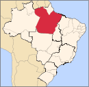
 Location of Belém in the State of Pará | |||
 Belém Location in Brazil | |||
| Coordinates: 1°27′21″S 48°30′14″W / 1.45583°S 48.50389°WCoordinates: 1°27′21″S 48°30′14″W / 1.45583°S 48.50389°W | |||
| Country |
| ||
| Region | North | ||
| State |
| ||
| Founded | 12 January 1616 | ||
| Government | |||
| • Mayor | Zenaldo Coutinho (PSDB) 2013–2016 | ||
| Area | |||
| • Municipality | 1,059.40 km2 (409.04 sq mi) | ||
| Elevation | 10 m (30 ft) | ||
| Population (2015 census) | |||
| • Municipality | 1,439,561 (11th) | ||
| • Density | 1,322/km2 (3,420/sq mi) | ||
| • Metro | 2,249,405 | ||
| Time zone | BRT (UTC-3) | ||
| Postal Code | 66000-000 | ||
| Area code(s) | +55 91 | ||
| HDI | 0.746 (UN) | ||
| Website | Official website | ||


Belém (Portuguese pronunciation: [beˈlẽj]), literally Portuguese for Bethlehem, is a Brazilian municipality, the capital and largest city of the state of Pará in the country's north. It is the gateway to the River Amazon with a busy port, airport, and bus/coach station. Belém lies approximately 100 km upriver from the Atlantic Ocean, on the Pará River, which is part of the greater Amazon River system, separated from the larger part of the Amazon delta by Ilha de Marajó (Marajo Island). With an estimated population of 1,439,561 people — or 2,249,405, considering its metropolitan area — it is the 11th most populous city in Brazil, as well as the 16th by economic relevance. It is the second largest in the North Region, second only to Manaus, in the state of Amazonas,
Founded in 1616 by the Kingdom of Portugal, Belém was the first European colony on the Amazon but did not become part of Brazil until 1775. The newer part of the city has modern buildings and skyscrapers. The colonial portion retains the charm of tree-filled squares, churches and traditional blue tiles. The city has a rich history and architecture from colonial times. Recently it witnessed a skyscraper boom.
Belém is also known as the Metropolis of the Brazilian Amazon region or the Cidade das Mangueiras (City of Mango Trees) due to the vast number of those trees found in the city. Brazilians often refer to the city as Belém do Pará ("Belém of Pará") rather than just Belém, a reference to an earlier name for the city, Santa Maria de Belém do Grão Pará, and also to differentiate it from a number of other towns called Belém in Brazil. It is named after Santa Maria de Belém in Lisbon, also better known by its shortened name, Belém.
Belém is served by two airports: Val de Cães International Airport, which connects the city with the rest of Brazil and other cities in South America, and Brig. Protásio de Oliveira Airport (formerly called Júlio César Airport) dedicated to general aviation. The city is also home to the Federal University of Pará and the Pará State University.
Name
The name Belém is the Portuguese word for Bethlehem, the town where Christians believe Jesus Christ was born. The city had a few other names before becoming Belém. Notice also that Brazil has a city called Natal, which means Christmas.
History

In 1615, Portuguese captain-general Francisco Caldeira Castelo Branco of the captaincy of Bahia commanded a military expedition sent by the Governor General of Brazil to check the trading excursions of foreigners (French, Dutch, English) up the river (Amazon) from the Cabo do Norte in Grão Pará.
On January 12, 1616, he anchored in what we now call Guajará bay formed by the confluence of the Para and Guama Rivers, called by the Tupinambás, "Guaçu Paraná". Caldeira mistook the bay for the main channel, and thirty leagues upstream, he built a wooden fort, covered with straw, which he called "Presépio" (now "Forte do Castelo"). The colony formed by the fort was given the name Feliz Lusitânia, "Happy Lusitania". It was the embryo of the future city of Belém. The fort failed to suppress Dutch and French trading, but did ward off colonization.
Feliz Lusitânia was later called Nossa Senhora de Belém do Grão Pará (Our Lady of Bethlehem of Grao-Para) and Santa Maria de Belém (St. Mary of Bethlehem). Belém was given city status in 1655 and was made capital of the State when Pará state was split off from Maranhão in 1772. The early decades of the 19th century were marked by political instability. Uprisings and internecine strife finally ended in 1836, after considerable loss of life.[1]
The sugar trade in the Belém region was important up to the end of the 17th century. Thereafter the city's economic importance alternately rose and fell. Cattle ranching supplanted sugar until the 18th century, when cultivation of rice, cotton and coffee became profitable. With the settlement of southern Brazil, where such crops could be produced more reasonably, Belém declined again. The city subsequently became the main exporting centre of the Amazon rubber industry, and by 1866 its position was further enhanced by the opening of the Amazon, Tocantins and Tapajós rivers to navigation. The rubber era ended after the boom of 1910–12, but Belém continued to be the main commercial centre of northern Brazil and the entrepôt for the Amazon valley.[2]
Geography
The city of Belém, capital of Pará, is full of indentations and recesses forming islands all around it. There are 55 of these islets, most of which are wild and uninhabitable, although some are home to small populations called ribeirinhos.
These include the islands of Mosqueiro, fringed by 14 freshwater beaches, and Caratateua which receive a large number of visitors in summertime. In addition to these and also near Belém, is the island of Tatuoca which is the location of one of the seven geophysical stations in the world, and the only station in Latin America.
Situated in the Guajará Bay, on the estuary of the rivers Guamá and Pará, the city began as a river port in 1616, immediately after the French were driven out of São Luís, the capital of the state of Maranhão.
Climate
Belém has a tropical rainforest climate (climate type Af), under Köppen’s Climate classification. In all 12 months of the year, the city on average sees more than 60 mm of rainfall, so the city has no true dry season month. However, Belém features noticeably wetter and drier seasons. The wetter season spans from December through May, while the drier season covers the remaining six months of the year. Like many cities with a tropical rainforest climate, average temperatures vary little throughout the course of the year, generally hovering around 26.5 degrees Celsius. As one would expect, tropical rainforest is the natural vegetation in and around the city.
| Climate data for Belém (1961–1990) | |||||||||||||
|---|---|---|---|---|---|---|---|---|---|---|---|---|---|
| Month | Jan | Feb | Mar | Apr | May | Jun | Jul | Aug | Sep | Oct | Nov | Dec | Year |
| Record high °C (°F) | 35.9 (96.6) |
34.8 (94.6) |
37.3 (99.1) |
35 (95) |
34 (93) |
35 (95) |
35.3 (95.5) |
35.5 (95.9) |
34 (93) |
35 (95) |
35 (95) |
37 (99) |
37.3 (99.1) |
| Average high °C (°F) | 30.9 (87.6) |
30.5 (86.9) |
30.4 (86.7) |
30.8 (87.4) |
31.3 (88.3) |
31.7 (89.1) |
31.7 (89.1) |
32.1 (89.8) |
32.1 (89.8) |
32.2 (90) |
32.3 (90.1) |
31.9 (89.4) |
31.5 (88.7) |
| Daily mean °C (°F) | 25.6 (78.1) |
25.4 (77.7) |
25.5 (77.9) |
25.6 (78.1) |
25.8 (78.4) |
26 (79) |
25.7 (78.3) |
26 (79) |
26 (79) |
26.4 (79.5) |
26.5 (79.7) |
26.2 (79.2) |
25.9 (78.6) |
| Average low °C (°F) | 22.1 (71.8) |
22.2 (72) |
22.4 (72.3) |
22.6 (72.7) |
22.6 (72.7) |
22.1 (71.8) |
21.7 (71.1) |
21.7 (71.1) |
21.7 (71.1) |
21.6 (70.9) |
21.9 (71.4) |
22 (72) |
22.1 (71.8) |
| Record low °C (°F) | 19.4 (66.9) |
18.8 (65.8) |
19.8 (67.6) |
19.2 (66.6) |
19.8 (67.6) |
19.8 (67.6) |
14 (57) |
18.5 (65.3) |
18.8 (65.8) |
18.9 (66) |
18.6 (65.5) |
19 (66) |
14 (57) |
| Average rainfall mm (inches) | 385.5 (15.177) |
412.5 (16.24) |
447.1 (17.602) |
353.4 (13.913) |
305.5 (12.028) |
155.3 (6.114) |
155.5 (6.122) |
126.4 (4.976) |
144.8 (5.701) |
114.6 (4.512) |
118.2 (4.654) |
203 (7.99) |
2,921.7 (115.028) |
| Average rainy days (≥ 1 mm) | 24 | 24 | 26 | 24 | 23 | 16 | 15 | 12 | 15 | 12 | 13 | 17 | 221 |
| Average relative humidity (%) | 89.7 | 91 | 91 | 91 | 88 | 86 | 85 | 84 | 84 | 83 | 83 | 86 | 86.8 |
| Mean monthly sunshine hours | 139.4 | 102.5 | 103.6 | 121.9 | 181.6 | 225.9 | 252.4 | 263.5 | 230.5 | 233.4 | 204.6 | 182.3 | 2,241.6 |
| Source: Brazilian National Institute of Meteorology (INMET).[3][4][5][6][7][8][9][10][11] | |||||||||||||
Vegetation

The Amazon represents more than half the planet's remaining rainforests and comprises the largest and most species-rich tract of tropical rainforest in the world. Wet tropical forests are the most species-rich biome, and tropical forests in the Americas are consistently more species rich than the wet forests in Africa and Asia.[12] As the largest tract of tropical rainforest in the Americas, the Amazonian rainforests have unparalleled biodiversity. More than one-third of all species in the world live in the Amazon Rainforest.[13]
Economy
The most valuable products now exported from the Amazon by way of Belém are aluminium, iron ore, and other metals.,[14] nuts (chiefly Brazil nuts), pineapples, cassava, jute, wood veneers, and hardwoods. Japanese immigration after the 1930s was an important factor in developing jute and black pepper, notably at Tomé-Açu, just south of Belém, and near Santarém.[15] Marajó Island, the largest fluvial island in the world, which lies just across the Rio Pará from Belém, has some livestock grazing.[16] Electricity is provided by the massive Tucuruí Dam, some 300 km southwest of the city on the Tocantins River.[17]
Tourism
Belém has a modern appearance with tree-lined streets, several plazas and public gardens, and many noteworthy buildings. The north's leading educational and cultural centre, it is the seat of a bishopric, and its cathedral (Igreja da Sé, founded in 1917) is one of Brazil's largest. Santo Alexandre, the oldest of Belém's churches, was built in 1616. The Museu (museum) Paraense Emílio Goeldi, the Teatro da Paz (a classical theatre), and the public library and archives are other notable institutions. The Universidade Federal do Pará (1957), a teacher-training school, an agricultural institute, and an institute for research on tropical diseases are also in the city. The Ver-o-Peso (Portuguese: "see the weight") market in the old port centre is a major tourist attraction. The city is also home to a large football stadium, the Estádio Olímpico do Pará.
Demographics
According to the IBGE of 2012, there were 2,079,699 people residing in the Metropolitan Region of Belém. The population density was 1,337.2 inhabitants per square kilometre (3,463/sq mi). The last PNAD (National Research for Sample of Domiciles) census revealed the following numbers: 1,379,655 Pardo (brown) people (64.5%), 588,225 White (27.5%), 156,147 Black (7.3%), 14,973 Asian or Amerindian people (0.7%).[18]
According to an autosomal DNA genetic study from 2011, the ancestral composition of the population of Belém is: 68.6% European ancestry, followed by 20.9% Amerindian ancestry and 10.6% African ancestry.[19]
Education
Portuguese is the official national language, and thus the primary language taught in schools. But English and Spanish are part of the official high school curriculum.
Education institutions
- Universidade Federal do Pará (UFPA);
- Universidade do Estado do Pará (UEPA);
- Universidade Federal Rural da Amazônia (UFRA);
- Universidade da Amazônia (UNAMA);
- Centro Universitário do Pará (Cesupa);
- Amazon Valley Academy International School (AVA);
- Escola Superior da Amazônia (ESAMAZ);
- Instituto Federal de Educação, Ciência e Tecnologia do Pará (IFPA)
Culture

Círio de Nazaré
On the second Sunday in October, Pará celebrates the largest and greatest religious event in Brazil: the procession of the Círio of Nazaré. The tradition started when a farmer and lumberman called Plácido José de Souza found an image of the Virgin and Child on the edge of the Murucutu creek, where the Basilica of Nazaré stands today. The humble man decided to take the image home. However, the image would mysteriously go back to the place where it was initially found every time he took it home. So Plácido decided to build a small chapel on the edge of the creek. This episode was regarded as miraculous throughout the region. It attracted hundreds of believers to see the image and pay homage to it.
Since then, the Círio is celebrated as a long procession of faith, in which thousands of people follow the statue through the streets of Belém, in a manifestation that lasts around five hours for unity, emotion and devotion, with no distinction of social classes, to express the strongest devotion to the belief. The Círio is regarded as the "Christmas of the Amazon" because it is a moment of congregation in which everyone is involved in the arrangements to receive the saint in an atmosphere of fraternity, with people becoming more sympathetic and happier. In early September, minor celebrations take place as a spiritual preparation for the Círio, with thousands of images scattered all over the capital and neighboring cities, gathering families from different parts of the capital to run pilgrimage of Our Lady among choirs and prayers.

In the old times the celebration was limited to the Trasladação (Transfer), the Círio, the Procession and the Re-círio (post-Círio). But it was necessary to incorporate new elements into the tradition due to the people's yearning to honor their patron saint. On Saturday morning, prior to the Círio, the statue is taken to the square of Ananindeua, a nearby city, in front of the Main Church to start at 6 am the Road Pilgrimage, organized by the Pará State Cargo Transportation Companies' Union (SINDICARPA), which conducts the image to the Icoaraci pier by road for a field Mass.
Then the river pilgrimage starts. It was created and organized by the former president of the Pará Tourism Company (PARATUR), Carlos Roque, to honor the "water men" who regard the Virgin of Nazareth as their patron saint. PARATUR also promotes a traditional ship contest to award the most originally decorated boat. When the Sacred Image leaves Icoaraci in the event's official ship, a Navy Corvette, it is followed by dozens of boats and ships of all colors and types, decorated to greet the Virgin and follow her through the waters of the Guajará Bay to the pier of Belém, where it will be escorted by motorcyclists all the way to the Gentil Bittencourt School, only leaving at 6 p.m. for the Trasladação (Transfer). This symbolizes the story of the discovery of the Saint and its return to the place where it was found. A candle-lit procession follows the Carriage, to which a huge rope is tied. The rope is carried by the faithful until the procession arrives at the Sé Cathedral.

During the procession, a fireworks show takes place with thousands of colorful fireworks, sponsored by the Stevedores' Union, marking the passage of the Saint until its arrival at the Cathedral, where it is received, gently, with a religious program. At daybreak of the next day, the faithful start to gather at the Old City, believing that this will bring them closer to the Virgin. At around 4 a.m., the rope is stretched by Our Lady's guards and, within minutes, is held by the "vowers", who have long looked forward to an incredible back-and-forth choreography, like human waves, sparking the solidarity from the bystanders, who try to quench the thirst of those carrying the rope by offering them water. While the 12 cars that take part in the procession, like the scouts' barge, the new barge, the angels' barge, the miracle's barge, amongst others, are orderly positioned to receive wax figures, wooden house miniatures and other images to thank for their achievements over the year. At 7 o'clock, the archbishop conducts Our Lady's image to the carriage as the bells toll and the fireworks explode, thus setting the beginning of the biggest religious event of Latin America. Throughout the course, the faithful make reflections on biblical themes, pray, sing, pay homage with a shredded paper shower, lifting their arms towards the sky, acclaiming during the procession and praising the Virgin. From the Padre Champagnat Street towards the Ver-o-Peso Market, passing by Portugal Avenue and Castilho França Boulevard, going up the Presidente Vargas Avenue, reaching the Republic Square to get to the Nazaré Avenue as far as the Architectonic Centre of Nazareth, known for its Sanctuary Square.
As it arrives at the square, the image is removed from the carriage for the celebration of a Mass and then lifted so that everybody will be blessed by the patron saint of Pará. This marks the end of the procession, which is filled with emotion and endless applause by the crowd.
The festivities are 15 days long, with religious celebrations, like the Children's Círio, and its procession, held two Sundays after the Círio. Cultural activities, visiting the Círio Museum, and leisure, with an amusement park at the Arraial de Nazaré. The Re-Círio marks the end of the celebrations, with a shorter course, but with no less emotion, for the Saint's farewell, with tears, waving with white handkerchiefs, hope and thanks, to the Gentil Bittencourt chapel, bringing a feeling of lightness and renovation to expect for another year.
Convention and Fair Centre of the Amazon
Built in a 23,000-square-metre area, the Hangar Convention and Fair Center of the Amazon has 12 rooms, ticket offices, baggage keeping, press room, and a food court, distributed in two big buildings with a parking lot for 800 vehicles. Genuine Amazonian trees will soon be planted in the outdoor area. With Hangar, Belém joins the market for national conventions that take place in a different city each time, such as the Brazilian Computer Society Congress. National conventions had not been held in the Northern region previously.
Hangar, whose auditorium has room for 2,160 participants, has some of the best technologies available in the world and is the most modern and functional space for events in the country. According to the Brazilian Association of Convention and Fair Centers (ABRACCEF), there are 17,500 events happening on average throughout the 53 main convention and exhibition centres of Brazil. These activities bring together approximately 28 million participants. Belém has great potential for this type of tourism.
Architecture
In many ways, Belém's colonial architecture reflects the seventeenth-century architecture of Lisbon in Portugal which served as the inspiration for the main housing projects of the time, with the frequent use of tile-hung façades. Neoclassical architecture is also present in buildings such as the Theatro da Paz, built in 1874. Many of the buildings at the end of the nineteenth century and early twentieth century also echo French architecture.
Belém began with the narrow streets of the Cidade Velha (Old City), a district which still preserves some structures that the Portuguese colonials built here, places like Forte do Castelo, a fort built to defend the region against French, Dutch and British colonization attempts, and one of the first structures in the capital. The Ver-o-pêso market is the biggest open market in Latin America where you can find everything, from the most exotic fruit, to the scented baths.
Cuisine
The local Amerindian culture extracts colors, scents, flavors, and native tastes from nature to produce a rich and exotic cuisine, adding up to the most authentic of regional cuisines. One such dish, "Cupuaçu", comes from the Cupuaçu tree, found in the Amazonian woods. Cupuaçu is easily identified by its smell and sour taste and is highly appreciated by both locals and tourists. Its pulp is also extracted to make juices, candies, jellies, liquors, and ice cream. Açaí is a palm tree with a long, thin stem. Açaí, also known as Jussara, is purple in color with a delicious taste. Long prized by the local population, it recently it has also reached the national menu.
Freshwater crab, a traditional local delicacy, is a very popular dish in the city's cuisine. Found only in swamps, its well-tempered meat can be served in different forms: as a shell, the so-called unha (the claws) or toc-toc. "Maniçoba" is one of the highlights of the local cuisine. Its preparation is time-consuming and its final appearance is quite surprising for those who have never tried it, due to the dark look of the cooked maniva (ground manioc leaves). But this first impression ends quickly, after you taste the dish with its seemingly awkward ingredients. Maniçoba is often served in ceramic dishes, and can be eaten with rice or with manioc flour and capsicum.
World Social Forum
The World Social Forum 2009 took place from January 27 to February 1 in Belém.
Tourism
Amazon Biopark Zoo
Located less than 15 kilometres (9.3 miles) from the center of Belém, in the Tenoné neighborhood, the Bioparque Amazônia Safari - Crocodilo Safari Zoo, is surrounded by forests, rivers and streams. Summary of the Amazon landscape with lush flora and fauna, the zoo has about 14 miles (23 kilometres) of trails in an area composed of four interconnected ecosystems.
A large attractive Bioparque is the Museum of Paleontology and Malacology where visitors can watch a collection of three thousand pieces of exposed shells and mollusks collected from all continents. On site, you will also see paintings with motifs of cabloco Amazon.
Bioparque The Amazon is a private investment, owner Jorge Arthur Aarão Monteiro, authorized and licensed by IBAMA to function as C class zoo, the only category of Pará There are four different species of alligators in a population of thousands of individuals, highlighting açu for alligator, monkeys, anteaters, and the otters, hyacinth macaw, papagaios, tucannos, pacaranas, harpy eagle, among other animals.[20] Also see the city turistic website here .
Rodrigues Alves Wood–Botanical Garden
Inspired by the Bois de Boulogne Park in Paris, the Rodrigues Alves Wood is a little piece of Amazonia preserved in the middle of the city. Comprising 16 hectares, in the ample Avenida Almirante Barroso, one of the city's busiest thoroughfares, having 2,500 native species, an orchidary, lakes, caverns, waterfalls and even a replica of a mountain. There you can see small animals characteristic to the region, such as squirrel monkeys, agoutis and macaws.
The Estação das Docas Complex
The Estação das Docas Complex reopened the windows of Belém to Guajará Bay. The restoration project covers the area of old warehouses of the Pará Docks Company. Constructed from prefabricated metal structures in England and that were built at the beginning of the twentieth century in Belém.[21]
There are eighteen thousand square metres (193,750 square feet) of urbanised area, with coffee bar services, various restaurants, stores, travel agencies, banks, in addition to an auditorium and two memorials: The Porto Memorial and the Fortaleza de São Pedro Nolasco Memorial There is, also, a fluvial station and extensive external area.
Ver-o-Peso Market
Created in 1688, as a result of the Portuguese deciding to levy a tax for everything entering and leaving Amazonia. Despite resembling a large retailer, the mixture of colours, fragrances and objects is very interesting as well as folkloric.
Medicinal herbs, various regional fruits, arts and crafts, domestic utilities, meats, fish and seasonings and spices can be found there. The Market brings together two thousand stalls and traders in every part and is located near to the old Mercado de Ferro (Iron market), on the quays.
Mosqueiro
The river island of Mosqueiro, 67 km (42 mi) north of the heart of the city, attracts beach tourists in the dry season.[22]
Infrastructure
Airports

Belém International Airport (Val de Cans) is the major airport serving the city of Belém. The building design uses plane curves on its roof to permit light to enter its entire large terminal hall.
The architect Sérgio Parada used adopted multiple-use totems integrated with light projectors, a sound system, air conditioning, and public telephones. Currently Belém International Airport serves 2.7 million passengers a year, in a constructed area of 33,255.17 square metres (357,955.67 square feet).[23]
Traditionally called Val-de-Cães Airport, it is responsible for increasing tourism in the Amazon region, as well as for the outflow of products and attracting new investments. The passenger terminal is fully air conditioned on two levels and has "futuristic" architecture, designed to take advantage of natural lighting. People with special needs have individualized service with own equipment at specific locations to facilitate their access. The terminal's interior is decorated with plants native to the Amazon region and is enclosed by a source able to imitate the sound of the rains that fall every day in the region.
The smaller Brig. Protásio de Oliveira Airport (Júlio César) also administrated by Infraero, is used for general aviation.
Highways
BR-316 is the major access highway for those coming from the Northeastern Brazil. For visitors from the Southern, Southeastern, and Mid-Eastern Regions, the best route is BR-010, which originates in Brasília in the South, and also PA-150, a route that links Belém to Southern Pará.
Waterways
Belém can be reached by the Tocantins River and Amazonas River and by the Atlantic Ocean. The city of Belém has been referenced in the opening episode of the TV series No Ordinary Family, where Powell's go for a family vacation.
Distances
- São Paulo: 2,933 km (1,822 mi)
- Rio de Janeiro: 3,250 km (2,020 mi)
- Brasília: 2,132 km (1,325 mi)
- Manaus: 1,489 km (925 mi)
- Teresina: 923 km (574 mi)
- São Luís: 806 km (501 mi)
- Santarém, Pará: 807 km (501 mi)
- Florianópolis: 3,577 km (2,223 mi)
- Cuiabá: 2,970 km (1,850 mi)
- Belo Horizonte: 2,824 km (1,755 mi)
Personalities
|
|

International relations
Belem has the following partnership cities:
References
- ↑ History of Belém Archived February 23, 2009, at the Wayback Machine.
- ↑ Rubber era in Belém
- ↑ "Temperatura Média Compensada (°C)" (in Portuguese). Brazilian National Institute of Meteorology. 1961–1990. Archived from the original on May 4, 2014. Retrieved August 19, 2014.
- ↑ "Temperatura Máxima (°C)" (in Portuguese). Brazilian National Institute of Meteorology. 1961–1990. Archived from the original on May 4, 2014. Retrieved August 19, 2014.
- ↑ "Temperatura Mínima (°C)" (in Portuguese). Brazilian National Institute of Meteorology. 1961–1990. Archived from the original on May 4, 2014. Retrieved August 19, 2014.
- ↑ "Precipitação Acumulada Mensal e Anual (mm)" (in Portuguese). Brazilian National Institute of Meteorology. 1961–1990. Archived from the original on May 4, 2014. Retrieved August 19, 2014.
- ↑ "Número de Dias com Precipitação Mayor ou Igual a 1 mm (dias)". Brazilian National Institute of Meteorology. Archived from the original on May 4, 2014. Retrieved August 19, 2014.
- ↑ "Insolação Total (horas)". Brazilian National Institute of Meteorology. Archived from the original on May 4, 2014. Retrieved August 19, 2014.
- ↑ "Umidade Relativa do Ar Média Compensada (%)". Brazilian National Institute of Meteorology. Archived from the original on May 4, 2014. Retrieved August 19, 2014.
- ↑ "Temperatura Máxima Absoluta (ºC)". Brazilian National Institute of Meteorology (Inmet). Archived from the original on June 21, 2014. Retrieved August 19, 2014.
- ↑ "Temperatura Mínima Absoluta (ºC)". Brazilian National Institute of Meteorology (Inmet). Archived from the original on June 21, 2014. Retrieved August 19, 2014.
- ↑ Turner, I. M. 2001. The ecology of trees in the tropical rainforest. Cambridge University Press, Cambridge. ISBN 0-521-80183-4
- ↑ Amazon Rainforest, Amazon Plants, Amazon River Animals
- ↑ Metals in Belém
- ↑ Japanese Immigration to Pará and Belém Archived February 13, 2009, at the Wayback Machine.
- ↑ About Marajó Island
- ↑ Tucuruí Dam Archived July 6, 2011, at the Wayback Machine.
- ↑ Síntese de Indicadores Sociais 2008 (PDF) (in Portuguese). Belém, Brazil: IBGE. 2008. ISBN 85-240-3919-1. Retrieved 2009-01-31.
- ↑ http://www.plosone.org/article/info%3Adoi%2F10.1371%2Fjournal.pone.0017063
- ↑ Amazon Biopark Zoo (Bioparque Amazônia)
- ↑ Estação das Docas
- ↑ "Ilha de Mosqueiro". Facebook. Retrieved September 16, 2014.
- ↑ International Airport of Belém
External links
-
 Media related to Belém at Wikimedia Commons
 -
 Belém travel guide from Wikivoyage
 - Website with information, guides and tourist information about Belém (English)
- Website of festivals, events and cultural agenda of the City of Belém (English)
Capital: Belém | |||||||||||||||||||||||||||
| Mesoregion Baixo Amazonas |
|  | |||||||||||||||||||||||||
| Mesoregion Marajó |
| ||||||||||||||||||||||||||
| Mesoregion Metropolitana de Belém |
| ||||||||||||||||||||||||||
| Mesoregion Nordeste Paraense |
| ||||||||||||||||||||||||||
| Mesoregion Sudeste Paraense |
| ||||||||||||||||||||||||||
| Mesoregion Sudoeste Paraense |
| ||||||||||||||||||||||||||