Belair National Park
| Belair National Park South Australia | |
|---|---|
|
IUCN category II (national park) | |
 Belair National Park | |
| Nearest town or city | Adelaide city centre |
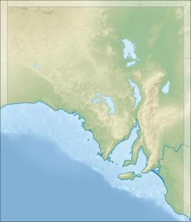
| Coordinates | 35°00′47″S 138°39′21″E / 35.01306°S 138.65583°ECoordinates: 35°00′47″S 138°39′21″E / 35.01306°S 138.65583°E |
| Established | 1891[1] |
| Area | 8.35 km2 (3.2 sq mi)[2] |
| Visitation | 358,619 (in 2003)[3] |
| Managing authorities | Department of Environment, Water and Natural Resources |
| Website | Belair National Park |
| See also | Protected areas of South Australia |
Belair National Park (formerly known as the National Park and as Belair Recreation Park) is a protected area located at Belair in South Australia (Australia), 13 kilometres (8.1 mi) south of Adelaide city centre and which covers an area of 835 hectares (2,060 acres). It was proclaimed in 1891 and was the first national park in South Australia, second in Australia (after Sydney's Royal National Park which was proclaimed in 1879) and the tenth in the world.[4] The national park lies within the Adelaide Hills and Mitcham council area, and forms part of a chain of protected areas located along the Adelaide Hills Face Zone. The national park is administered by the Department of Environment, Water and Natural Resources.
Description
The Belair National Park has excellent recreation and social facilities within an outdoor environment. There are many areas of interest within the park, including Old Government House, the Nursery, Playford Lake and the Adventure Playground. It has numerous tennis courts and ovals, and has walking, bike and horse-riding trails. The national park has an outstanding presentation of the State’s native fauna, attracting visitors, showcasing the State’s park system and contributing to the community awareness of the natural environment. Some species of fauna commonly encountered in the national park include the southern brown bandicoot (Isoodon obesulus), tawny frogmouth (Podargus strigoides), brown tree frog ((Litoria ewingii) and shingleback lizard (Tiliqua rugosa).
Naming
For most of its existence, it has been known as the 'National Park'. Between the years 1972 and 1991 it was known as the 'Belair Recreation Park'. In 1991, the Belair Recreation Park was abolished and the land that it occupied was constituted as a national park and given the name “Belair National Park”.[5][6]
History
The first European to settle on the land now known as Belair National Park was one Nicholas Foott, who squatted there rent-free in his "Manning cottage", to which he had added several stone out-buildings, on the understanding he would have to move if the land were sold. In July 1840 he was given notice to quit, as Governor Gawler had decided to set up a farm there to grow hay for police horses and other Government livestock, and the Government formally took over 800 acres (320 ha) (sections 819–828), plus a considerable portion of unsurveyed land, making a total of 2,148 acres (869 ha). Foott was awarded ₤300 for his improvements. John McLaren was appointed superintendent of the farm.
Governor Grey arrived in May 1841, with a remit to cut Government expenditure and raise revenue, and announced in the Gazette of 15 July of the intended sale by auction of the land. This, however, did not take place, and in the depression of 1841–1842 a dozen or so unemployed men and their families were allowed to settle there temporarily. In June 1844, four sections at the western end (874, 875, 878 and 882) totalling about 400 acres (160 ha) were sold. In 1848 a cottage, long since demolished, was erected alongside the creek as a residence for the farm manager, and for occasional use by the Governor.
In 1858 a residence, complete with swimming pool, was built as a "summer house" for the Governor, Sir Richard MacDonnell (served 1855–1862), and used by his successors Sir Anthony Musgrave (1873–1877), and presumably Sir William Jervois (1877–1883), at least until the more imposing edifice at Marble Hill was completed.
From 1874 to 1884 the Government Farm was managed by William Cook (1815–1897), father of Edith Agnes Cook. His eldest daughter Katherine wrote an article on that period of the farm's history[7] for the South Australian Archives.[8] His predecessor was Ebenezer Jarvis (c. 1829–1897), who left to take a post as manager of Government House, Adelaide. Two great bushfires occurred during their time; in 1866/1867 and 1877, when many old trees were destroyed.[9]
Proposals in 1881 to sell off parts of small portions of the land were opposed by Walter Gooch, James Page and the Australian Natives Association, which led in 1883 to an Act of Parliament prohibiting its sale. In 1888 further agitation by Gooch, A. F. Robin and Samuel Dixon of the Royal Society of South Australia led to a parliamentary decision that the Government Farm be established as a public park, and after some delays the National Park Act received the Governor's assent in January 1892.[10]
In 1985, the Belair National Park was declared as a state heritage area under the South Australian Heritage Act 1978-1980.[4]
Weed invasion

The first European people traversed the Belair area in 1837. In 1840, Governor Gawler raised a government farm on which sick horses and bullocks from government departments could be agisted. In 1881, a proposal was put forward for small agricultural holdings and also, the national park was dedicated, making it the first National Park in South Australia. Many exotic and non-indigenous plants were introduced and are now found in the park as weeds. Numerous native plants, such as Cootamundra wattle, have become environmental weeds after being introduced into areas outside their natural range.
The Belair National Park has suffered major disturbance to its natural ecosystems and natural vegetation communities through the accidental invasion of non-indigenous plants as well as the deliberate introduction of exotic and non-indigenous plants to certain zones within the park.
Walking Trails


- Wood Duck Dawdle
A short circuit around Playford Lake.
- Lorikeet Loop Walk
A 3 km circuit walk from the main car park to the Adventure Playground.
- Valley Loop Walk
A 3 km circuit walk to Long Gully.
- Microcarpa Walk
A 4 km circuit departing from near Playford Lake.
- Waterfall Hike
The national park 's best walk. A 6.5 km circuit that visits the park's waterfalls and travels to the higher areas away from the recreation areas.
- Yurrebilla Trail
The first 5 km of the Yurrebilla Trail is in the national park . It begins at the Belair railway station and continues toward the Lower Waterfall before departing the park at the Sheoak Road boundary.
See also
| Wikimedia Commons has media related to Belair National Park. |
References
- ↑ "History". Belair National Park website. Department of Environment, Water and Natural Resources (South Australia). 6 February 2014. Retrieved 6 February 2014.
- ↑ "CAPAD 2012 South Australia Summary (see 'DETAIL' tab)". CAPAD 2012. Australian Government - Department of the Environment. 6 February 2014. Retrieved 6 February 2014.
- ↑ "Visitor Use" (PDF). Belair National Park Management Plan, p. 38. Department for Environment and Heritage. 6 February 2014. Retrieved 6 February 2014.
- 1 2 "Belair National Park state heritage area". Government of South Australia. Retrieved 4 December 2016.
- ↑ "Belair National Park state heritage area (fact sheet)" (PDF). Government of South Australia. p. 3. Retrieved 4 December 2016.
- ↑ "National Parks and Wildlife Act 1972 Part III: Reconstitution of Certain Reserves as National Parks; Proclamation by the Governor" (PDF). South Australian Government Gazette. Government of South Australia. 20 June 1991. p. 1920. Retrieved 4 December 2016.
- ↑ "Out among the People". The Advertiser (Adelaide). LXXXVI, (26538). South Australia. 25 October 1943. p. 4. Retrieved 15 July 2016 – via National Library of Australia.
- ↑ "Death Of Miss Harriet Cook". The Advertiser (Adelaide). LXXXVI, (26571). South Australia. 2 December 1943. p. 2. Retrieved 14 July 2016 – via National Library of Australia.
- ↑ "The Government Farm". Adelaide Observer. XXXIX, (2102). South Australia. 14 January 1882. p. 35. Retrieved 15 July 2016 – via National Library of Australia.
- ↑ J. B. Cleland, in National Park and Reserves, Bernard C. Cotton ed., Government Printer, Adelaide 1953