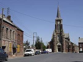
Beauvois-en-Cambrésis
| Beauvois-en-Cambrésis | ||
|---|---|---|
 | ||
| ||
 Beauvois-en-Cambrésis | ||
|
Location within Hauts-de-France region  Beauvois-en-Cambrésis | ||
| Coordinates: 50°08′19″N 3°23′01″E / 50.1386°N 3.3836°ECoordinates: 50°08′19″N 3°23′01″E / 50.1386°N 3.3836°E | ||
| Country | France | |
| Region | Hauts-de-France | |
| Department | Nord | |
| Arrondissement | Cambrai | |
| Canton | Carnières | |
| Intercommunality | Caudrésis–Catésis | |
| Government | ||
| • Mayor (2008–2014) | Gérard Devaux | |
| Area1 | 3.52 km2 (1.36 sq mi) | |
| Population (2009)2 | 2,124 | |
| • Density | 600/km2 (1,600/sq mi) | |
| Time zone | CET (UTC+1) | |
| • Summer (DST) | CEST (UTC+2) | |
| INSEE/Postal code | 59063 / 59157 | |
| Elevation | 86–121 m (282–397 ft) | |
|
1 French Land Register data, which excludes lakes, ponds, glaciers > 1 km² (0.386 sq mi or 247 acres) and river estuaries. 2 Population without double counting: residents of multiple communes (e.g., students and military personnel) only counted once. | ||
Beauvois-en-Cambrésis is a commune in the Nord department in northern France.
Population
| Historical population | ||
|---|---|---|
| Year | Pop. | ±% |
| 1793 | 626 | — |
| 1800 | 372 | −40.6% |
| 1806 | 483 | +29.8% |
| 1821 | 799 | +65.4% |
| 1831 | 913 | +14.3% |
| 1836 | 968 | +6.0% |
| 1841 | 1,060 | +9.5% |
| 1846 | 1,090 | +2.8% |
| 1851 | 1,051 | −3.6% |
| 1856 | 1,100 | +4.7% |
| 1861 | 1,307 | +18.8% |
| 1866 | 1,477 | +13.0% |
| 1872 | 1,959 | +32.6% |
| 1876 | 2,309 | +17.9% |
| 1881 | 3,333 | +44.3% |
| 1886 | 3,406 | +2.2% |
| 1891 | 3,878 | +13.9% |
| 1896 | 3,990 | +2.9% |
| 1901 | 3,986 | −0.1% |
| 1906 | 4,214 | +5.7% |
| 1911 | 4,105 | −2.6% |
| 1921 | 3,291 | −19.8% |
| 1926 | 3,071 | −6.7% |
| 1931 | 2,881 | −6.2% |
| 1936 | 2,759 | −4.2% |
| 1946 | 2,499 | −9.4% |
| 1954 | 2,548 | +2.0% |
| 1962 | 2,454 | −3.7% |
| 1968 | 2,286 | −6.8% |
| 1975 | 2,260 | −1.1% |
| 1982 | 2,258 | −0.1% |
| 1990 | 2,099 | −7.0% |
| 1999 | 1,994 | −5.0% |
| 2006 | 2,104 | +5.5% |
| 2009 | 2,124 | +1.0% |
Heraldry
.svg.png) |
The arms of Beauvois-en-Cambrésis are blazoned : Vert, a covered cup Or. |
See also
References
| Wikimedia Commons has media related to Beauvois-en-Cambrésis. |
This article is issued from Wikipedia - version of the 8/29/2016. The text is available under the Creative Commons Attribution/Share Alike but additional terms may apply for the media files.