Bear Grass, North Carolina
| Beargrass, North Carolina | |
|---|---|
| Town | |
 Beargrass, North Carolina Location within the state of North Carolina | |
| Coordinates: 35°45′58″N 77°7′46″W / 35.76611°N 77.12944°WCoordinates: 35°45′58″N 77°7′46″W / 35.76611°N 77.12944°W | |
| Country | United States |
| State | North Carolina |
| County | Martin |
| Area | |
| • Total | 0.3 sq mi (0.7 km2) |
| • Land | 0.3 sq mi (0.7 km2) |
| • Water | 0.0 sq mi (0.0 km2) |
| Elevation | 56 ft (17 m) |
| Population (2010) | |
| • Total | 73 |
| • Density | 197.3/sq mi (76.2/km2) |
| Time zone | Eastern (EST) (UTC-5) |
| • Summer (DST) | EDT (UTC-4) |
| ZIP code | 27892 |
| Area code(s) | 252 |
| FIPS code | 37-04180[1] |
| GNIS feature ID | 1024491[2] |
Bear Grass is a town in Martin County, North Carolina, United States. The population was 73 at the 2010 census.
Geography
Bear Grass is located at 35°45′58″N 77°7′46″W / 35.76611°N 77.12944°W (35.765988, -77.129453).[3]
According to the United States Census Bureau, the town has a total area of 0.3 square miles (0.78 km2), all of it land.
It is one of the few incorporated areas of North Carolina that does not host any primary numbered state highways (0-999).
Demographics
| Historical population | |||
|---|---|---|---|
| Census | Pop. | %± | |
| 1910 | 56 | — | |
| 1920 | 108 | 92.9% | |
| 1930 | 131 | 21.3% | |
| 1940 | 114 | −13.0% | |
| 1950 | 128 | 12.3% | |
| 1960 | 103 | −19.5% | |
| 1970 | 99 | −3.9% | |
| 1980 | 82 | −17.2% | |
| 1990 | 77 | −6.1% | |
| 2000 | 53 | −31.2% | |
| 2010 | 73 | 37.7% | |
| Est. 2015 | 71 | [4] | −2.7% |
As of the census[1] of 2000, there were 53 people, 26 households, and 17 families residing in the town. The population density was 197.3 people per square mile (75.8/km²). There were 28 housing units at an average density of 104.2 per square mile (40.0/km²). The racial makeup of the town was 100.00% White.
There were 26 households out of which 15.4% had children under the age of 18 living with them, 53.8% were married couples living together, 11.5% had a female householder with no husband present, and 34.6% were non-families. 34.6% of all households were made up of individuals and 11.5% had someone living alone who was 65 years of age or older. The average household size was 2.04 and the average family size was 2.53.
In the town the population was spread out with 15.1% under the age of 18, 7.5% from 18 to 24, 15.1% from 25 to 44, 37.7% from 45 to 64, and 24.5% who were 65 years of age or older. The median age was 54 years. For every 100 females there were 76.7 males. For every 100 females age 18 and over, there were 80.0 males.
The median income for a household in the town was $24,375, and the median income for a family was $30,625. Males had a median income of $14,375 versus $38,333 for females. The per capita income for the town was $18,562. There were 24.0% of families and 22.7% of the population living below the poverty line, including 41.7% of under eighteens and 44.4% of those over 64.
References
- 1 2 "American FactFinder". United States Census Bureau. Archived from the original on 2013-09-11. Retrieved 2008-01-31.
- ↑ "US Board on Geographic Names". United States Geological Survey. 2007-10-25. Retrieved 2008-01-31.
- ↑ "US Gazetteer files: 2010, 2000, and 1990". United States Census Bureau. 2011-02-12. Retrieved 2011-04-23.
- ↑ "Annual Estimates of the Resident Population for Incorporated Places: April 1, 2010 to July 1, 2015". Retrieved July 2, 2016.
- ↑ "Census of Population and Housing". Census.gov. Archived from the original on May 11, 2015. Retrieved June 4, 2015.
Municipalities and communities of Martin County, North Carolina, United States | ||
|---|---|---|
| Towns | 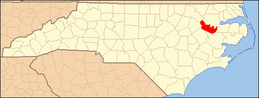 | |