Beak Island
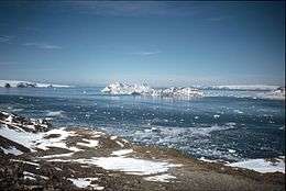 View of Beak Island from western summit of View Point | |
 Beak Island Location in Antarctica | |
| Geography | |
|---|---|
| Location | Antarctica |
| Coordinates | 63°37′S 57°18′W / 63.617°S 57.300°WCoordinates: 63°37′S 57°18′W / 63.617°S 57.300°W |
| Highest elevation | 360 m (1,180 ft) |
| Administration | |
|
None | |
| Demographics | |
| Population | Uninhabited |
| Additional information | |
| Administered under the Antarctic Treaty System | |
Beak Island is an arc-shaped island, 7 kilometres (4 nmi) long and 360 metres (1,200 ft) high, lying 1 kilometre (0.5 nmi) northeast of Eagle Island in the northeast part of Prince Gustav Channel. It was probably first seen in 1902–03 by members of the Swedish Antarctic Expedition under Otto Nordenskiöld. The Falkland Islands Dependencies Survey surveyed Beak Island in 1945 and so named it because of its shape and relative position to nearby Tail Island and Eagle Island.[1]
See also
References
- ↑ "Beak Island". Geographic Names Information System. United States Geological Survey. Retrieved 2011-05-25.
![]() This article incorporates public domain material from the United States Geological Survey document "Beak Island" (content from the Geographic Names Information System).
This article incorporates public domain material from the United States Geological Survey document "Beak Island" (content from the Geographic Names Information System).
This article is issued from Wikipedia - version of the 11/11/2016. The text is available under the Creative Commons Attribution/Share Alike but additional terms may apply for the media files.