Bayview, North Carolina
| Bayview, North Carolina | |
|---|---|
| Census-designated place | |
 Bayview  Bayview | |
| Coordinates: 35°26′13″N 76°47′31″W / 35.43694°N 76.79194°WCoordinates: 35°26′13″N 76°47′31″W / 35.43694°N 76.79194°W | |
| Country | United States |
| State | North Carolina |
| County | Beaufort |
| Area | |
| • Total | 1.0 sq mi (2.7 km2) |
| • Land | 1.0 sq mi (2.7 km2) |
| • Water | 0 sq mi (0 km2) |
| Elevation | 7 ft (2 m) |
| Population (2010) | |
| • Total | 346 |
| • Density | 327/sq mi (126.3/km2) |
| Time zone | Eastern (EST) (UTC-5) |
| • Summer (DST) | EDT (UTC-4) |
| Area code(s) | 252 |
| GNIS feature ID | 1018990[1] |
| FIPS code | 37-04040 |
Bayview is an unincorporated community and census-designated place (CDP) in Beaufort County, North Carolina, United States. As of the 2010 census it had a population of 346.[2]
The community is located on the north bank of the Pamlico River south of North Carolina Highway 92.
References
- ↑ "US Board on Geographic Names". United States Geological Survey. 2007-10-25. Retrieved 2008-01-31.
- ↑ "Geographic Identifiers: 2010 Demographic Profile Data (G001): Bayview CDP, North Carolina". U.S. Census Bureau, American Factfinder. Retrieved February 6, 2014.
Municipalities and communities of Beaufort County, North Carolina, United States | ||
|---|---|---|
| City | 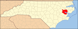 | |
| Towns | ||
| CDPs | ||
| Unincorporated community | ||
This article is issued from Wikipedia - version of the 7/27/2016. The text is available under the Creative Commons Attribution/Share Alike but additional terms may apply for the media files.