Bayport, Minnesota
| Bayport, Minnesota | |
|---|---|
| City | |
| Motto: "A Historic City on the St. Croix River"[1] | |
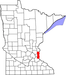
 Location of the city of Bayport within Washington County, Minnesota | |
| Coordinates: 45°1′4″N 92°46′49″W / 45.01778°N 92.78028°W | |
| Country | United States |
| State | Minnesota |
| County | Washington |
| Area[2] | |
| • Total | 1.75 sq mi (4.53 km2) |
| • Land | 1.75 sq mi (4.53 km2) |
| • Water | 0 sq mi (0 km2) |
| Elevation | 709 ft (216 m) |
| Population (2010)[3] | |
| • Total | 3,471 |
| • Estimate (2012[4]) | 3,605 |
| • Density | 1,983.4/sq mi (765.8/km2) |
| Time zone | Central (CST) (UTC-6) |
| • Summer (DST) | CDT (UTC-5) |
| ZIP code | 55003 |
| Area code(s) | 651 |
| FIPS code | 27-04114[5] |
| GNIS feature ID | 0639747[6] |
| Website | bayport.govoffice.com |
Bayport is a city in Washington County, Minnesota, United States. The population was 3,471 at the 2010 census.[7]
Bayport is located along the St. Croix River, one mile south of Stillwater, Minnesota.
History
The City of Bayport began as three small settlements along the St. Croix River. In 1873, the St. Croix Railway Improvement Company combined the three settlements into South Stillwater, which was incorporated as a village in 1881. Because many people confused South Stillwater with the City of Stillwater, the City changed its name to Bayport in 1922.[8]
Like its northern neighbor Stillwater, the early economy of Bayport centered around the lumber industry. From 1852 to 1916, several sawmills operated within the City. The Andersen Corporation is the successor to Bayport’s early lumbering firms. The Andersen Corporation (then the Andersen Lumber Company) moved to Bayport in 1913, among other reasons, to take advantage of the City’s rail lines first built in 1872. The Andersen Corporation prospered in Bayport, becoming the largest window and patio door manufacturer in the world.[9]
In 1914, the Minnesota Correctional Facility - Stillwater moved from Stillwater to Bayport. Experts at the time considered the prison to be one of the most modern penal institutions in the world. As of 2010, the prison housed about 1600 inmates, who are counted as Bayport residents for census purposes. The maximum security Minnesota Correctional Facility - Oak Park Heights opened just beyond Bayport’s western boundary in 1982.[10]
Due to its location on the St. Croix River, Bayport has long been associated with boating. The Bayport Boat Yard, located just south of the Andersen Corporation, built several well-known steamboats. Barge construction and repairs continued at the boatyard through World War Two.[8] Today, the City is home to the Bayport Marina, and many boaters gain access to the St. Croix River at one of Bayport’s public boat launches.
Geography
According to the United States Census Bureau, the city has a total area of 1.75 square miles (4.53 km2), all of it land.[2]
Minnesota State Highway 95 serves as a main route in the community.
Demographics
| Historical population | |||
|---|---|---|---|
| Census | Pop. | %± | |
| 1880 | 601 | — | |
| 1890 | 1,304 | 117.0% | |
| 1900 | 1,422 | 9.0% | |
| 1910 | 1,343 | −5.6% | |
| 1920 | 1,936 | 44.2% | |
| 1930 | 2,590 | 33.8% | |
| 1940 | 2,633 | 1.7% | |
| 1950 | 2,502 | −5.0% | |
| 1960 | 3,205 | 28.1% | |
| 1970 | 2,987 | −6.8% | |
| 1980 | 2,932 | −1.8% | |
| 1990 | 3,200 | 9.1% | |
| 2000 | 3,162 | −1.2% | |
| 2010 | 3,471 | 9.8% | |
| Est. 2015 | 3,714 | [11] | 7.0% |
2010 census
As of the census[3] of 2010, there were 3,471 people, 855 households, and 502 families residing in the city. The population density was 1,983.4 inhabitants per square mile (765.8/km2). There were 912 housing units at an average density of 521.1 per square mile (201.2/km2). The racial makeup of the city was 73.2% White, 19.1% African American, 4.8% Native American, 1.5% Asian, 0.2% from other races, and 1.2% from two or more races. Hispanic or Latino of any race were 4.1% of the population.
There were 855 households of which 25.6% had children under the age of 18 living with them, 44.9% were married couples living together, 8.8% had a female householder with no husband present, 5.0% had a male householder with no wife present, and 41.3% were non-families. 34.4% of all households were made up of individuals and 17.7% had someone living alone who was 65 years of age or older. The average household size was 2.20 and the average family size was 2.82.
The median age in the city was 36.9 years. 11.3% of residents were under the age of 18; 12.3% were between the ages of 18 and 24; 40.9% were from 25 to 44; 24.2% were from 45 to 64; and 11.4% were 65 years of age or older. The gender makeup of the city was 72.4% male and 27.6% female.
2000 census
As of the census[5] of 2000, there were 3,162 people, 763 households, and 489 families residing in the city. The population density was 1,739.0 people per square mile (670.8/km²). There were 789 housing units at an average density of 433.9 per square mile (167.4/km²). The racial makeup of the city was 72.93% White, 17.99% African American, 4.46% Native American, 0.70% Asian, 0.98% from other races, and 2.94% from two or more races. Hispanic or Latino of any race were 3.19% of the population.
There were 763 households out of which 26.6% had children under the age of 18 living with them, 49.1% were married couples living together, 9.7% had a female householder with no husband present, and 35.9% were non-families. 31.1% of all households were made up of individuals and 15.1% had someone living alone who was 65 years of age or older. The average household size was 2.28 and the average family size was 2.83.
In the city the population was spread out with 12.3% under the age of 18, 12.3% from 18 to 24, 47.3% from 25 to 44, 17.5% from 45 to 64, and 10.5% who were 65 years of age or older. The median age was 35 years.
The median income for a household in the city was $53,026, and the median income for a family was $62,917. Males had a median income of $36,375 versus $32,024 for females. The per capita income for the city was $18,490. About 2.0% of 420 families and 3.7% of the population were below the poverty line, including 5.5% of those under age 18 and 3.4% of those age 65 or over.
Economy
Bayport is the headquarters of the Andersen Corporation, a major manufacturer of windows.[13]
Parks and recreation
Bayport has four public parks that offer recreation facilities. The parks include Lakeside Park, Barker's Alps Park, Perro Park and Village Green Park.[1]
Education
Bayport is located in the Stillwater Area School District (ISD 834).[14]
Public schools serving this area:
- Stillwater Area High School
- Oakland Jr. High
- Andersen Elementary School
Private schools serving this area:
- St. Croix Catholic School
- Salem Lutheran School
Charter schools serving this area:
- St. Croix Preparatory Academy
- New Heights Charter School
Infrastructure
Prison system
The Minnesota Correctional Facility - Stillwater is located in Bayport.
References
- 1 2 "City of Bayport Minnesota". City of Bayport Minnesota. Retrieved October 16, 2012.
- 1 2 "US Gazetteer files 2010". United States Census Bureau. Archived from the original on 2012-01-24. Retrieved 2012-11-13.
- 1 2 "American FactFinder". United States Census Bureau. Retrieved 2012-11-13.
- ↑ "Population Estimates". United States Census Bureau. Archived from the original on 2013-06-17. Retrieved 2013-05-28.
- 1 2 "American FactFinder". United States Census Bureau. Archived from the original on 2013-09-11. Retrieved 2008-01-31.
- ↑ "US Board on Geographic Names". United States Geological Survey. 2007-10-25. Retrieved 2008-01-31.
- ↑ "2010 Census Redistricting Data (Public Law 94-171) Summary File". American FactFinder. U.S. Census Bureau, 2010 Census. Archived from the original on 21 July 2011. Retrieved 23 April 2011.
- 1 2
- ↑
- ↑ "Archived copy". Archived from the original on 2010-03-18. Retrieved 2010-05-21.
- ↑ "Annual Estimates of the Resident Population for Incorporated Places: April 1, 2010 to July 1, 2015". Retrieved July 2, 2016.
- ↑ "Census of Population and Housing". Census.gov. Archived from the original on May 11, 2015. Retrieved June 4, 2015.
- ↑ "Anderson Corporation". Anderson Companies. Retrieved October 16, 2012.
- ↑ "Stillwater Area Public Schools". Stillwater Area Public Schools. Retrieved October 16, 2012.
External links
- City of Bayport, Minnesota – Official Website
- Stillwater Area Public Schools
- City-Data.com
- ePodunk: Profile Profile for Bayport, Minnesota
Municipalities and communities of Washington County, Minnesota, United States | ||
|---|---|---|
| Cities |
|  |
| Townships | ||
| Unincorporated communities | ||
| Ghost towns | ||
| Footnotes | ‡This populated place also has portions in an adjacent county or counties | |
Coordinates: 45°01′17″N 92°46′52″W / 45.02139°N 92.78111°W