Gulf of Honduras
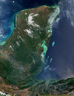

The Gulf or Bay of Honduras is a large inlet of the Caribbean Sea, indenting the coasts of Belize, Guatemala, and Honduras. From north to south, it runs for approximately 200 km from Dangriga, Belize, to La Ceiba, Honduras.
The inner Gulf of Honduras is lined by the Belize Barrier Reef which forms the southern part of the 900 km long Mesoamerican Barrier Reef System, the second-largest coral reef system in the world. The Belize Barrier Reef includes a number of small islands, called cays, and collectively known as the Pelican Cays.
The Gulf of Honduras is marked by complex dynamics of coastal and open waters, and ocean currents, which have produced a very diverse and unique ecosystem with a wide variety of coastal marine waters, including coastline estuaries, barrier beaches, lagoons, intertidal salt marshes, mangrove forests, seagrass beds, keys and barrier reefs.[1]
The gulf receives the runoff from the watersheds of 12 rivers with an estimated discharge of 1232 m³ s−1.[2] These rivers include the Moho, Sarstún, Río Dulce, Motagua, and Ulúa. Increased volumes of sediments drained in the Gulf of Honduras pose a threat to its marine ecosystem.[2]
Many American anglers visit the Gulf of Honduras to catch the marlin that abound there. Tourists are often taken on boat trips to the Pelican Cays, notably Caye Caulker and Ambergris Caye.
In 1961 Hurricane Hattie swept across the Gulf of Honduras, destroying buildings in Belize.
The infamous pirate Blackbeard spent the winter of 1717-1718 harassing shipping boats sailing to and from the port of Vera Cruz, Mexico and traversing the Bay of Honduras.[3] In April 1718, at Turneffe Atoll, Blackbeard captured the logwood cutting sloop Adventure and forced its captain, David Herriot, to join him. Blackbeard then made Israel Hands captain of the Adventure and began sailing for North Carolina.[4]
References
- ↑ Pollution Control Program in the Gulf of Honduras. "Environmental Protection and Maritime Transport" (PDF). Retrieved 2009-04-11.
- 1 2 Thattai, Deeptha; Björn Kjerfve; W. D. Heyman (December 2003). "Hydrometeorology and Variability of Water Discharge and Sediment Load in the Inner Gulf of Honduras, Western Caribbean". Journal of Hydrometeorology. 4 (6): 985–995. doi:10.1175/1525-7541(2003)004<0985:HAVOWD>2.0.CO;2. Retrieved 2009-02-23.
- ↑ Woodard, Colin. "A Blackbeard mystery solved". Republic of Pirates Blog. Retrieved 25 March 2016.
- ↑ Byrd Downey, Cristopher (22 May 2012). Stede Bonnet: Charleston's Gentleman Pirate. The History Press. p. 44. ISBN 1609495403. Retrieved 25 March 2016.
External links
- When Blackbeard Scourged the Seas, History.org
Coordinates: 16°09′05″N 88°15′06″W / 16.1514°N 88.2517°W