Basin, Wyoming
| Basin, Wyoming | |
|---|---|
| Town | |
|
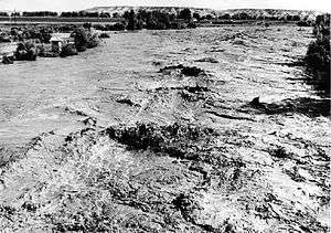
Downtown Basin, Wyoming | |
| Nickname(s): Lilac City | |
 Location of Basin, Wyoming | |
 Basin, Wyoming Location in the United States | |
| Coordinates: 44°22′44″N 108°2′35″W / 44.37889°N 108.04306°WCoordinates: 44°22′44″N 108°2′35″W / 44.37889°N 108.04306°W | |
| Country | United States |
| State | Wyoming |
| County | Big Horn |
| Area[1] | |
| • Total | 2.43 sq mi (6.29 km2) |
| • Land | 2.40 sq mi (6.22 km2) |
| • Water | 0.03 sq mi (0.08 km2) |
| Elevation | 3,878 ft (1,182 m) |
| Population (2010)[2] | |
| • Total | 1,285 |
| • Estimate (2012[3]) | 1,292 |
| • Density | 535.4/sq mi (206.7/km2) |
| Time zone | Mountain (MST) (UTC-7) |
| • Summer (DST) | MDT (UTC-6) |
| ZIP code | 82410 |
| Area code(s) | 307 |
| FIPS code | 56-05320[4] |
| GNIS feature ID | 1585173[5] |

Basin is a town in, and the county seat of, Big Horn County, Wyoming, United States.[6] The population was 1,285 at the 2010 census. The community is located near the center of the Bighorn Basin with the Big Horn River east of the town. Basin's post office, built in 1919, is listed on the National Register of Historic Places.
Geography
Basin is located at 44°22′44″N 108°2′35″W / 44.37889°N 108.04306°W (44.378777, -108.043100).[7]
According to the United States Census Bureau, the town has a total area of 2.43 square miles (6.29 km2), of which, 2.40 square miles (6.22 km2) of it is land and 0.03 square miles (0.08 km2) is water.[1]
Basin is known as The Lilac City. Basin hosts the Big Horn County Fair each summer.
Climate
Basin has a cold desert climate (Köppen climate classification BWk). The town had the highest temperature ever recorded in Wyoming, 115 °F (46 °C), on August 8, 1983,[8] and also holds the state record high temperatures for April (93 °F or 33.9 °C in 1948) and July (114 °F or 45.6 °C in 1900).[9]
In general, the eastern portion of the Bighorn Basin is hotter than the rest of Wyoming during the summer months.[10] Due to frequent low humidity, daily temperature ranges are large, whilst due to the very dry conditions snowfall is among the lightest in the northern Rockies and Plains region – it is not uncommon for no measurable precipitation to fall in a month between September and April. There are an average of 50.9 days annually with highs of 90 °F (32 °C) or higher and an average of 186.0 nights with lows of 32 °F (0 °C) or lower. The all-time record low for Basin was −51 °F (−46 °C) on January 30, 1951. The wettest calendar year in Basin was 2005 with 10.43 inches (265 mm) and the driest 1902 with 2.63 inches (67 mm). The most precipitation in one month was 4.56 inches (116 mm) in June 1967. The most precipitation in 24 hours was 2.23 inches (57 mm) on June 29, 1909. The most snowfall in one season was 38.50 inches (0.978 m) between July 1958 and June 1959, whilst the most snow in one month was 23.0 inches (0.58 m) during September 1984.[11]
| Climate data for Basin, Wyoming | |||||||||||||
|---|---|---|---|---|---|---|---|---|---|---|---|---|---|
| Month | Jan | Feb | Mar | Apr | May | Jun | Jul | Aug | Sep | Oct | Nov | Dec | Year |
| Record high °F (°C) | 62 (17) |
73 (23) |
81 (27) |
93 (34) |
98 (37) |
114 (46) |
115 (46) |
112 (44) |
102 (39) |
90 (32) |
77 (25) |
67 (19) |
115 (46) |
| Average high °F (°C) | 27.4 (−2.6) |
37.6 (3.1) |
51.0 (10.6) |
61.6 (16.4) |
71.4 (21.9) |
82.4 (28) |
89.8 (32.1) |
88.6 (31.4) |
76.3 (24.6) |
62.5 (16.9) |
43.1 (6.2) |
30.6 (−0.8) |
60.19 (15.65) |
| Daily mean °F (°C) | 14.6 (−9.7) |
24.0 (−4.4) |
37.0 (2.8) |
47.2 (8.4) |
56.9 (13.8) |
66.7 (19.3) |
72.9 (22.7) |
71.1 (21.7) |
59.4 (15.2) |
47.2 (8.4) |
30.7 (−0.7) |
18.3 (−7.6) |
45.5 (7.49) |
| Average low °F (°C) | 1.7 (−16.8) |
10.3 (−12.1) |
23.0 (−5) |
32.7 (0.4) |
42.3 (5.7) |
50.9 (10.5) |
56.0 (13.3) |
53.5 (11.9) |
42.4 (5.8) |
31.8 (−0.1) |
18.2 (−7.7) |
5.9 (−14.5) |
30.72 (−0.72) |
| Record low °F (°C) | −43 (−42) |
−41 (−41) |
−25 (−32) |
5 (−15) |
18 (−8) |
30 (−1) |
39 (4) |
27 (−3) |
16 (−9) |
−1 (−18) |
−18 (−28) |
−45 (−43) |
−45 (−43) |
| Average precipitation inches (mm) | 0.25 (6.4) |
0.16 (4.1) |
0.33 (8.4) |
0.71 (18) |
1.30 (33) |
1.00 (25.4) |
0.60 (15.2) |
0.44 (11.2) |
0.81 (20.6) |
0.61 (15.5) |
0.28 (7.1) |
0.28 (7.1) |
6.77 (172) |
| Average snowfall inches (cm) | 4.1 (10.4) |
2.5 (6.4) |
2.3 (5.8) |
1.3 (3.3) |
0.1 (0.3) |
0.0 (0) |
0.0 (0) |
0.0 (0) |
0.3 (0.8) |
0.6 (1.5) |
2.1 (5.3) |
4.0 (10.2) |
17.3 (44) |
| Average precipitation days (≥ 0.01 inch) | 3.0 | 2.2 | 2.7 | 4.6 | 6.5 | 5.9 | 3.6 | 3.4 | 4.6 | 3.1 | 3.0 | 3.2 | 45.8 |
| Average snowy days (≥ 0.1 inch) | 2.7 | 1.8 | 1.7 | 0.7 | 0.05 | 0.0 | 0.0 | 0.0 | 0.2 | 0.2 | 1.5 | 2.5 | 11.35 |
| Source #1: NOAA (normals, 1971–2000) [12] | |||||||||||||
| Source #2: Weather.com;[13] InfoPlease[9] (April and July record highs) | |||||||||||||
Demographics
| Historical population | |||
|---|---|---|---|
| Census | Pop. | %± | |
| 1910 | 763 | — | |
| 1920 | 1,088 | 42.6% | |
| 1930 | 903 | −17.0% | |
| 1940 | 1,099 | 21.7% | |
| 1950 | 1,220 | 11.0% | |
| 1960 | 1,319 | 8.1% | |
| 1970 | 1,145 | −13.2% | |
| 1980 | 1,349 | 17.8% | |
| 1990 | 1,180 | −12.5% | |
| 2000 | 1,238 | 4.9% | |
| 2010 | 1,285 | 3.8% | |
| Est. 2015 | 1,305 | [14] | 1.6% |
2010 census
As of the census[2] of 2010, there were 1,285 people, 520 households, and 333 families residing in the town. The population density was 535.4 inhabitants per square mile (206.7/km2). There were 571 housing units at an average density of 237.9 per square mile (91.9/km2). The racial makeup of the town was 94.2% White, 0.5% African American, 1.9% Native American, 0.5% Asian, 1.6% from other races, and 1.3% from two or more races. Hispanic or Latino of any race were 5.4% of the population.
There were 520 households of which 25.0% had children under the age of 18 living with them, 51.9% were married couples living together, 8.3% had a female householder with no husband present, 3.8% had a male householder with no wife present, and 36.0% were non-families. 31.5% of all households were made up of individuals and 15.8% had someone living alone who was 65 years of age or older. The average household size was 2.27 and the average family size was 2.83.
The median age in the town was 46.4 years. 20.1% of residents were under the age of 18; 6.7% were between the ages of 18 and 24; 21.5% were from 25 to 44; 27.2% were from 45 to 64; and 24.4% were 65 years of age or older. The gender makeup of the town was 50.0% male and 50.0% female.
2000 census
As of the census[4] of 2000, there were 1,238 people, 504 households, and 330 families residing in the town. The population density was 613.7 people per square mile (236.6/km²). There were 565 housing units at an average density of 280.1 per square mile (108.0/km²). The racial makeup of the town was 96.77% White, 0.08% African American, 1.05% Native American, 0.24% Asian, 0.97% from other races, and 0.89% from two or more races. Hispanic or Latino of any race were 2.26% of the population.
There were 504 households out of which 22.2% had children under the age of 18 living with them, 56.3% were married couples living together, 6.3% had a female householder with no husband present, and 34.5% were non-families. 31.3% of all households were made up of individuals and 16.5% had someone living alone who was 65 years of age or older. The average household size was 2.20 and the average family size was 2.74.
In the town the population was spread out with 20.1% under the age of 18, 5.5% from 18 to 24, 19.6% from 25 to 44, 27.9% from 45 to 64, and 26.9% who were 65 years of age or older. The median age was 48 years. For every 100 females there were 90.8 males. For every 100 females age 18 and over, there were 86.6 males.
The median income for a household in the town was $33,519, and the median income for a family was $42,768. Males had a median income of $33,942 versus $20,139 for females. The per capita income for the town was $17,890. About 6.1% of families and 11.6% of the population were below the poverty line, including 17.5% of those under age 18 and 12.7% of those age 65 or over.
Government and infrastructure
The Wyoming Department of Health Wyoming Retirement Center, a nursing home,[16] is located in Basin.[17][18] The facility was operated by the Wyoming Board of Charities and Reform until that agency was dissolved as a result of a state constitutional amendment passed in November 1990.[19]
The United States Postal Service operates the Basin Post Office.[20]
Education
Public education in the town of Basin is provided by Big Horn County School District #4. The district has four campuses – Laura Irwin Elementary School (grades K-4), Manderson Elementary School (grade 5), Cloud Peak Middle School (grades 6–8), and Riverside High School (grades 9–12).
See also
References
- 1 2 "US Gazetteer files 2010". United States Census Bureau. Archived from the original on 2012-01-24. Retrieved 2012-12-14.
- 1 2 "American FactFinder". United States Census Bureau. Retrieved 2012-12-14.
- ↑ "Population Estimates". United States Census Bureau. Archived from the original on 2013-06-17. Retrieved 2013-06-01.
- 1 2 "American FactFinder". United States Census Bureau. Archived from the original on 2013-09-11. Retrieved 2008-01-31.
- ↑ "US Board on Geographic Names". United States Geological Survey. 2007-10-25. Retrieved 2008-01-31.
- ↑ "Find a County". National Association of Counties. Archived from the original on 2012-07-12. Retrieved 2011-06-07.
- ↑ "US Gazetteer files: 2010, 2000, and 1990". United States Census Bureau. 2011-02-12. Retrieved 2011-04-23.
- ↑ http://www.infoplease.com/ipa/A0001416.html
- 1 2 Wyoming Extreme Temperatures
- ↑ "Wyoming Climate". University of Wyoming. Archived from the original on 2009-09-05.
- ↑ http://www.wrcc.dri.edu/cgi-bin/cliMAIN.pl?wy0540
- ↑ "Climatography of the United States NO.81" (PDF). National Oceanic and Atmospheric Administration. Retrieved January 13, 2011.
- ↑ Weather Channel—. Retrieved 18 July 2010.
- ↑ "Annual Estimates of the Resident Population for Incorporated Places: April 1, 2010 to July 1, 2015". Retrieved July 2, 2016.
- ↑ "Census of Population and Housing". Census.gov. Archived from the original on May 11, 2015. Retrieved June 4, 2015.
- ↑ "WDH Who We Are - Wyoming Retirement Center." Wyoming Department of Health. Retrieved on December 12, 2010.
- ↑ "WDH Directory." Wyoming Department of Health. Retrieved on December 12, 2010. "890 Highway 20, Basin WY 82410 Fax (307) 568-3887" (Retirement Center)
- ↑ "Basin town, Wyoming." U.S. Census Bureau. Retrieved on December 12, 2010.
- ↑ "About the Department of Corrections." Wyoming Department of Corrections. Retrieved on August 22, 2010.
- ↑ "Post Office Location - BASIN Archived August 20, 2010, at the Wayback Machine.." United States Postal Service. Retrieved on December 12, 2010.
External links
| Wikimedia Commons has media related to Basin, Wyoming. |
Municipalities and communities of Big Horn County, Wyoming, United States | ||
|---|---|---|
| Towns | 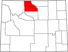 | |
| CDPs | ||
| Unincorporated communities | ||
| Footnotes | ‡This populated place also has portions in an adjacent county or counties | |