Barskon
| Barskon Барскоон | |
|---|---|
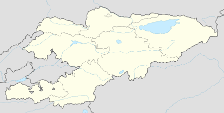 Barskon Location in Kyrgyzstan | |
| Coordinates: 42°9′22″N 77°36′14″E / 42.15611°N 77.60389°E | |
| Country |
|
| Province | Issyk Kul Province |
| Elevation | 1,753 m (5,751 ft) |
| Population (2009)[1] | |
| • Total | 6,912 |
Barskon, Barskoon or Barskaun, ancient Barsgan, Barskhan or Barsqan (Russian: Барскон; Kyrgyz: Барскоон; Persian: بارسغان) is a small settlement on the southern shore of Lake Issyk Kul in the Issyk Kul Province of Kyrgyzstan. It is on the A363 highway between Bokonbaevskoe to the west and Kyzyl-Suu to the east.
Etymology
According to his testament Pand nāma, Saboktagin was from the tribe (or place) of Barskhan and according to C. E. Bosworth's summary from preface of the book, the tribe was "so named because in ancient times, one of the rulers of Persia had settled in Turkestan and become a ruler there. He was called Pārsi-khwān that is, one who is literate in Persian, and this became contracted to Barskhan."[2]
Geography
Barskon is a village at the mouth of the Barskon valley - which has an impressive Barskoon waterfall and is a good centre for trekking and horse riding. Just to the west is the village of Tamga-Tash, which is named after a rock ('tash') with a Buddhist inscription dating from the 3rd to 8th centuries which the locals interpreted as a Tamga.
History
Ancient caravan ways dispersed from here, ancient Barsqan, to the East and South, to China and India, the ruins of a caravanserai are quite evidences of those times. The 11th century scholar Mahmud al-Kashgari (also known as Barskhani) was a native of this area. He is best known as the author of the first Turkic languages comparative dictionary which he wrote whilst living in Baghdad in 1072-4. His map of the then known world has Barskon at the centre of the world. His tomb is South of Kashgar - on the road to Pakistan. The modern town began as a military post.
Sights
The road south from Barskon which passes up the Barskon valley (A364) used to be one of the routes of the Silk Road, passing over the Bedel Pass (4,284 m) into China (the section from Kara-Say to Bedel Pass is now closed). It is now the main road leading to the Kumtor Gold Mine - hence it is well maintained and there is a reasonable amount of traffic - including lorries making their way up to the mine and back.
In the spring of 1998, a lorry carrying cyanide used in the gold refining process was involved in an accident - leaving the road and crashing into a stream - polluting the waters and decimating the tourist industry around Lake Issyk Kul as many tourists cancelled their planned holidays.
There are two interesting sights along the road - a Soviet lorry mounted on a plinth and a bust of Yuri Gagarin, who holidayed on the South shore of Issyk Kul after his historical first manned space flight.
In the mountains to the East is a region known as Sytyr - an "alpine cold desert". A364, one of the few good roads into the mountains in southern Issyk Kul Province, goes south down the valley, over the Barskoon and Söok Passes to Kara-Say in the Naryn valley and then goes east northeast to Ak-Shyrak. The road from here to Engilchek is currently (early 2008) not passable. Barskon is the home of Shepherd's Way Trekking.[3]
References
- ↑ Population and Housing Census 2009. Book 3 (in tables). Provinces of Kyrgyzstan: Issyk-Kul Province (Перепись населения и жилищного фонда Кыргызской Республики 2009. Книга 3 (в таблицах). Регионы Кыргызстана: Иссык-Кульская область (PDF), Bishkek: National Committee on Statistics, 2010, archived from the original (PDF) on 2011-08-10
- ↑ Bosworth, E. C. (1978). "The heritage of rulership". Iranian Studies. 11: 25. doi:10.1080/00210867808701538.
- ↑ Barskoon Valley in Orexca.com
External links
Coordinates: 42°9′22″N 77°36′14″E / 42.15611°N 77.60389°E