Barmston and Fraisthorpe
| Barmston and Fraisthorpe | |
|---|---|
| Civil parish | |
 | |
| Coordinates: 54°02′N 0°14′W / 54.033°N 0.233°WCoordinates: 54°02′N 0°14′W / 54.033°N 0.233°W | |
| Country | England |
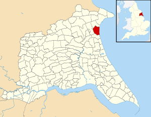
| Primary council | East Riding of Yorkshire |
| Region | Yorkshire and the Humber |
| Status | Parish |
| Government | |
| • Type | Parish Council |
| • UK Parliament | East Yorkshire |
| • EU Parliament | Yorkshire and the Humber |
| Population (2011 census)[1] | |
| • Total | 127 |
Barmston and Fraisthorpe (also known as simply as Barmston) is a civil parish in the East Riding of Yorkshire, England.
The civil parish includes the villages of Barmston and Fraisthorpe. The former villages of Auburn and Hartburn have been abandoned due to coastal erosion.
According to the 2011 UK census, Barmston and Fraisthorpe parish had a population of 127,[1] a decrease on the 2001 UK census figure of 277.[2] The parish covering an area of 1,765.014 hectares (4,361.44 acres).[3]
History
The village of Barmston gave its name to the ancient parish and ecclesiastical parishes of Barmston.[4] The parish was bounded by watercourses of Earl's Dike (also known as Watermill Grounds Beck) to the north, and Barmston drain to the south.[4] In 1935 the civil parish was substantially enlarged with the addition of most of the parish of Fraisthorpe to the north, an increase of 1,995 acres (807 ha).[4][5]
The village of Hartburn on the Holderness coast was deserted after the 15th century and no longer exists due to coastal erosion.[6] The village was located just south of the outflow of Earl's Dike on the coastline.[7]
The hamlet of Winkton in the parish of Barmston had also been long abandoned by the 1850s.[8]
The village of Auburn in the former parish of Fraisthorpe was abandoned to coastal erosion, except for a farm;[map 1] the chapel was dismantled in the 1780s.[9]
Geography
The civil parish is almost completely low lying agricultural land with several farmsteads; excluding the Holderness coast and the two villages of Barmston and Fraisthorpe. the high point is 26 metres (85 ft) at Hamilton Hill, which is a triangulation point.[map 2] The A165 Bridlington Road passes through the parish.[10]
References
- 1 2 "Key Figures for 2011 Census: Key Statistics: Area: Barmston CP (Parish)". Neighbourhood Statistics. Office for National Statistics. Retrieved 2 February 2013.
- ↑ "2001 Census: Key Statistics: Parish Headcounts: Area: Barmston CP (Parish)". Neighbourhood Statistics. Office for National Statistics. Retrieved 12 March 2008.
- ↑ "2001 Census Area Profile" (PDF). East Riding of Yorkshire County Council. 2004. Archived (PDF) from the original on 18 March 2012. Retrieved 8 February 2013.
- 1 2 3 "Barmston EP through time : Administrative history of Ecclesiastical Parish: hierarchies, boundaries". A Vision of Britain Through Time. University of Portsmouth et al. 2009. Retrieved 2 February 2013.
- ↑ "Fraisthorpe With Auburn and Wilsthorpe CP through time : Administrative history of Parish-level Unit: hierarchies, boundaries". A Vision of Britain Through Time. University of Portsmouth et al. 2009. Retrieved 2 February 2013.
- ↑ Allison, K.J.; Baggs, A.P.; Cooper, T.N.; Davidson-Cragoe, C.; Walker, J. (2002). "North division: Barmston". In Kent, G.H.R. A History of the County of York East Riding: Volume 7: Holderness Wapentake, Middle and North Divisions. pp. 213–223. Retrieved 13 August 2011.
- ↑ Ordnance Survey, 1854, 1:10,560
- ↑ Sheahan, J.J.; Whellan, T. (1857). "History of Holderness : Barmston". History and topography of the City of York, the East Riding of Yorkshire ... 2. pp. 401–402.
- ↑ Sheahan, J.J.; Whellan, T. (1857). "Dickering Wapentake : Auburn". History and topography of the City of York, the East Riding of Yorkshire ... 2. p. 463.
- ↑ Ordnance Survey, 2007, 1:25,000
Maps
- ↑ 54°02′44″N 0°13′05″W / 54.0456081°N 0.2181752°W Site of the medieval village of Auburn
- ↑ 54°01′32″N 0°13′34″W / 54.025547°N 0.225979°W Hamilton Hill
Sources
- Gazetteer — A–Z of Towns Villages and Hamlets. East Riding of Yorkshire Council. 2006. pp. 3, 6.
- Sheahan, J.J.; Whellan, T. (1857). History and topography of the City of York, the East Riding of Yorkshire, and a portion of the West Riding: embracing a general review of the early history of Great Britain, and a general history and description of the county of York. 2. John Green (Beverley) (printer).
External links
![]() Media related to Barmston and Fraisthorpe at Wikimedia Commons
Media related to Barmston and Fraisthorpe at Wikimedia Commons