Barling, Arkansas
| Barling, Arkansas | |
|---|---|
| City | |
 Location in Sebastian County and the state of Arkansas | |
| Coordinates: 35°19′22″N 94°18′2″W / 35.32278°N 94.30056°WCoordinates: 35°19′22″N 94°18′2″W / 35.32278°N 94.30056°W | |
| Country | United States |
| State | Arkansas |
| County | Sebastian |
| Area | |
| • Total | 22 sq mi (57.1 km2) |
| • Land | 21.9 sq mi (56.8 km2) |
| • Water | 0.1 sq mi (0.3 km2) |
| Elevation | 486 ft (148 m) |
| Population (2010) | |
| • Total | 4,649 |
| • Density | 189.8/sq mi (73.1/km2) |
| Time zone | Central (CST) (UTC-6) |
| • Summer (DST) | CDT (UTC-5) |
| ZIP code | 72923 |
| Area code(s) | 479 |
| FIPS code | 05-03640 |
| GNIS feature ID | 0057330 |
Barling is a city in Sebastian County, Arkansas, United States. It is part of the Fort Smith, Arkansas-Oklahoma Metropolitan Statistical Area. As of the 2010 Census the population was 4,649.[1] According to the 2005 US Census Bureau estimate, the population of Barling was 4,367,[2] ranking it eighth in the Greater Fort Smith Area. Barling was incorporated in 1956.
Geography
Barling is located at 35°19′22″N 94°18′2″W / 35.32278°N 94.30056°W (35.322728, -94.300663).[3] It was named after Aaron Barling, a soldier originally posted to Fort Gibson in Indian Territory who subsequently farmed in Arkansas.
According to the United States Census Bureau, the city has a total area of 22.1 square miles (57 km2), of which, 21.9 square miles (57 km2) of it is land and 0.1 square miles (0.26 km2) of it (0.59%) is water.
Demographics
| Historical population | |||
|---|---|---|---|
| Census | Pop. | %± | |
| 1960 | 770 | — | |
| 1970 | 1,739 | 125.8% | |
| 1980 | 3,761 | 116.3% | |
| 1990 | 4,078 | 8.4% | |
| 2000 | 4,176 | 2.4% | |
| 2010 | 4,649 | 11.3% | |
| Est. 2015 | 4,740 | [4] | 2.0% |
2014 Estimate[6] | |||
As of the census[7] of 2000, there were 4,176 people, 1,599 households, and 1,122 families residing in the city. The population density was 190.4 people per square mile (73.5/km²). There were 1,697 housing units at an average density of 77.4 per square mile (29.9/km²). The racial makeup of the city was 87.05% White, 1.39% Black or African American, 1.87% Native American, 5.10% Asian, 0.02% Pacific Islander, 2.04% from other races, and 2.54% from two or more races. 3.98% of the population were Hispanic or Latino of any race.
There were 1,599 households out of which 35.2% had children under the age of 18 living with them, 53.3% were married couples living together, 12.6% had a female householder with no husband present, and 29.8% were non-families. 26.5% of all households were made up of individuals and 10.3% had someone living alone who was 65 years of age or older. The average household size was 2.54 and the average family size was 3.07.
In the city the population was spread out with 26.5% under the age of 18, 8.7% from 18 to 24, 30.3% from 25 to 44, 21.8% from 45 to 64, and 12.7% who were 65 years of age or older. The median age was 36 years. For every 100 females there were 86.9 males. For every 100 females age 18 and over, there were 85.9 males.
The median income for a household in the city was $37,605, and the median income for a family was $41,421. Males had a median income of $28,218 versus $22,936 for females. The per capita income for the city was $16,485. About 10.0% of families and 11.9% of the population were below the poverty line, including 15.8% of those under age 18 and 14.3% of those age 65 or over.
Notable people
- Hal Smith, Major League Baseball player
Climate
The climate in this area is characterized by hot, humid summers and generally mild to cool winters. According to the Köppen Climate Classification system, Barling has a humid subtropical climate, abbreviated "Cfa" on climate maps.[8]
References
- ↑ "American Fact Finder". Retrieved 29 April 2014.
- ↑ Population Estimates for All Places: 2000 to 2006
- ↑ "US Gazetteer files: 2010, 2000, and 1990". United States Census Bureau. 2011-02-12. Retrieved 2011-04-23.
- ↑ "Annual Estimates of the Resident Population for Incorporated Places: April 1, 2010 to July 1, 2015". Retrieved July 2, 2016.
- ↑ "Census of Population and Housing". Census.gov. Archived from the original on May 11, 2015. Retrieved June 4, 2015.
- ↑ "Annual Estimates of the Resident Population for Incorporated Places: April 1, 2010 to July 1, 2014". Retrieved June 4, 2015.
- ↑ "American FactFinder". United States Census Bureau. Archived from the original on September 11, 2013. Retrieved 2008-01-31.
- ↑ Summary for Barling, Arkansas
External links
- Encyclopedia of Arkansas History & Culture entry: Barling (Sebastian County)
Municipalities and communities of Sebastian County, Arkansas, United States | ||
|---|---|---|
| Cities | 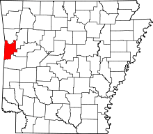 | |
| Towns | ||
| Unincorporated communities | ||
| Footnotes | ‡This populated place also has portions in an adjacent county or counties | |