Barataria, Louisiana
| Barataria | |
| Census-designated place | |
| Country | United States |
|---|---|
| State | Louisiana |
| Parish | Jefferson |
| Elevation | 3 ft (0.9 m) |
| Coordinates | 29°42′54″N 90°06′58″W / 29.71500°N 90.11611°WCoordinates: 29°42′54″N 90°06′58″W / 29.71500°N 90.11611°W |
| Area | 4.9 sq mi (12.7 km2) |
| - land | 4.4 sq mi (11 km2) |
| - water | 0.5 sq mi (1 km2), 10.2% |
| Population | 1,109 (2010) |
| Density | 258.8/sq mi (99.9/km2) |
| Timezone | CST (UTC-6) |
| - summer (DST) | CDT (UTC-5) |
| Area code | 504 |
 Location of Barataria in Louisiana
| |
 Location of Louisiana in the United States
| |
Barataria is a census-designated place (CDP) in Jefferson Parish, Louisiana, United States. The population was 1,109 at the 2010 census.[1] It is part of the New Orleans–Metairie–Kenner Metropolitan Statistical Area. Barataria is the name of the fictional island awarded to Sancho Panza, to govern, as a prank in Part II of Don Quixote.[2]
Geography
Barataria is located at 29°42′54″N 90°6′58″W / 29.71500°N 90.11611°W (29.715121, -90.116024).[1]
According to the United States Census Bureau, the CDP has a total area of 4.9 square miles (13 km2), of which, 4.4 square miles (11 km2) of it is land and 0.4 square miles (1.0 km2) of it (9.22%) is water.
Demographics
As of the census[3] of 2000, there were 1,333 people, 500 households, and 367 families residing in the CDP. The population density was 301.2 people per square mile (116.2/km²). There were 571 housing units at an average density of 129.0 per square mile (49.8/km²). The racial makeup of the CDP was 86.95% White, 11.10% African American, 0.60% Native American, 0.23% from other races, and 1.13% from two or more races. Hispanic or Latino of any race were 1.88% of the population.
There were 500 households out of which 29.6% had children under the age of 18 living with them, 59.0% were married couples living together, 10.4% had a female householder with no husband present, and 26.4% were non-families. 22.8% of all households were made up of individuals and 10.0% had someone living alone who was 65 years of age or older. The average household size was 2.67 and the average family size was 3.17.
In the CDP the population was spread out with 23.6% under the age of 18, 8.6% from 18 to 24, 26.5% from 25 to 44, 27.5% from 45 to 64, and 13.7% who were 65 years of age or older. The median age was 40 years. For every 100 females there were 98.4 males. For every 100 females age 18 and over, there were 96.1 males.
The median income for a household in the CDP was $28,169, and the median income for a family was $29,913. Males had a median income of $27,159 versus $18,000 for females. The per capita income for the CDP was $12,890. About 13.6% of families and 15.9% of the population were below the poverty line, including 19.2% of those under age 18 and 13.6% of those age 65 or over.
Education
Residents are zoned to Jefferson Parish Public Schools.
Residents from K-6 are zoned to Lafitte Elementary School. Those from 7-12 are zoned to Fisher Middle-High School.
See also
- Barataria Bay
- Jean Lafitte National Historical Park and Preserve - Barataria Preserve
References
- 1 2 "US Gazetteer files: 2010, 2000, and 1990". United States Census Bureau. 2011-02-12. Retrieved 2011-04-23.
- ↑ Cervantes, Miguel de. Don Quixote, Part II (1615), chapter 42
- ↑ "American FactFinder". United States Census Bureau. Archived from the original on September 11, 2013. Retrieved 2008-01-31.
Municipalities and communities of Jefferson Parish, Louisiana, United States | ||
|---|---|---|
| Cities | 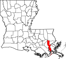 | |
| Towns | ||
| CDPs | ||
| Others Unincorporated communities | ||