Bar Nunn, Wyoming
| Bar Nunn, Wyoming | |
|---|---|
| Town | |
 Location of Bar Nunn, Wyoming | |
 Bar Nunn, Wyoming Location in the United States | |
| Coordinates: 42°54′48″N 106°20′49″W / 42.91333°N 106.34694°WCoordinates: 42°54′48″N 106°20′49″W / 42.91333°N 106.34694°W | |
| Country | United States |
| State | Wyoming |
| County | Natrona |
| Area[1] | |
| • Total | 2.10 sq mi (5.44 km2) |
| • Land | 2.10 sq mi (5.44 km2) |
| • Water | 0 sq mi (0 km2) |
| Elevation | 5,285 ft (1,611 m) |
| Population (2010)[2] | |
| • Total | 2,213 |
| • Estimate (2012[3]) | 2,428 |
| • Density | 1,053.8/sq mi (406.9/km2) |
| Time zone | Mountain (MST) (UTC-7) |
| • Summer (DST) | MDT (UTC-6) |
| ZIP codes | 82601, 82609 |
| Area code(s) | 307 |
| FIPS code | 56-05245[4] |
| GNIS feature ID | 1609352[5] |
| Historical population | |||
|---|---|---|---|
| Census | Pop. | %± | |
| 1990 | 835 | — | |
| 2000 | 936 | 12.1% | |
| 2010 | 2,213 | 136.4% | |
| Est. 2015 | 2,820 | [6] | 27.4% |
| [7] | |||
Bar Nunn is a town in Natrona County, Wyoming, United States. It is a part of the Casper, Wyoming Metropolitan Statistical Area. The population was 2,213 at the 2010 census. It was incorporated in 1980.
The town was constructed around the runways of Wardwell Airport, Casper's original airport, which was later replaced by Casper–Natrona County International Airport.
History
Bar Nunn was founded in the 1970s by Romie Nunn, and named for him.[8]
Geography
Bar Nunn is located at 42°54′48″N 106°20′49″W / 42.91333°N 106.34694°W (42.913444, -106.347054).[9]
According to the United States Census Bureau, the town has a total area of 2.10 square miles (5.44 km2), all of it land.[1]
Demographics
2010 census
As of the census[2] of 2010, there were 2,213 people, 748 households, and 605 families residing in the town. The population density was 1,053.8 inhabitants per square mile (406.9/km2). There were 761 housing units at an average density of 362.4 per square mile (139.9/km2). The racial makeup of the town was 93.4% White, 0.8% African American, 0.8% Native American, 0.1% Asian, 2.6% from other races, and 2.3% from two or more races. Hispanic or Latino of any race were 7.2% of the population.
There were 748 households of which 49.1% had children under the age of 18 living with them, 65.1% were married couples living together, 9.0% had a female householder with no husband present, 6.8% had a male householder with no wife present, and 19.1% were non-families. 12.8% of all households were made up of individuals and 2.6% had someone living alone who was 65 years of age or older. The average household size was 2.96 and the average family size was 3.23.
The median age in the town was 30.5 years. 32.6% of residents were under the age of 18; 7.4% were between the ages of 18 and 24; 32.1% were from 25 to 44; 21.8% were from 45 to 64; and 6% were 65 years of age or older. The gender makeup of the town was 49.7% male and 50.3% female.
2000 census
As of the census[4] of 2000, there were 936 people, 315 households, and 252 families residing in the town. The population density was 458.6 people per square mile (177.2/km²). There were 339 housing units at an average density of 166.1 per square mile (64.2/km²). The racial makeup of the town was 93.80% White, 0.53% African American, 1.18% Native American, 0.11% Asian, 0.53% Pacific Islander, 2.03% from other races, and 1.82% from two or more races. Hispanic or Latino of any race were 4.81% of the population.
There were 315 households out of which 46.0% had children under the age of 18 living with them, 66.7% were married couples living together, 7.9% had a female householder with no husband present, and 20.0% were non-families. 13.3% of all households were made up of individuals and 1.3% had someone living alone who was 65 years of age or older. The average household size was 2.97 and the average family size was 3.26.
In the town the population was spread out with 33.0% under the age of 18, 9.5% from 18 to 24, 31.8% from 25 to 44, 21.7% from 45 to 64, and 4.0% who were 65 years of age or older. The median age was 32 years. For every 100 females there were 103.9 males. For every 100 females age 18 and over, there were 103.6 males.
The median income for a household in the town was $40,313, and the median income for a family was $42,000. Males had a median income of $32,431 versus $18,636 for females. The per capita income for the town was $15,045. About 8.0% of families and 12.3% of the population were below the poverty line, including 16.2% of those under age 18 and 12.5% of those age 65 or over.
Education
Public education in the town of Bar Nunn is provided by Natrona County School District #1.
Recent growth
In 2006, Bar Nunn led the state of Wyoming in population growth. Between 2005 and 2006, the community saw an estimated 18.6 percent increase in population –- up to 1,527 in 2006. That was a 63% increase over the census count in 2000.[10] The large growth in Bar Nunn and Natrona County has been attributed to a boom in Wyoming's energy sector.
See also
References
- 1 2 "US Gazetteer files 2010". United States Census Bureau. Archived from the original on January 24, 2012. Retrieved 2012-12-14.
- 1 2 "American FactFinder". United States Census Bureau. Retrieved 2012-12-14.
- ↑ "Population Estimates". United States Census Bureau. Archived from the original on June 17, 2013. Retrieved 2013-06-01.
- 1 2 "American FactFinder". United States Census Bureau. Archived from the original on September 11, 2013. Retrieved 2008-01-31.
- ↑ "US Board on Geographic Names". United States Geological Survey. 2007-10-25. Retrieved 2008-01-31.
- ↑ "Annual Estimates of the Resident Population for Incorporated Places: April 1, 2010 to July 1, 2015". Retrieved July 2, 2016.
- ↑ "Historical Decennial Census Population for Wyoming Counties, Cities, and Towns". Wyoming Department of State / U.S. Census Bureau. Retrieved 2008-06-30.
- ↑ Rundquist, Thomas J. (1 August 2000). Substitute Teacher Survival Activities Vol 1. Nova Media Inc. p. 46. ISBN 978-1-884239-51-9.
- ↑ "US Gazetteer files: 2010, 2000, and 1990". United States Census Bureau. 2011-02-12. Retrieved 2011-04-23.
- ↑ Town leads state in growth, Bar Nunn - Casper Star Tribune, June 29, 2007
External links
- Town of Bar Nunn, Wyoming – Official site.
Municipalities and communities of Natrona County, Wyoming, United States | ||
|---|---|---|
| City | 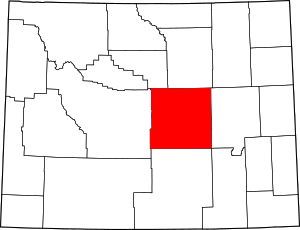 | |
| Towns | ||
| CDPs | ||
| Unincorporated communities | ||