Bantwal
| Bantwal ಬಂಟ್ವಾಳ | |
|---|---|
| Town | |
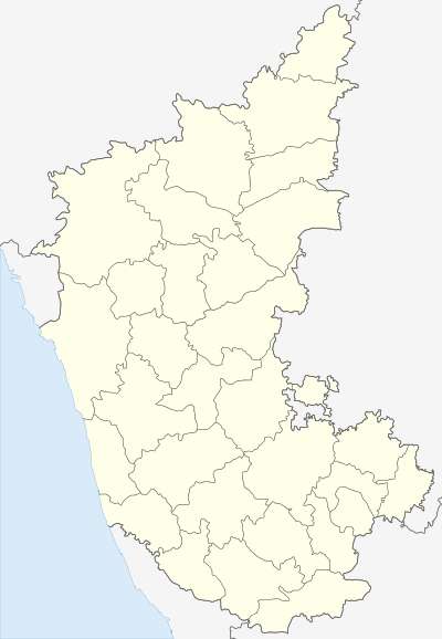 Bantwal Location in Karnataka, India | |
| Coordinates: 12°54′00″N 75°01′59″E / 12.9°N 75.033°ECoordinates: 12°54′00″N 75°01′59″E / 12.9°N 75.033°E | |
| Country |
|
| State | Karnataka |
| District | Dakshina Kannada |
| Region | Coastal Karnataka |
| Area | |
| • Total | 25 km2 (10 sq mi) |
| Elevation | 36 m (118 ft) |
| Population (2011[1]) | |
| • Total | 40,155 |
| • Density | 1,473.2/km2 (3,816/sq mi) |
| Languages | |
| • Official | Kannada |
| • Regional | Tulu, Konkani, Beary |
| Time zone | IST (UTC+5:30) |
| PIN | 574 211 |
| Telephone code | 08255 |
| Vehicle registration | KA-19 |
| Website |
www |
Bantwal is a taluk in Dakshina Kannada district, Karnataka, India. It is also a City by the same name. The adjacent City of B. C. Road (Bantwal Cross Road) serves as the commercial center.
History
Bantwal City is reverentially called as Vatapura Kshetra by some communities. It is situated on the banks of River Nethravati on the National Highway - 73, 25 km east of Mangalore.
In the olden days, the City of Bantwal was known for trade. However, flooding caused by the river Netravathi during the monsoons compelled traders and newer settlements to move to the adjacent city of B. C. Road due to its higher altitude. Gradually, most Government offices shifted to B. C. Road.
Prior to 1852, Bantwal Taluk was the largest taluk in the entire of Canara Province (then comprising North Canara, Udupi, Mangalore and Kasaragod Districts) with 411 villages and a total population of 1,69,416. In 1852, a portion of it was formed into the Taluk of Puttur.[2] Bantwal was an enterpot for the produce of the province on its way to the Mysore Country and had derived great benefit of late years from the extension of the coffee trade. It contained about thousand scattered houses inhabited by Billava, Bunts, Goud Saraswat Brahmins, Konkani Catholics and a few Jains.[3]
Demographics
As of 2001 India census,[4] Bantwal had a population of 36,829. Males constitute 50% of the population and females 50%. Bantwal has an average literacy rate of 74%, higher than the national average of 59.5%; with 76% of the males and 72% of females literate. 12% of the population is under 6 years of age. Tulu is the main language spoken here.In addition to tulu the town also has Konkani and Beary speaking population.
According to the 2011 India census, Hindus make up 61.27% of total population, Muslims 32.47% and Christians 5.95%.[5]
Economy
The town is still considered an important trade center for groceries, tobacco, hardware and most importantly gold.
Geography
The taluk is flanked by the state of Kerala in the south, and the towns of Belthangady and Puttur in the east, the city of Mangalore in the west and Karkala in the north. It covers an area of about 720 km square. National Highway 73 cuts through B. C. Road. The highway serves as the conduit for several arterial routes leading to neighboring towns with Mangalore. Mangalore is connected with other cities in Karnataka such as Mysore and Bangalore via NH-73. It is well connected to Uppala through Uppala-Mudipu-Bantwal Highway.
The Grama Panchayats in Bantwal taluk are Golthamajalu, Kolnadu, Sajipa Muda, Kurnadu, Maani, Navooru, Pudu, Sangabettu, Maavinakatte, Sarapady, Thumbe, Veerakumba and Vittla (Vittal).
The Netravati River passes through the taluka. Water supply to Mangalore city is provided by a vented dam at Thumbe to Netravathi. There is a bridge over the Netravati river at Panemangalore.
Some other places in Bantwal taluk of interest are Kadeshivalaya, Ajilamogaru, Alike, Karanje, Naraharibetta, Nandavara and Modankap.
Transport
Many buses ply to nearby places such as Mudipu, Moodabidri, Surathkal, Mulki, Kinnigoli, Vitla operate from the B. C Road bus stand. The railway station at B. C Road is maintained by south western railways. The Mangalore port is about 30 kilometres from here. Mangalore International Airport is about 45 minutes from B.C Road
Education
List of schools
- Primary and secondary
- SVS English School, Vidyagiri, Bantwal
- SVS Temple School, Bantwal
- SVS High School, Bantwal
- Infant Jesus School, Modankap
- Deepika highschool, Modankap
- Carmel Convent School, Modankap
- GEM High School and Primary Public School, Goltamajal, Vitla road, Kalladka
- Manarul Islam Aided Primary School, Lower Bazar
- Holy Saviour School, Agrar
- Christa Jyothi High School, Agrar
- St.Jacob's School, Farla
- St Patrick's HR Primary School, Siddakatte
- Govt pre university college, Siddakatte
- B.A, Thumbay, Thouheed English Medium School,
- Sri Sharada High School, Panemangalore
- Hayathul Islam Aided Primary School, Goodinabali
- St.Thomas Aided Hr. Primary School, Chelur
- Shamboor High School
List of colleges
- Pre-university
- SVS PU College, Vidyagiri, Bantwal.
- Carmel PU College, Modankapu.
- General Courses
- Sri Venkataramana Swamy College, Vidyagiri, Bantwal
- P.A. Fr. Gr. College, Nadupadavu, Kairangala.
- Govt High school & Junior college, Mudipu
- Govt High School & Junior college, Sajeepa Muda
- Engineering
- Canara Engineering College, Benjanapadavu.
- P A College of Engineering, Nadupadavu, Kairangala.
- Government Polytechnic Bantwal.
Places to visit
- Temples
- Shri Dhama Manila.
- Shri Mahalingeshwara Temple: is one of the oldest temples in the region and is dedicated to Lord Shiva.
- Shri Tirumala Venkatramana Swamy Temple of Bantwal is very famous. It is believed that Lord Venkateshwara or Balaji came here all the way from Tirupati.
- Shri Vinayaka Shankaranarayana Durgamba temple at Nandavara: is another historical and famous temple situated in the banks of Netravati River.
- Shree Gopalakrishna Devasthana, Kairangala
- Shri Seetharam Temple
- Shri Somanatheshwara temple,Near B.C.Road
- Shri Chandikeswari Temple,B.C.Road
- Rakhteshwari Temple
- Shri Hanumanth Temple
- shri veeramukyaprana temple rayara chavadi baddakatte bantwal
- Shri Krishna Math
- Banks of River Netravathi
- Panekala Padpu and its history
- Shri Mahamaya Temple- Borimar, 3.5 km from Soorkmeri Near Mani.
- Shri Narahari Temple, Kalladka
- Shri Lakshmi Narasimha Swamy Temple, Kadeshivalaya
- Shri Panchalingeswara Temple.Vittal
- Shri Karinjeshwara Temple, Karinje, Bantval Taluk. This temple is situated at a place called Karinja of Kavalamudur village of Bantval taluk. 38 km away from Mangalore and 14 km away from Bantval. Could be reached from (2 km) a place called Vogga on Mangalore-Belthangady route. This temple is dedicated to Lord Shiva and Parvathi. The temple stands high on the hill amidst beautiful surroundings. The view of the lake below the hill will certainly cool one's eyes. Every year in months of February — March, Shivaratri, the festival of Lord Shiva is celebrated here with much festivity, which attracts large masses of people.
- Shri Rajarajeswari Temple, Polali, Bantval Taluk, placed at 20 km away from the city and 20 km away from Mangalore city and 10 km away from Mangalore Airport(Bajpe Airport). The famous temple, where the idol is made up of clay. The temple festival is famous and known as :Polali Chendu. Watermelons are offered to lord as it's a land of growing Watermelons.
- Nara Hari Betta, Bantwal: This Shiva temple is also historically known as a place where Nara and Hari, incarnations of Lord Vishnu were supposed to have performed the penance. This hill top temple is also known for its lyrical ponds, which are in the shape of Shanka (Conch), Chakra (Wheel), Gadha (Heavy Weapon) and Padma (Lotus), the weapons of Vishnu. Taking a holy dip in these ponds on the day of Karthik Somvar is considered to be sacred according to the Hindu mythology. Location: It is situated 25 km from Mangalore in Bantwal.
- Shri Pancha Durgaparameshwari Temple, Kakyabeedu, 12 km from Sri Karinjeshwara Temple on Vagga-Uli- Uppinagady Road
- Brahmashree Narayana Guru Jnana Mandira, Sajipa Muda Subhash Nagara. Unique architecture in south India, built in red stone
- Daiva (Bhuta) Shrines
- "Panolibail Kallurti Daiva Sthana" which is most famous sthana situated in few km distance from bantwal. This holy place famous for "Agelu".
- Ambadady annappa panjurli daivasthana bantwal
- Sri Vaidyanatha, Arasu, Jumadi banta Daivasthana, Sujeer, Bantwala
- sri vaidyanatha arasu jumadi banta daivasthana, nandana hittlu bantwala
- sri kallurti kalkuda, Annappa panjurli daivasthana Bhandary hittlu bantwala.
- Churches
- The Most Holy Saviour Church on the hills of Agrar three kilometers away from the town is more than three hundred years old and has got beautiful paintings on the walls similar to the ones at the St. Aloysius Chapel.
- Infant Jesus Church, Modankap is also a three-hundred-year-old church which is the main church of the Bantwal deanery headed by the Vicar Var.
- Our Lady of Vailankani ChurcH, Farla
- Our Lady of Loretto Church, loretto.
- St Patrick Church Siddakatte.
- Church Of The Sacred Heart Of Jesus, Shamboor (Shambur).
- Multiplexes and tech parks
- Nakshatra multiplex theatre, Krishnima complex, B C Road
- Infosys Campus, Kamblapadavu, Kurnad Post, Pajeeru Village, Bantwal.
Nearby Places
- Mangalore
- Moodabidri
- Uppala
- Kasargod
- Puttur
- Vitla
- Belthangadi
- Siddapur
- Siddakatte
- Goodinabali
- Nandavara
- Shamboor
- Shri Dhama Manila
- Dharmastala
References
- ↑ "Archived copy". Archived from the original on 2013-10-21. Retrieved 2013-10-21.
- ↑ "A Gazetteer of Southern India" published in 1855
- ↑ "A Gazetteer of Southern India" published in 1855
- ↑ "Census of India 2001: Data from the 2001 Census, including cities, villages and towns (Provisional)". Census Commission of India. Archived from the original on 2004-06-16. Retrieved 2008-11-01.
- ↑ http://www.deccanherald.com/content/501585/muslim-population-goes-up-dkamp8200tooamp8200census.html
External links
| Wikimedia Commons has media related to Bantwal. |
- Shree Dhama Manila
- Shri Karinjeshwara Shiva & Parvati Temples, Karinje
- Shri Veera Maruthi Temple,Nandavar
- Bantwal
- Sri Venkataramana Swamy College Bantwal
- https://web.archive.org/web/20131021123414/http://www.bantwaltown.gov.in/