Bangsund
| Bangsund | |
|---|---|
| Village | |
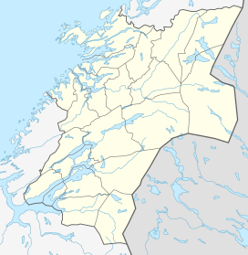 Bangsund  Bangsund Location in Nord-Trøndelag | |
| Coordinates: 64°23′41″N 11°23′44″E / 64.39472°N 11.39556°ECoordinates: 64°23′41″N 11°23′44″E / 64.39472°N 11.39556°E | |
| Country | Norway |
| Region | Trøndelag |
| County | Nord-Trøndelag |
| District | Namdalen |
| Municipality | Namsos |
| Area[1] | |
| • Total | 0.66 km2 (0.25 sq mi) |
| Elevation[2] | 15 m (49 ft) |
| Population (2013)[1] | |
| • Total | 918 |
| • Density | 1,391/km2 (3,600/sq mi) |
| Time zone | CET (UTC+01:00) |
| • Summer (DST) | CEST (UTC+02:00) |
| Post Code | 7822 Bangsund |
Bangsund is a village in the municipality of Namsos in Nord-Trøndelag county, Norway. It lies along the Løgnin arm of the Namsenfjorden, about 15 kilometres (9.3 mi) south of the town of Namsos. The 0.66-square-kilometre (160-acre) village has a population (2013) of 918. The population density is 1,391 inhabitants per square kilometre (3,600/sq mi).[1]
History
Norsemen referred to it as "Icebound", even though there isn’t much ice. Bangsund was originally an extremely old settlement. In 1886, a worker found a tombstone that dated back to about 500-600 AD.
The original farm was divided into two when its owner, Mickel Bangsund, gave one half to each of his two sons. After the sons had kids and died off, the little farm started growing into a small town. In 1801, the population was 30 people.
One of Bangsund’s resources was the "Bangdalsbruget" sawmill. The mill burned to the ground in 1907 and was rebuilt in 1910. The sawmill was then used until 1980 and is said to have been one of the biggest sawmills in Northern Norway.[3]
References
- 1 2 3 Statistisk sentralbyrå (1 January 2013). "Urban settlements. Population and area, by municipality.".
- ↑ "Bangsund" (in Norwegian). yr.no. Retrieved 2011-08-23.
- ↑ Store norske leksikon. "Bangsund" (in Norwegian). Retrieved 2011-08-23.