Banbury and Cheltenham Direct Railway
| Banbury and Cheltenham Direct Railway | |
|---|---|
| Overview | |
| Locale | Oxfordshire, Gloucestershire |
| Operation | |
| Opened | 1855 |
| Operator(s) | Great Western Railway, British Railways |
| Technical | |
| Track gauge | 4 ft 8 1⁄2 in (1,435 mm) |
| Banbury & Cheltenham |
|---|
Legend |
The Banbury and Cheltenham Direct Railway is a former railway in the Cotswold Hills in Gloucestershire and Oxfordshire, England.
Origins and development
The railway was built and opened in stages.[1] The Chipping Norton Railway opened in 1855, linking the town of Chipping Norton with the Oxford, Worcester and Wolverhampton Railway at Kingham.[2] The Bourton-on-the-Water Railway between Kingham and Bourton-on-the-Water opened in 1862.
By 1881[3] two further sections of railway had been completed: one between Chipping Norton and King's Sutton and the other between Bourton-on-the-Water and Cheltenham.[4] Together these four sections of railway formed a complete line between Cheltenham and King's Sutton.
The BCDR company did not operate services on the line: it contracted the Great Western Railway to do so in return for a share of the receipts.
In 1891 the Midland and South Western Junction Railway built a junction with the BCDR at Andoversford. The M&SWJR paid for running rights on the BCDR between Andoversford and Cheltenham.
The BCDR remained a separate company until the GWR absorbed it in 1897.[5] All services along the BCDR used to have to change directions at Kingham until 1906, when the GWR built a loop over the OW&W that bypassed the station.[2]
Major structures
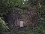
There were two tunnels between Chipping Norton and Hook Norton: Chipping Norton Tunnel, 685 yards (626 m) long,[6] and Hook Norton Tunnel, 418 yards (382 m) long.[7] Hook Norton Tunnel is actually nearer the village of Swerford and is sometimes called Swerford Park Tunnel.
There were two viaducts at Hook Norton: Hook Norton no. 1 and Hook Norton no. 2.
Closure

In 1951 British Railways withdrew passenger services between Chipping Norton and King's Sutton and closed all intermediate passenger stations on that section of line. In 1958 a landslide at Hook Norton caused freight services to be discontinued between Hook Norton and Chipping Norton.
In 1963 Richard Beeching's report The Reshaping of British Railways recommended the withdrawal of passenger services between Cheltenham and Chipping Norton.[8] BR had withdrawn all passenger services between Cheltenham and Kingham on 15 October 1962 and between Kingham and Chipping Norton on 1 December 1962.[9] and all freight services on 7 September 1964.[4]
Sources
- Brown, Bob; Parkhouse, Neil; Jenkins, Stanley C (2004). The Banbury and Cheltenham Direct Railway. Witney: Lightmoor Press. ISBN 1-899889-15-9.
- Oakley, Mike (2003). Gloucestershire Railway Stations. Wimborne: Dovecote Press. p. 9. ISBN 1-904349-24-2.
| Wikimedia Commons has media related to Banbury and Cheltenham Direct Railway. |
References
- ↑ Brown, Parkhouse & Jenkins 2004
- 1 2 Disused Railways website
- ↑ dukedog-GWR family tree from dukedog.co.uk
- 1 2 Oakley, 2003, page 9
- ↑ "Railway Companies and Contractors". Signalbox.org. Retrieved 2012-12-18.
- ↑ "Railway Tunnel Lengths website, page 1". www.railwaycodes.org.uk. 1929-01-28. Retrieved 2012-12-18.
- ↑ "Railway Tunnel Lengths website, page 2". www.railwaycodes.org.uk. 2012-10-02. Retrieved 2012-12-18.
- ↑ "The Reshaping of British Railways — map of proposed withdrawal of passenger train services". Retrieved 2012-12-18.
- ↑ "The Cheltenham to Kingham line". Archived from the original on 6 July 2008.