Banaswadi
| Banaswadi, Bengaluru ಬಾಣಸವಾಡಿ | |
|---|---|
| Neighbourhood | |
 Banaswadi, Bengaluru | |
| Coordinates: 13°00′54″N 77°39′07″E / 13.015°N 77.652°ECoordinates: 13°00′54″N 77°39′07″E / 13.015°N 77.652°E | |
| Country | India |
| State | Karnataka |
| District | Bangalore |
| Government | |
| • Body | BBMP |
| Area | |
| • Total | 3.46 km2 (1.34 sq mi) |
| Population (2012) | |
| • Total | 46,142 |
| • Density | 13,000/km2 (35,000/sq mi) |
| Languages | |
| • Official | Kannada |
| Time zone | IST (UTC+5:30) |
| Area code(s) | 91-80 |
| Vehicle registration | KA 53 |
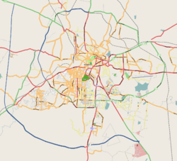
Banaswadi is a locality situated to the north east of Bangalore, about 6 km from the city centre. It is Ward no 27 of the BBMP[1] and is further divided into two regions; Chikka Banaswadi and Dodda Banaswadi. Historically the area was known as primarily residential; little more than a village on the city outskirts;[2] however the ongoing expansion of the city limits, the proximity of the locality to the international airport and the arrival of the outer ring road connecting Banaswadi to the City's IT hubs has seen the rapid improvement of the area and the emergence of a number of commercial and business activities.[3]
Demographics
The population of Banaswadi has grown by approximately 44% since 2001, adding 14,144 people. Based on 2001 Census data, 10.6% of the population are Scheduled Castes, whilst less than 1% are Scheduled Tribes.
Location
 |
Kammanahalli, Bangalore | Kalyan Nagar, Bangalore | Outer Ring Road, Bangalore | |
| Cox Town | |
Hennur | ||
| ||||
| | ||||
| Byappanahalli Metro station area | Kasturi Nagar and Old Madras road | Ramamurthy Nagar and KR Puram |
References
- ↑ Ward, BBMP. "BBMP ward & Councillors".
- ↑ Kumar, Sheila (11 February 2013). "Lost more than we've gained?". Bangalore Mirror.
- ↑ Dsouza Prabhu, Ruth (28 December 2012). "Pockets of Progress". Deccan Herald.
External links
| Wikimedia Commons has media related to Banaswadi. |