Ban Laem District
| Ban Laem บ้านแหลม | |
|---|---|
| Amphoe | |
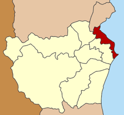 Amphoe location in Phetchaburi Province | |
| Coordinates: 13°12′2″N 99°58′49″E / 13.20056°N 99.98028°ECoordinates: 13°12′2″N 99°58′49″E / 13.20056°N 99.98028°E | |
| Country |
|
| Province | Phetchaburi |
| Seat | Ban Laem |
| Area | |
| • Total | 189.885 km2 (73.315 sq mi) |
| Population (2008) | |
| • Total | 54,068 |
| • Density | 290.7/km2 (753/sq mi) |
| Time zone | THA (UTC+7) |
| Postal code | 76110 |
| Geocode | 7607 |
Ban Laem (Thai: บ้านแหลม, pronounced [bâːn lɛ̌ːm]) is a district (Amphoe) in the northeastern part of Phetchaburi Province, western Thailand.
History
Originally, the area were Khwaeng Khun Chamnan and Phrommasan under Mueang Phetchaburi district. They were put together and upgraded to a full district in 1904.[1]
Geography
Neighboring districts are (from the southwest clockwise) Mueang Phetchaburi, Khao Yoi of Phetchaburi Province, Amphawa, Mueang Samut Songkhram of Samut Songkhram Province and the Bay of Bangkok.
Administration
The district is subdivided into 10 subdistricts (tambon), which are further subdivided into 73 villages (muban). There are two subdistrict municipalities (thesaban tambon) - Bang Thabun and Ban Laem. Ban Laem covers parts of tambon Ban Laem. Bang Thabun covers parts of tambon Bang Thabun and Bang Tabun Ok. There are further 9 Tambon administrative organizations (TAO).
| No. | Name | Thai | Villages | Inh.[2] |
|---|---|---|---|---|
| 1. | Ban Laem | บ้านแหลม | 10 | 15,565 |
| 2. | Bang Khun Sai | บางขุนไทร | 11 | 7,013 |
| 3. | Pak Thale | ปากทะเล | 4 | 2,365 |
| 4. | Bang Kaeo | บางแก้ว | 8 | 4,955 |
| 5. | Laem Phak Bia | แหลมผักเบี้ย | 4 | 2,288 |
| 6. | Bang Tabun | บางตะบูน | 8 | 4,177 |
| 7. | Bang Tabun Ok | บางตะบูนออก | 5 | 3,078 |
| 8. | Bang Khrok | บางครก | 12 | 6,936 |
| 9. | Tha Raeng | ท่าแร้ง | 7 | 4,835 |
| 10. | Tha Raeng Ok | ท่าแร้งออก | 4 | 2,856 |
References
- ↑ แจ้งความกระทรวงมหาดไทย เรื่อง ตั้งอำเภอบ้านแหลม มณฑลราชบุรี (PDF). Royal Gazette (in Thai). 21 (7): 84. 1904-05-15.
- ↑ "Population statistics 2008". Department of Provincial Administration.
External links
- amphoe.com (Thai)