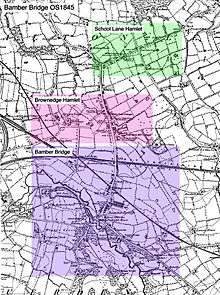
Bamber Bridge
| Bamber Bridge | |
 Bamber Bridge Library |
|
 Bamber Bridge |
|
| Population | 12,126 [1] |
|---|---|
| OS grid reference | SD564265 |
| District | South Ribble |
| Shire county | Lancashire |
| Region | North West |
| Country | England |
| Sovereign state | United Kingdom |
| Post town | PRESTON |
| Postcode district | PR5 |
| Dialling code | 01772 |
| Police | Lancashire |
| Fire | Lancashire |
| Ambulance | North West |
| EU Parliament | North West England |
| UK Parliament | Ribble Valley |
|
|
Coordinates: 53°43′59″N 2°39′36″W / 53.733°N 2.660°W
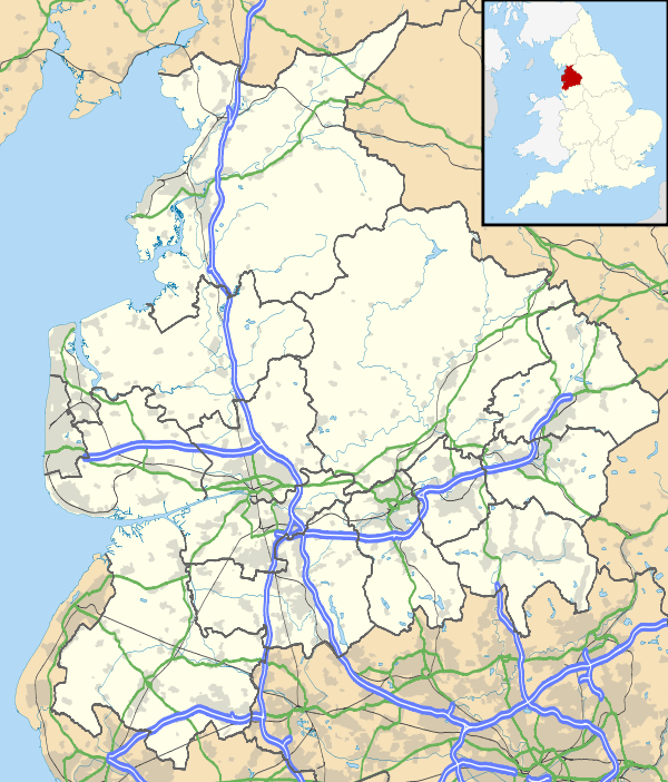
Bamber Bridge is a large suburban village in Lancashire, England, 3 miles (5 km) south-east of the city of Preston, in the borough of South Ribble. The name derives from the Old English "bēam" and "brycg", which probably means "tree-trunk bridge". It is mentioned in an undated medieval document.[2] Bamber Bridge is often referred to as "the Brig" by residents. People born in Bamber Bridge are known as "Briggers". The total population for the 3 active Bamber Bridge Wards was 12,126 at the 2001 census, increasing to a total of 13,945 at the 2011 Census.
History
Textiles
By 1764 calico printing had been established in what was then a village; this was the first example of calico printing anywhere in Lancashire. Previously had been mainly carried out in the south of England, before spreading to Scotland and the northern counties.[3][4]
In 1857, as a result of the downturn in the cotton trade, a large manufacturer and spinner in te village (Bamber Bridge SP & WN Co.) reported liabilities estimated at £40,000 to £60,000, and were about to go on short time.[5]
On 31 October 1859, the Withy Trees Mill in the village, owned by Eccles and Company, burnt down. It was reported that the spinning-master and engineer had stayed on after the mill had closed at 6:00 pm to repair some machinery on the third floor. A spark from a lamp is said to have dropped on some cotton waste, igniting it. Nobody was killed or injured, but between 16,000 and 17,000 spindles and 270 looms were destroyed and 250 people lost their jobs.[6]
On 7 June 1862, The Times stated that 600 hands had been thrown out of work with the stoppage of Dewhurst's Mill. The same report described the economic problems of the village: 1 in 5 people in Bamber Bridge and Walton-le-Dale and the surrounding area were now reduced to pauperism.[7]
A petition against the recognition of the Confederate States of America was presented to the House of Commons on Monday, 29 June 1863, by a villager, a Mr Barnes. No mention is made of his first name or whether he represented any organisation.[8]
The trade unionist George Woodcock was born in Bamber Bridge on 20 October 1904. He was a voluntary official of the Bamber Bridge branch of the Weavers' Association after a spell of tuberculosis. He won a TUC scholarship to Ruskin College, Oxford in 1929. He was awarded the CBE in 1953 and appointed a member of the Privy Council in 1957. He was General Secretary of the TUC in 1960 and a member of the Royal Commission on Trade Unions and Employers' Associations in 1965 and served as chairman from 1969 to 1971. He died on 30 October 1979.[9][10]
-

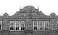
Top of the tower, all that remains of Orr's Mill, School Lane. This was originally the top part of the tower of the Bamber Bridge Spinning & Weaving Company mill, Wesley Street (image shown in this collection). A similar dome had adorned Orr's Mill.
-

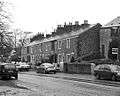
These cottages on Withy Trees Road were constructed for the hands at Withy Trees Mill
-
Handloom weavers' cottages, Church Road
-

Spinners' cottages, Spinners Square
-

Remains of the Bamber Bridge Spinning & Weaving Company Mill, Wesley Street.
-
Inscription, Bamber Bridge Spinning & Weaving Company Mill, Wesley Street.
Railways
The first railway through Bamber Bridge was the horsedrawn Lancaster Canal Tramroad, which connected two parts of the Lancaster Canal, and crossed Station Road.
The steam-hauled railway came to Bamber Bridge around the same time as the first cotton mills. A line was built connecting Blackburn with the West Coast Main Line at Farington, with a branch connecting Bamber Bridge directly to Preston. A station was built where the railway crossed Station Road at a level crossing.
The stretch of track through the village was first owned by the East Lancashire Railway, then the Lancashire and Yorkshire Railway following incorporation in 1847.
In March 1859, a Hurricane engine bolted off the rails at Bamber Bridge, ran across the level crossings and caught the end of a house, knocking down the gable end. The accident did not end with any death or injury, even though a woman was washing in the kitchen of the house.[11]
The railway was then amalgamated into the London and North Western Railway in 1922, and twelve months later became part of the London, Midland and Scottish Railway (LMS). The LMS plaque was still in existence on the station subway buildings before their demolition in 2005 due to dilapidation. The railways were nationalised in 1948, becoming part of British Railways (later rebranded as British Rail). The railways were privatised in 1994 by the Conservative government.
The line from Farington to Blackburn is now part of the East Lancashire Line.
The direct route to Preston was closed by British Rail in the 1970s, and most of the route is now a cycle route, forming part of the National Cycle Network.
Roads
Station Road is the main road through Bamber Bridge, and most of the shops are on this road. It crosses the railway at a level crossing next to the railway station. It was formerly part of the A6, until a bypass was built in the 1980s.[12]
The village is also at the northern end of the A49, where it meets the A6.
The section of the M6 motorway around the village is part of the Preston Bypass opened in 1958,[13] the first motorway in Britain, and includes the junction with the M61 from Manchester. More recently the M65 has been extended to join the A6, also in Bamber Bridge.
The "Battle" of Bamber Bridge
During the Second World War, Bamber Bridge played host to a number of American servicemen. Their base was situated on Mounsey Road, part of which still exists now as home to 2376 (Bamber Bridge) Squadron of the Air Training Corps (or Air Cadets).
Trouble began on the evening of 24 June 1943, and it was largely an all-American affair that helped to highlight racial tensions within the American forces. Two white military policemen (MPs) had entered the Hob Inn on Church Road to arrest a black soldier, who was out without a pass. An argument ensued between the black soldier and the white MPs, with local people and British servicemen siding with the black soldier and the small group of comrades he was with. The MPs left the pub to seek reinforcements and intercepted the soldiers as they returned to their barrack rooms. A melee broke out, guns were drawn and several men were shot.
Rumours abounded at the camp that the MPs were going to shoot the intercepted men and a crowd gathered at the gates of the camp. A party of armed men then commandeered a vehicle and drove out into the village, where more shooting broke out. White Americans were chased down the street and passing army vehicles were fired upon. Military reinforcements were brought in and a machine gun ambush was set up along Station Road. The local police stayed away from the area and locals were warned to stay indoors.
At midnight, a large group of MPs arrived at the camp armed with machine guns. A general panic broke out, resulting in black soldiers arming themselves from the camp gunroom. There was then general chaos. Groups of armed men were stalking each other in the fields and back lanes of the village until around 4.00 the next morning, when an American general arrived. The only black officer was placed in charge of the situation and the rifles were then all handed in. One man was killed (Pte. William Crossland of Pittsylvania County, Virginia [14]), three were injured and 35 arrested.[15][16][17]
Culture and recreation
Public houses
-

Ye Olde Hob Inn, Church Road
-

Black Bull, Station Road (Now closed as public house. Now business premises)
-

Hospital Inn, Brindle Road
-
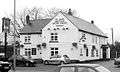
Ye Olde Original Withy Trees
'Ye Olde Hob Inn, Church Road. 17th century coach house, built c. 1616 and originally smaller than its present dimensions. Before it was known as the Hob, it was called the 'Black Horse'.
Black Bull, Station Road - now closed
Mackenzies In Brig bar (formerly the Mackenzie Arms), Station Road - now closed - now demolished
Lancs & Yorks, Station Road - now closed - currently used by Enterprise Rent-a-Car
White Bull, Station Road - now closed
Punch and Truncheon (chain-pub formerly known as 'The Blue Ball' then 'Last Orders'. The building was also the old police station), Station Road
Ye Olde Original Withy Trees (formerly Withy Trees Farm), Station Road
Withy Arms (formerly the Top House and prior to that 'Shifty O'Shea's', an Irish theme bar and prior to that the Withy Trees), Station Road
Pear Tree, Station Road
Peters Bar (formerly Tommy Tuckers), School Lane
Woodsman, School Lane - now closed
Hospital Inn, Brindle Road
Poachers, Lostock Lane
Walton Fox, South Rings Business Park
Clubs and associations
-

Trades Hall (formerly the Liberal Club), Station Road
-

Bamber Bridge & County Catholic Club, Aspden Street
- Bamber Bridge Band Club, Station Road
- Bamber Bridge Conservative Club, Cranbourne Street
- Trades Hall, Station Road (formerly the Liberal Club)
- Bamber Bridge & County Catholic Club, Aspden Street
- Bamber Bridge F.C., Irongate, Brownedge Road
- School Lane Working Men's Club & Institute, St. Aidan's Road
- Bamber Bridge Scooter Club, Station Road
- 2376 (Bamber Bridge) Squadron ATC (Air Cadets), Mounsey Road
Politics
Local
Bamber Bridge is in South Ribble district. It is represented on the council by two councillors for each of three wards: Bamber Bridge East (Cllr. James Owen & Cllr. David John Watts (Mayor), both Labour Party), Bamber Bridge North (Cllr. Stephen Bennett, Labour & Cllr. Carol Ann Chisholm, Conservative) and Bamber Bridge West (Cllr. Thomas George Hanson, Labour & Cllr. Paul Andrew Foster, Labour).[18]
County
Bamber Bridge is covered by two electoral divisions on Lancashire County Council. The first, Bamber Bridge & Walton-le-Dale, covers the majority of Bamber Bridge and as of 2009 is represented by Peter Mullineaux, of the Conservative Party. The second, South Ribble Rural East, covers the southern part of Bamber Bridge and is represented by Tom Sharratt, of the Idle Toad party.[19]
Parliamentary
Following their review of parliamentary representation in Lancashire, the Boundary Commission for England created a modified Ribble Valley seat and the three Bamber Bridge electoral wards - Bamber Bridge East, Bamber Bridge North and Bamber Bridge West - moved into this constituency at the 2010 UK general election. This means that Bamber Bridge is currently represented in the House of Commons by Nigel Evans, the Conservative Party MP for Ribble Valley. The wards were transferred despite objections raised by the Labour Party in Bamber Bridge.[20] Prior to the 2010 UK general election, the three Bamber Bridge electoral wards were in the Preston parliamentary constituency and were represented by Mark Hendrick MP.
Demographics
Population. The 2001 Census data for the three wards that make up Bamber Bridge listed the entire population as 12,126. Of this number, 5,882 are listed as male and 6,244 as female.
Age. The population was divided into the following age groups; 0–4 years, 5.86%; 5–15 years, 14.64%; 16–19 years, 4.19%; 20–44 years, 34.34%; 45–64 years, 25.21%, and; over 65 years, 15.75%.
Ethnicity. According to census returns, the ethnic make-up of the village was; White, 98.10%; Mixed, 0.50%; Asian or Asian British, 0.66%; Black, Black British, 0.23%, and; Chinese or other ethnic group, 0.51%.
Religion. The percentage of people listing themselves as; Christian, 86.68%; Buddhist, 0.10%; Hindu, 0.32%; Jewish, 0.00%; Muslim, 0.21%; Sikh, 0.11%; Other religions, 0.07%; No religion, 7.91%, and; Religion not stated, 4.60%.
Housing. In 2001, there were a total of 5,027 households in the three wards. Of the total 84.14% were owner occupied and 15.86% were rented. Expressed as a percentage of the total; 34.50% owned their property outright; 48.47% owned their property with a mortgage or a loan, and; 1.16% of householders had shared ownership of their property. Expressed as a percentage of the total; 0.86% rented their home from the local authority; 10.22% rented from a housing association; 3.05% rented from a private landlord or a letting agency, and; 1.73% rented from another source.
Health. In 2001; 67.28% of people were listed as 'in good health'; 22.89% in fairly good health; 9.83% not in good health, and; 19.74% of people were listed with a limiting long-term illness.[1]
Transport
Bamber Bridge railway station has hourly direct trains to Preston, Lytham St Annes, Blackpool South, Blackburn, Accrington and Burnley and various railway stations in between. Trains to Bradford, Leeds, York and Blackpool North that pass through the unmanned station normally require a change at either Blackburn or Preston, except for one service each way daily which calls at Bamber Bridge. On Sundays between April and October, the "Dalesrail" service operates from Blackpool North to Carlisle via Blackburn, Clitheroe and the Settle–Carlisle Line, calling at Bamber Bridge.
The 125 bus route from Preston to Bolton runs through Bamber Bridge, as does the 113 service from Preston to Wigan and the 112 and 150 services, also from Preston.
Worship
Bamber Bridge has two Anglican churches, both are parish churches in the Diocese of Blackburn.[21] The first to be built was St.Saviour's Church, on Church Road at the south end of the village, was built in 1837 on land given by Mr. R. Townley Parker (Guild mayor of Preston in 1862) and was considerably altered and enlarged in 1886/87, when the altered church was opened by Lord Cranbourne. The land for the churchyard was donated by Mr. R. A. Tatton of Cuerden Hall.[22] It is a Grade II listed building.[23] St. Aidan's Church, on Station Road, was founded in 1895.[24]
The village's Roman Catholic church, St. Mary's Church, is on Brownedge Lane, and was built in 1826, as a replacement for a chapel. A spire was added in 1866, and the church was partly rebuilt by Peter Paul Pugin in 1892. The church has a neo-gothic altar.[25]
Bamber Bridge Methodist Church is on the corner of Wesley Street and Station Road, and was opened in 2006, as a replacement for an older building on the same site.[26]
Bamber Bridge is also home to Valley Church[27] which meets in Fourfields House on Station Road. The church was planted in 2007 by Pastors Ed and Michele Carter, with the vision of 'empowering a new generation'. Valley Church is a church plant from Fulwood Free Methodist Church [28] and originally met in Walton-le-Dale Arts College and High School before outgrowing the facilities there and moving to Fourfields House in 2011. The church meets twice every Sunday (10.30am and 6.00pm) for services with vibrant music and life-relevant teaching.
|


See also
Citations
- 1 2 "2001 census returns for the three Bamber Bridge Wards". Neighbourhood Statistics. Office For National Statistics. Retrieved 10 March 2016.
- ↑ "Bamber Bridge" A. D. Mills, A Dictionary of British Place-Names. Oxford University Press, 2003.
- ↑ The Times, Friday, 27 June 1913; p. 31; Issue 40249; col B
- ↑ The Calico Printing Industry of Lancastria in the 1840s by K. L. Wallwork. Transactions of the Institute of British Geographers, No. 45. (September , 1968), pp. 143-156.
- ↑ The Times, Wednesday, 27 May 1857; p. 10; Issue 22691; col F
- ↑ The Times, Friday, 4 November 1859; p. 4; Issue 23455; col E
- ↑ The Times, Saturday, 7 June 1862; p. 12; Issue 24266; col F
- ↑ The Times, Tuesday, 30 June 1863; p. 7; Issue 24598; col D
- ↑ The Times, Monday, 19 November 1979; p. 25; Issue 60478; col C
- ↑ Geoffrey Goodman, "Woodcock, George (1904–1979)", Oxford Dictionary of National Biography, Oxford University Press, 2004
- ↑ The Times, Monday, 14 March 1859; p. 9; Issue 23253; col F
- ↑ SABRE - Road Lists - The First 99 - A6 http://www.sabre-roads.org.uk/roadlists/f99/6.shtml
- ↑ CBRD - Motorway Database - M6
- ↑ http://www.victorianvilla.com/sims-mitchell/local/war/ww2/cas/
- ↑ David Hunt, A History Of Preston, Carnegie Press, 1992, pp. 246-47.
- ↑ BBC - WW2 People's War - The Battle of Bamber Bridge
- ↑ BBC - Manchester - Features - Remembering the North at War
- ↑ "Archived copy". Archived from the original on 6 October 2007. Retrieved 5 January 2007.[wards].[ward]&header=wardname#Bamber%20Bridge%20East
- ↑ "Councillor Info – Lancashire County Council". www.councillor.info. Lancashire County Council. Retrieved 2009-09-24.
- ↑ News Release dated 19 January 2005, The Boundary Commission for England
- ↑ "Leyland Deanery". Diocese of Blackburn. Retrieved 2008-10-01.
- ↑ GENUKI: Central Wesleyan Methodist, Bacup, Lancashire genealogy
- ↑ "Detailed Record: Church of St Saviour, Church Road, Bamber Bridge, South Ribble, Lancashire". Images of England. English Heritage. Retrieved 2008-10-01.
- ↑ GENUKI: Burnley Road United Methodist Free Church, Bacup, Lancashire genealogy
- ↑ Home Page
- ↑ Bamber Bridge Methodist Church
- ↑ Valley Church
- ↑ Fulwood Free Methodist Church
External links
-
 Media related to Bamber Bridge at Wikimedia Commons
 |
Walton-le-Dale, Preston | | ||
| Lostock Hall, Farington, New Longton, Hutton, Longton | |
Gregson Lane, Hoghton, Brindle, Feniscowles, Blackburn | ||
| ||||
| | ||||
| Cuerden, Clayton-le-Woods, Leyland, Chorley |