Balvatnet
| Balvatnet Bállávvre | |
|---|---|
 | |
| Location | Saltdal, Nordland |
| Coordinates | 66°56′38″N 15°54′02″E / 66.94389°N 15.90056°E / 66.94389; 15.90056Coordinates: 66°56′38″N 15°54′02″E / 66.94389°N 15.90056°E / 66.94389; 15.90056 |
| Basin countries | Norway |
| Max. length | 11 kilometres (6.8 mi) |
| Max. width | 9 kilometres (5.6 mi) |
| Surface area | 41.46 km2 (16.01 sq mi) |
| Shore length1 | 54.32 kilometres (33.75 mi) |
| Surface elevation | 597 metres (1,959 ft) |
| References | NVE |
| 1 Shore length is not a well-defined measure. | |
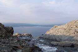
Balvatnet (Lule Sami: Bállávrre) is a lake that lies in the municipality of Saltdal in Nordland county, Norway. The 41.46-square-kilometre (16.01 sq mi) lake is located on the border of Junkerdal National Park, about 2 kilometres (1.2 mi) west of the border with Sweden. The lake is regulated for hydroelectric power at the Daja power station 16 kilometres (9.9 mi) to the north in Sulitjelma.[1]
See also
References
- ↑ Store norske leksikon. "Balvatnet" (in Norwegian). Retrieved 2012-03-27.
This article is issued from Wikipedia - version of the 9/4/2015. The text is available under the Creative Commons Attribution/Share Alike but additional terms may apply for the media files.