Baltoro Muztagh
| Baltoro Muztagh | |
|---|---|
 | |
| Highest point | |
| Peak | K2 |
| Elevation | 8,611 m (28,251 ft) |
| Coordinates | 35°52′57″N 76°30′48″E / 35.88250°N 76.51333°E |
| Geography | |
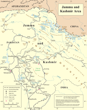
| Countries | Pakistan and China (claimed by India) |
| States/Provinces | Baltistan and Xinjiang (Claimed by Jammu and Kashmir in India) |
| Parent range | Karakoram |
The Baltoro Muztagh (simplified Chinese: 巴尔托洛慕士塔格山; traditional Chinese: 巴爾托洛慕士塔格山; pinyin: Bā'ěrtuōluò Mùshìtǎgé Shān) is a subrange of the Karakoram mountain range, in Baltistan region of the Gilgit-Baltistan province in northern Pakistan; and in Xinjiang, China and is claimed by India. The crest of the range forms part of the Pakistan-China border disputed by India.
The range is home to K2 (8,611 metres (28,251 ft)), the second highest mountain in the world, and to three other Eight-thousander peaks. They are located on the north and east sides of the Baltoro Glacier.
Selected peaks of the Baltoro Muztagh
The following is a table of the peaks in the Baltoro Muztagh which are over 7,200 metres (23,620 ft) in elevation and have over 500 metres (1,640 ft) of topographic prominence. (This is a common criterion for peaks of this stature to be independent.)
Lower summits

There are a number of lower summits near the tongue of the Baltoro Glacier which are striking rock towers, and are famous for their aesthetic, difficult climbing. These include:
- Great Trango, 6,286 m
- Trango (Nameless) Tower, 6,239 m
- Uli Biaho Tower, 6,109 m
See also
| Wikimedia Commons has media related to Baltoro Muztagh. |
Sources
Jerzy Wala, Orographical Sketch Map of the Karakoram, Swiss Foundation for Alpine Research, Zurich, 1990.