Baileyton, Tennessee
| Baileyton, Tennessee | |
|---|---|
| Town | |
|
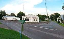
Intersection of Brunner Street and Horton Highway | |
 Location of Baileyton, Tennessee | |
| Coordinates: 36°19′41″N 82°49′50″W / 36.32806°N 82.83056°W | |
| Country | United States |
| State | Tennessee |
| County | Greene |
| Incorporated | 1915 |
| Government | |
| • Type | Mayor/Aldermen |
| • Mayor | Tommy Casteel |
| • Vice Mayor | Kenneth Bailey Sr. |
| • Town Recorder | Barbara Tilson |
| • Police Chief | Joshua Ferguson |
| • Aldermen |
List of Aldermen
|
| Area | |
| • Total | 1.4 sq mi (3.7 km2) |
| • Land | 1.4 sq mi (3.7 km2) |
| • Water | 0.0 sq mi (0.0 km2) |
| Elevation | 1,211 ft (369 m) |
| Population (2010) | |
| • Total | 431 |
| • Density | 310/sq mi (120/km2) |
| Time zone | Eastern (EST) (UTC-5) |
| • Summer (DST) | EDT (UTC-4) |
| ZIP code | 37745 |
| Area code(s) | 423 |
| FIPS code | 47-02780[1] |
| GNIS feature ID | 1276120[2] |
Baileyton is a town in northern Greene County, Tennessee, United States. The population was 431 at the 2010 census, down from 504 at the 2000 census. Baileyton is located 12 miles north of Greeneville and 18 miles southeast of Rogersville.
History
Originally called Laurel Gap, the Baileyton area was first settled in 1776. The name Baileyton stems from two brothers who lived there: Claudius and Thomas P. Bailey. The town was incorporated in 1915.[3]
Geography
Baileyton is located at 36°19′41″N 82°49′50″W / 36.32806°N 82.83056°W (36.328094, -82.830501).[4] The town is situated in a rugged area of northern Greene County, just south of the Hawkins County line. Bays Mountain, part of the greater Ridge-and-Valley Appalachians, rises prominently to the north. The town is drained primarily by Gardner Creek and Hughes Branch, both tributaries of Lick Creek (which is in turn a tributary of the Nolichucky River).[5]
According to the United States Census Bureau, the town has a total area of 1.4 square miles (3.6 km2), all of it land.
Demographics
| Historical population | |||
|---|---|---|---|
| Census | Pop. | %± | |
| 1920 | 169 | — | |
| 1930 | 212 | 25.4% | |
| 1940 | 229 | 8.0% | |
| 1950 | 224 | −2.2% | |
| 1960 | 206 | −8.0% | |
| 1970 | 258 | 25.2% | |
| 1980 | 333 | 29.1% | |
| 1990 | 309 | −7.2% | |
| 2000 | 504 | 63.1% | |
| 2010 | 431 | −14.5% | |
| Est. 2015 | 431 | [6] | 0.0% |
| Sources:[7][8] | |||
As of the census[1] of 2000, there were 504 people, 237 households, and 138 families residing in the town. The population density was 353.6 people per square mile (136.1/km²). There were 275 housing units at an average density of 192.9 per square mile (74.3/km²). The racial makeup of the town was 98.21% White, 0.99% African American, 0.20% Native American, 0.40% from other races, and 0.20% from two or more races. Hispanic or Latino of any race were 0.79% of the population.
There were 237 households out of which 23.6% had children under the age of 18 living with them, 44.7% were married couples living together, 12.2% had a female householder with no husband present, and 41.4% were non-families. 36.3% of all households were made up of individuals and 15.2% had someone living alone who was 65 years of age or older. The average household size was 2.13 and the average family size was 2.77.
In the town the population was spread out with 19.0% under the age of 18, 8.7% from 18 to 24, 25.4% from 25 to 44, 29.6% from 45 to 64, and 17.3% who were 65 years of age or older. The median age was 42 years. For every 100 females there were 88.1 males. For every 100 females age 18 and over, there were 83.8 males.
The median income for a household in the town was $20,139, and the median income for a family was $34,375. Males had a median income of $26,389 versus $18,056 for females. The per capita income for the town was $12,410. About 13.1% of families and 20.4% of the population were below the poverty line, including 26.0% of those under age 18 and 25.9% of those age 65 or over.
Postal service
Baileyton does not have a post office, The closest post office is in Greeneville. Baileyton along with Greeneville and Tusculum share the zip code 37745.
Education
Schools in Baileyton are operated by the Greene County Schools:
- Baileyton Elementary School – serves grades PK–8
- North Greene High School – serves grades 9–12.
Economy
Most residents in Baileyton work in Greeneville or other nearby cities. There are several restaurants and gas stations off Interstate 81 exit 36. Several stores are also located in Baileyton.
Transportation
Baileyton is located off Interstate 81 exit 36, North of Greeneville. State Route 172 connects Greeneville to Interstate 81 in Baileyton.
Van Hill Road (a former alignment of State Route 172) connects to State Route 347 which goes to Rogersville and Kingsport.
Horton Highway is the main west-east road through Baileyton. It connects Baileyton with Tennessee State Route 70 west of town near Romeo and Tennessee State Route 93 east of Baileyton, north of Fall Branch.
Recreation
- Baileyton RV Park and Baileyton Golf Club.
References
- 1 2 "American FactFinder". United States Census Bureau. Archived from the original on 2013-09-11. Retrieved 2008-01-31.
- ↑ "US Board on Geographic Names". United States Geological Survey. 2007-10-25. Retrieved 2008-01-31.
- ↑ Larry L. Miller (October 2001). Tennessee place names. Indiana University Press. p. 11. ISBN 978-0-253-21478-2. Retrieved 21 November 2011.
- ↑ "US Gazetteer files: 2010, 2000, and 1990". United States Census Bureau. 2011-02-12. Retrieved 2011-04-23.
- ↑ U.S. Geological Survey 1:24,000 topographical maps: Baileyton, TN.
- ↑ "Annual Estimates of the Resident Population for Incorporated Places: April 1, 2010 to July 1, 2015". Retrieved July 2, 2016.
- ↑ "Census of Population and Housing: Decennial Censuses". United States Census Bureau. Retrieved 2012-03-04.
- ↑ "Incorporated Places and Minor Civil Divisions Datasets: Subcounty Resident Population Estimates: April 1, 2010 to July 1, 2012". Population Estimates. U.S. Census Bureau. Archived from the original on 17 June 2013. Retrieved 11 December 2013.
External links
| Wikimedia Commons has media related to Baileyton, Tennessee. |
Coordinates: 36°19′41″N 82°49′50″W / 36.328094°N 82.830501°W
Municipalities and communities of Greene County, Tennessee, United States | ||
|---|---|---|
| City | ||
| Towns | ||
| CDP | ||
| Unincorporated communities | ||
| Footnotes | ‡This populated place also has portions in an adjacent county or counties | |