Baden bei Wien
| Baden | ||
|---|---|---|
 | ||
| ||
 Baden Location within Austria | ||
| Coordinates: 48°00′12″N 16°13′52″E / 48.00333°N 16.23111°ECoordinates: 48°00′12″N 16°13′52″E / 48.00333°N 16.23111°E | ||
| Country | Austria | |
| State | Lower Austria | |
| District | Baden | |
| Government | ||
| • Mayor | Kurt Staska (ÖVP) | |
| Area | ||
| • Total | 26.89 km2 (10.38 sq mi) | |
| Elevation | 230 m (750 ft) | |
| Population (1 January 2016)[1] | ||
| • Total | 25,692 | |
| • Density | 960/km2 (2,500/sq mi) | |
| Time zone | CET (UTC+1) | |
| • Summer (DST) | CEST (UTC+2) | |
| Postal code | 2500 | |
| Area codes | 0 22 52 | |
| Vehicle registration | BN | |
| Website | www.baden-bei-wien.at | |


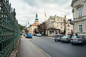
Baden (German for "Baths"),[2] unofficially distinguished from other Badens as Baden bei Wien (Baden near Vienna),[3] is a spa town in Austria. It serves as the capital of Baden District in the state of Lower Austria. Located about 26 km (16 mi) south of Vienna, the municipality consists of cadastral Baden, Braiten, Gamingerhof, Leesdorf, Mitterberg, Rauhenstein, and Weikersdorf.
Geography

Baden located at the mouth of the Schwachat River's St Helena Valley (Helenenthal)[4] in the Vienna Woods (Wienerwald) range. It takes its name from the area's 13 hot springs, which vary in temperature from 72 to 97 °F (22 to 36 °C)[4] and contain lime sulphate.[5] They lie for the most part at the foot of Mt Calvary (Calvarienberg; 1,070 ft or 326 m).[5]
The highest point in the area is the Iron Gate (Eisernes Tor or Hoher Lindkogel), whose 2,825 ft (861 m) can be ascended in about three hours.[5]
History
The celebrity of Baden dates back to the days of the Romans, who knew it by the name of Aquae Cetiae[4] or Thermae Pannonicae.[6] Some ruins are still visible.[6] The settlement was mentioned as Padun in a deed from AD 869. The nearby abbey of Heiligenkreuz's Romanesque church was constructed in the 11th century; it subsequently served as the burial place for members of the Babenberg family.[5] The castle Rauheneck was constructed on the right bank of the river at the entrance to the valley in the 12th century; the castle Rauhenstein was built on the opposite bank at the same time.[5] The town received its legal privileges in 1480.[5] Although repeatedly sacked by Hungarians and Turks, it soon flourished again each time.[6]

The town was largely destroyed by a fire in 1812 but was excellently rebuilt[4] in a Biedermeier style according to plans by architect Joseph Kornhäusel, it is therefore sometimes referred to as the "Biedermeierstadt". Archduke Charles, the victor of Aspern, constructed the Château Weilburg at the foot of Rauheneck between 1820 and 1825.[5] In the 19th century, it was connected to the railway running between Vienna and Graz, which led to thousands of Viennese visiting each year to take the waters, including members of the imperial family, who constructed extensive villas nearby.[4] The town boasted a theater, military hospital, and casino.[4] The composer Ludwig van Beethoven stayed a number of times in Baden and his residences still form local tourist spots. The location at Rathausgasse 10 now forms a museum open to the public.[n 1] Mayerling, a hunting lodge about 4 mi (6.4 km) up the valley, was the site of Crown Prince Rudolf's murder-suicide in 1889.[5] Its primary export in the 19th century were steel razors, which were reckoned of excellent quality.[4]


The City Theater (Stadttheater) was built in 1909 by Ferdinand Fellner. By the time of the First World War, Baden was Vienna's principal resort: 20 000 came each year, double the town's local population.[5] In addition to a modern "Curehouse" (Kurhaus), there were 15 separate bathing establishments and several parks.[5] During the war, Baden served as a temporary seat of the Austro-Hungarian high command. A new casino in 1934 made the town the premier resort throughout Austria. The Château Weilburg was destroyed during World War II. After World War II, Baden served as the headquarters of Soviet forces within occupied Austria until 1955.
Transportation
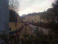
Baden can be reached by the Süd Autobahn (A2) and is linked with the Südbahn railway line (including S-Bahn line S9) at the Baden train station as well as with the Badner Bahn tram-train to Vienna.
Government
Kurt Staska (ÖVP) is Baden's Bürgermeister as a result of elections of 2010. His deputy is Helga Krismer from the Greens.
Local board (German: Gemeinderat) consists of 41 places:
- ÖVP holds 18 places
- SPÖ has 9 members
- local bloc — 7 places
- the Greens hold 5 places
- FPÖ has 2 members
| Baden bei Wien | ||||||||||||||||||||||||||||||||||||||||||||||||||||||||||||
|---|---|---|---|---|---|---|---|---|---|---|---|---|---|---|---|---|---|---|---|---|---|---|---|---|---|---|---|---|---|---|---|---|---|---|---|---|---|---|---|---|---|---|---|---|---|---|---|---|---|---|---|---|---|---|---|---|---|---|---|---|
| Climate chart (explanation) | ||||||||||||||||||||||||||||||||||||||||||||||||||||||||||||
| ||||||||||||||||||||||||||||||||||||||||||||||||||||||||||||
| ||||||||||||||||||||||||||||||||||||||||||||||||||||||||||||
Population
| Historical population | ||
|---|---|---|
| Year | Pop. | ±% |
| 1971 | 22,727 | — |
| 1981 | 23,140 | +1.8% |
| 1991 | 23,488 | +1.5% |
| 2001 | 24,518 | +4.4% |
| 2006 | 25,212 | +2.8% |
| 2010 | 25,136 | −0.3% |
| 2014 | 25,229 | +0.4% |
Notable people
Natives
- Louis V. Arco (born Lutz Altschul; 1899—1975), a Jewish Austrian actor
- Vincent Bach (1890—1976), trumpeter
- (Maximilian) Hugo Bettauer (1872—1925), a Jewish Austrian writer
- Caterina Canzi (1805–1890), opera singer
- Willi End (born 1921), an Austrian mountaineer (de)
- Lucie Englisch (1902—1965), an Austrian actress (de)
- Bert Fortell (1924—1996), an actor (de)
- Josef Frank (1885—1967), a Jewish Austrian-Swedish architect
- Mizzi Griebl (1872—1952), an Austrian female singer and actress (de)
- Archduke Carl Ludwig of Austria (1918—2007), a 5th child of Kaiser Karl I von Österreich and Kaiserin Zita (de)
- Archduchess Maria Immakulata of Austria (1878—1968, Altshausen, Germany), the 7th child of Archduke Karl Salvator of Austria and Princess Maria Immaculata of Bourbon-Two Sicilies
- Marianne Hainisch (1839—1936, Vienna), an Austrian female feminist (women's rights activist)
- Erwin "Jimmy" Hoffer (born 1987), a footballer
- Natalie von Hohenlohe-Waldenburg-Schillingsfürst, Ratibor und Corvey (1911[7] — 1989), a 2nd daughter of Maria Henriette Erzherzogin von Österreich
- Georg Michael Höllering (1897—1980), an Austrian-British author and film director
- Max Kuttner (1883 (1880) — 1953), a German opera- and operetta tenor, grammophone/record- and radio singer (de)
- Karl Landsteiner (1868—1943, New York City), a Jewish physician, discoverer of the Blood type
- Heinrich von Lützow (1852—1935), an Austro-Hungarian diplomat (de)
- Hertha Martin (born 1930), an Austrian actress
- Heribert Meisel (1920—1966), a legendary Austrian sport-journalist and sport-presenter of the ORF and ZDF (de)
- Maximilian Melcher (1922—2002), artist and lecturer (de)
- Eduard Melkus (born 1928), an Austrian violinist and violist (de)
- Josef Müllner (1879—1968), an Austrian sculptor (de)
- Rosa Papier (1859—1932), an Austrian female opera singer and singing-educator (de)

- Jakob Pazeller (1869—1957), a composer
- Karl Pfeifer (born 1928), an Austrian journalist (de)
- Arnulf Rainer (born 1929), an Austrian painter
- Max Reinhardt (Maximilian Goldmann; 1873—1943, New York City), a Jewish theatre director and theatre manager
- Franz Josef Reinl (1903—1977), an Austrian composer (de)
- Franz Reznicek (born 1903), an Austrian architect (de)
- Rollett family:
- Alexander Rollett (1834—1903), an Austrian physiologist and histologist (de)
- Georg Anton Rollett (1778—1842), an Austrian collector, natural scientist and doctor (de)
- Hermann Rollett (1819—1904), a Vormärz-poet, writer on art, archivist of the city (de)
- Herbert Schambeck (born 1934), a jurist (de)
- Katharina Schratt (1853—1940), an actress
- Anton Maria Schwartz (1852—1929), a Catholic priest (de)
- Karl Holdhaus (1883—1975), an Austrian entomologist
- Rudolf Steinboeck (1908—1996), an actor, director
- Marlene Streeruwitz (born 1950), a female writer (de)
- Theodor Tomandl (born 1933), an Austrian jurisprudent (de)
- Carl Ignaz Umlauf (1824—1902), a composer
- Thomas Vanek (born 1984), professional ice hockey player for the Minnesota Wild (NHL) of Czech and Slovak descent
- Ignaz Vitzthumb (Witzthumb) (1724—1816, Brussels), an Austrian composer, acted in the Austrian Netherlands
- Erik Werba (1918—1992), an Austrian pianist and composer
- Ralph Wiener (born 1924), a Kabarettist, author (de)
- Besian Idrizaj (1987—2010), an Austrian professional football player
- Elisabeth Woska (born 1938), an actress (de)
- Karin Scheele (born 1968), an Austrian social democratic politician and previously a member of the European Parliament
Residents
- Karel Komzák II (1850, Prague — 1905, Baden), Czech-Austrian composer
- Mirabehn (1892, England – 1982, Baden), Indian freedom fighter
- Sigi Maron (born 1944, Vienna), a singer-songwriter (de)
- Veniamin Kostitsin (born 1949, Krasnoyarsk), a Russia-born painter active in Baden
- Michael Korobkov-De'Lagardie-Voeikov (born 1956, Moscow), Russian-British noble and businessman. CEO of IMM Birest International
- Hans-Joachim Roedelius (born 1934, Berlin), German experimental, ambient and electronic musician
Notes
- ↑ Other street addresses include Antonsgasse 4, Braitnerstrasse 26, Frauengasse 10, Johannesgasse 12, Kaiser Franz Ring 9, and Weilburgstrasse 13.
References
Citations
- ↑ Statistik Austria - Bevölkerung zu Jahresbeginn 2002-2016 nach Gemeinden (Gebietsstand 2016-01-01), 2016-01-01.
- ↑ Charnock, "Baden", Local Etymology, p. 23.
- ↑ "Baden near Vienna". Google search. Google. Retrieved 2015-10-10.
- 1 2 3 4 5 6 7 EB (1878).
- 1 2 3 4 5 6 7 8 9 10 EB (1911), p. 183.
- 1 2 3 EB (1911), p. 184.
- ↑ Lokal-Nachrichten. Taufe in der Weilburg. Badener Zeitung, 2 August 1911, p.3
Bibliography
- "Baden", Encyclopædia Britannica, 9th ed., Vol. III, New York: Charles Scribner's Sons, 1878, p. 227.
- "Baden", Encyclopædia Britannica, 11th ed., Vol. III, Cambridge: Cambridge University Press, 1911, pp. 183–184.
External links
| Wikivoyage has a travel guide for Baden (Austria). |
| Wikimedia Commons has media related to Baden, Lower Austria. |
- Official homepage
- Synagogue
- Casino
- Römertherme
- Kurhaus
- Stadttheater
- Hauervinothek
- "Baden: I. A town of Lower Austria". The American Cyclopædia. 1879.