Aylmerton
| Aylmerton | |
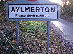 Village road sign |
|
 Aylmerton |
|
| Area | 6.86 km2 (2.65 sq mi) |
|---|---|
| Population | 458 (parish, 2011 census)[1] |
| – density | 67/km2 (170/sq mi) |
| OS grid reference | TG2040 |
| – London | 137 miles (220 km) |
| Civil parish | Aylmerton |
| District | North Norfolk |
| Shire county | Norfolk |
| Region | East |
| Country | England |
| Sovereign state | United Kingdom |
| Post town | CROMER |
| Postcode district | NR11 |
| Dialling code | 01263 |
| Police | Norfolk |
| Fire | Norfolk |
| Ambulance | East of England |
| EU Parliament | East of England |
| UK Parliament | North Norfolk |
Coordinates: 52°54′37″N 1°14′34″E / 52.91022°N 1.24287°E
Aylmerton is a village in the county of Norfolk, England.[2] It is in the area of North Norfolk and lies 2.2 miles (3.5 km) south of the North Sea, 3.2 miles (5.1 km) south-west of Cromer and 7.5 miles (12.1 km) west of Holt. The parish is bordered by the parishes of Beeston Regis and Runton to the north, West Beckham to the west, Felbrigg to the east and Gresham and Sustead to the south. The village is ¾ miles south of the A148 King’s Lynn to Cromer road. The nearest railway stations are Cromer at 2.9 miles (4.7 km) and Roughton Road at 4.1 miles (6.6 km). The civil parish has an area of 6.86 square kilometres and in the 2001 census the population was 435 in 178 households, increasing to 458 at the 2011 Census. For the purposes of local government, the parish is in North Norfolk, whose headquarters are in Cromer.
History
Aylmerton has an entry in the Domesday Book of 1085.[3] In the great book Aylmerton is recorded by the names Almartune, and Almertune, the main land holder being William de Warren and the main tenant Roger Bigot. The survey also states that there is ½ a church. In the Domesday survey fractions[4] were used to indicate that the entry, in this case a church, was on an estate that lay within more than one parish.
The Felbrigg Estate
The Felbrigg estate, owned by the National Trust, is close to the village lying to the east. The estate covers some 1,760 acres (7.1 km2) of parkland and mixed woodland. The dominant feature is the 520-acre (2.1 km2) Great Wood which shelters the house. The estate has particular significance through the connections with Nathaniel Kent and Humphry Repton, both of whom were involved at Felbrigg in the early stages of their careers. A lake, which is invisible from the Hall, was created in the mid-18th century by damming the Scarrow Beck. A pleasant and attractive feature, the lake encourages a wide range of bio-diversity. To the west and north, pasture woodland merges into the Great Wood. Local residents continue to enjoy access to the network of footpaths, many being old rights of way, which run through grassland, woodland pasture and woods. Especially popular is the well-known “Lions Mouth”, an attractive beauty spot which can be reached from the main road (A148) and is particularly popular with walkers and ramblers. Particular care is taken with veteran trees, and there is a programme for gradual replacement of small 20th-century softwood plantations by hardwoods, notably sweet chestnut, beech and oak, which have long grown here.
The Parish Church
The parish church is called St John the Baptist and is a 15th-century building.[5] It has a round flint tower, thought to be over 700 years old. The church stands above the village on the side of a small hillside. The priest’s room, which is over the porch, can be entered via the original ironbound door in the nave. The chancel windows date from the middle of the 14th century, and there are some beautiful carvings, a traceried screen dating 1500 and four elaborate bench ends with poppy heads which were carved over 400 years ago. There are the remains of a transept on the north side of the church, reduced when the nave was rebuilt.
Stone Cross
One mile south of the village on Church Road, at a small junction of the Lower Gresham to Metton lane, is an ancient cross which has been restored. Aylmerton wayside cross (TG181388) is on the parish boundary with Gresham, and was said to be a guide to Walsingham. Three roads meet here, and a rough track heading westwards is said to have been part of the pilgrims' way heading to the holy shrines to be found there. In the fields near the cross are many shallow pits. These known locally as the 'Shrieking Pits', because of their reputation for being haunted by the ghost of a Stone Age woman.[6]
Aylmerton Gallery
-
.JPG)
Aylmerton Stone Cross
-
.JPG)
Aylmerton Parish Church
See also
There is also Aylmerton, New South Wales in Australia
References
- ↑ "Parish population 2011". Retrieved 3 September 2015.
- ↑ OS Explorer Map 24 (Edition A 1997) – Norfolk Coast Central. ISBN 0-319-21726-4.
- ↑ The Domesday Book, Englands Heritage, Then and Now, Editor: Thomas Hinde,Norfolk page 186 ISBN 1-85833-440-3
- ↑ The Normans in Norfolk, By Sue Margeson, Fabienne Seillier and Andrew Rogerson, Pub:1994, Page 21, ISBN 0-903101-62-9
- ↑ Norfolk 1: Norwich and North-East, By Nikolaus Pevsner and Bill Wilson, Aylmerton entry. ISBN 0-300-09607-0
- ↑ "Hidden East Anglia". Hidden East Anglia. Retrieved 22 August 2014.
External links
| Wikimedia Commons has media related to Aylmerton. |
- Information from Genuki Norfolk on Aylmerton.
- Website with photos of Aylmerton St John the Baptist
- Aylmerton in the Domesday Book