Aveland
Coordinates: 52°51′00″N 0°24′58″W / 52.85°N 0.416°W
| Aveland | |
|---|---|
|
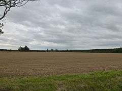
Aveland Moot There was once a moat in this field, now only visible on crop marks. It is thought to have been the meeting-place of the Aveland Wapentake.[1] | |
 Aveland | |
| OS grid reference | TF 0675 2961 |
| |
Aveland was a Wapentake of Kesteven from the time of the Danelaw until the Local Government Act 1888. Its meeting place was The Aveland at grid reference TF 0675 2961 in the parish of Aslackby.[1]
Origins
Aveland was probably established as an administrative unit soon after 921 when Edward the Elder ably assisted until 918, by Æthelflæd had restored English rule in the part of the Danelaw represented by Kesteven. The wapentake included the parishes of Aslackby, Bourne, Dembleby, Dowsby, Dunsby, Folkingham, Haconby, Haceby, Horbling, Kirkby Underwood, Laughton, Morton, Newton, Osbournby, Pickworth, Pointon, Rippingale, Sempringham, Spanby, Swaton, Threekingham and Walcot; some of which have since been amalgamated.
There is documentary evidence for a settlement called Avethorpe, from the Domesday survey onwards, but no actual location is known.[2]
Decline
Between 921 and 1888, the administrative significance of the wapentake was reduced by many small steps. The first was as a result of the invasion of England by Swein in 1013. The Kesteven people supported it so that, when order was restored, the shire of Lincoln was set up and given powers over the wapentakes. Subsequently, piecemeal, privileges were given to lords of the manors in Aveland so that it became progressively less significant. By 1250, there was little power left. For the purposes of the 1834 Poor Law Amendment Act, The territory of Aveland was included in the Union of Bourne.[3]
Modern usage
- The name Aveland is retained as that of an electoral ward in South Kesteven administrative district[4]
- It was also the name of a school in Billingborough from 1963 to 2012[5]
- In the Diocese of Lincoln, there is an Aveland and Ness with Stamford Deanery[6]
- Lincoln Hall, a residence at the University of Nottingham, has a house named Aveland.
References
- 1 2 Historic England. "The Aveland moat (348358)". PastScape. Retrieved 31 October 2009.
- ↑ Historic England. "Avethorpe (348363)". PastScape. Retrieved 31 October 2009.
- ↑ "Statistics of parishes in Bourne Union: 1843". Bourne Archive.
- ↑ "Aveland details from the district council". Archived from the original on 11 November 2005.
- ↑ "The Aveland High School", St. George's Academy. Retrieved 15 June 2015
- ↑ "Organization of Aveland and Ness with Stamford Deanery". Archived from the original on 1 August 2009.
- Roffe, D. Medieval Administration in Bennett, S. & Bennett, N. ed. An Historical Atlas of Lincolnshire (1993) ISBN 0-85958-604-9
- Notes on Wapentake of Aveland from 'Introduction: Lost vills and other forgotten places', Final Concords of the County of Lincoln: 1244-1272 (1920), pp. L-LXV.
External links
- Historical sources in the deanery (Genealogy of UK & Ireland site).
- 1817 Land Tax assessments in the Wapentake of Aveland.