Australian places named by James Cook
This is a list of Australian places named by James Cook. James Cook was the first navergator to chart most of the Australian east coast, one of the last major coastlines in the world unknown to Europeans at the time. Cook named many bays, capes and other geographic features, nearly all of which are still gazetted,[1] and most of which are still in use today, although in some places the spelling is slightly different. This is a list of the placenames he used in his first voyage listed from south to north as described on his 1773 chart [2] and in his journals.
| Name | Date (1770) | Reason for naming | Coords | Notes |
|---|---|---|---|---|
| Point Hicks | 19 April | Lieutenant Zachary Hickes, "first to sight the land" | 37°48′S 149°16′E / 37.800°S 149.267°E | spelled his name Hickes, Cook wrote it without the "e" |
| Ram Head | 19 April | Ramhead "go in to Plymouth Sound" | 37°46′S 149°29′E / 37.767°S 149.483°E | |
| Cape Howe | 20 April | Richard Howe, 1st Earl Howe | 37°30′S 149°58′E / 37.500°S 149.967°E | |
| Cape Dromedary (Montague Island) | 21 April | A point running out from under Mount Dromedary. | 36°17′S 150°08′E / 36.283°S 150.133°E | Cook mistook Montague Island for a headland.[3] |
| Mount Dromedary | 21 April | "pretty high mountain laying near the shore which on account of its figure I named Mount Dromedary" | 36°17′51″S 150°01′00″E / 36.29750°S 150.01667°E | now called Mount Gulaga |
| Batemans Bay | 21 April | 35°42′S 150°11′E / 35.700°S 150.183°E | ||
| Point Upright | 22 April | "on account of its perpendicular Clifts" | 35°37′S 150°19′E / 35.617°S 150.317°E | |
| Pigeon House | 22 April | "a remarkable peaked hill laying inland the top of which look'd like a Pigeon house" | 35°17′S 150°17′E / 35.283°S 150.283°E | Marked on chart as Pidgeon House |
| Cape St. George | 23 April | discovered on St George's Day | 35°10′S 150°45′E / 35.167°S 150.750°E | now Jervis Bay Territory |
| Long Nose | 25 April | "on account of its Figure" | 34°48′S 150°40′E / 34.800°S 150.667°E | now called Beecroft Peninsula (to the north of Jervis Bay) |
| Red Point | 25 April | red colour | 34°29′S 150°55′E / 34.483°S 150.917°E | |
| Point Solander | 28 April | Daniel Solander, botanist on board | 34°00′S 151°14′E / 34.000°S 151.233°E | to the south of Botany Bay |
| Botany Bay | 28 April – 6 May | "The great quantity of plants Mr. Banks and Dr. Solander found in this place occasioned my giving it the Name of Botany Bay" | 33°58′S 151°10′E / 33.967°S 151.167°E | originally Stingray Harbour |
| Cape Banks | 6 May | Joseph Banks | 33°59′S 151°15′E / 33.983°S 151.250°E | to the north of Botany Bay |
| Port Jackson | 6 May | George Jackson, a secretary of the Admiralty | 33°50′S 151°16′E / 33.833°S 151.267°E | |
| Broken Bay | 7 May | "broken land that appear'd to form a bay" | 33°34′07″S 151°19′00″E / 33.56861°S 151.31667°E | Cook's Broken Bay was the area near Narrabeen Lake. |
| Cape Three Points | 7 May | "high land which projected out in 3 bluff Points" | 33°29′S 151°26′E / 33.483°S 151.433°E | between Copacabana and Avoca Beach |
| Point Stephens | 11 May | Sir Philip Stephens, Secretary to the Admiralty (1763–95) | 32°44′S 152°12′E / 32.733°S 152.200°E | On the coast near Fingal Bay, New South Wales |
| Port Stephens | 11 May | Sir Philip Stephens, Secretary to the Admiralty | 32°41′46″S 152°08′30″E / 32.69611°S 152.14167°E | |
| Black Head | 11 May | 32°04′S 152°32′E / 32.067°S 152.533°E | SE of Tinonee | |
| Cape Hawke | 11 May | Sir Edward Hawke, 1st Baron Hawke, First Lord of the Admiralty | 32°12′S 152°34′E / 32.200°S 152.567°E | |
| Three Brothers | 12 May | "3 remarkable large high hills lying Contigious to each other... bore some resemblance to each other" | 31°39′52″S 152°46′26″E / 31.66444°S 152.77389°E | called separately South Brother (31°44′37″S 152°40′15″E / 31.74361°S 152.67083°E ), Middle Brother and North Brother |
| Smoakey Cape | 13 May | "fires that Caused a great Quantity of smoke" on the cape | 30°54′S 153°06′E / 30.900°S 153.100°E | |
| Solitary Isles | 15 May | 29°55′S 153°23′E / 29.917°S 153.383°E | ||
| Cape Byron | 15 May | John Byron | 28°37′58″S 153°38′20″E / 28.63278°S 153.63889°E | Easternmost point of Australia |
| Mount Warning | 16 May | breakers found within sight | 28°23′50″S 153°16′15″E / 28.39722°S 153.27083°E | |
| Point Danger | 16 May | Point off which shoals lie | 28°10′S 153°33′E / 28.167°S 153.550°E | Cook's Point Danger was Fingal Head – 2n Miles South of the present-day Point Danger on the Qld–NSW border |
| Point Lookout | 17 May | 27°26′S 153°33′E / 27.433°S 153.550°E | North-eastern point of North Stradbroke Island | |
| Morton Bay | 17 May | Robert Hinch, 14th Earl of Morton, was President of the Royal Society | 27°15′S 153°15′E / 27.250°S 153.250°E | Moreton was a later misspelling of Morton. What Cook named Morton Bay comprised the Pacific Ocean side of what is now called Moreton Island. The name Moreton Bay is now applied to larger expanse of water on the inland side of Moreton and Stradbroke Islands, comprising the mouth of the Brisbane River. |
| Cape Morton | 17 May | James Douglas, 14th Earl of Morton | 27°01′S 153°28′E / 27.017°S 153.467°E | Northern end of Moreton Island |
| Glasshouse Bay | 17 May | 27°04′S 153°17′E / 27.067°S 153.283°E | Cook did not realise it was part of Moreton Bay; between Moreton Island and Bribie Island | |
| The Glass Houses | 17 May | hills resemble glass houses | 26°55′S 152°56′E / 26.917°S 152.933°E | Now called The Glass House Mountains |
| Double Island Point | 18 May | "on account of its figure... the point itself is of such an unequal Height that it looks like 2 Small Islands laying under the land" | 25°55′57″S 153°11′12″E / 25.93250°S 153.18667°E | |
| Wide Bay | 18 May | large open bay | 25°54′S 153°08′E / 25.900°S 153.133°E | Wide Bay–Burnett is used as the region name for the larger surrounding area today. Rainbow Beach is on the bay. |
| Indian Head | 19 May | "a number of the Natives were Assembled" there | 25°00′S 153°22′E / 25.000°S 153.367°E | Eastern point of Fraser Island |
| Sandy Cape | 20 May | sand | 24°41′52″S 153°15′21″E / 24.69778°S 153.25583°E | Northern point of Fraser Island |
| Break Sea Spit | 21 May | "now we had smooth water, whereas upon the whole Coast to the Southward of it we had always a high Sea or swell from the South-East." | 24°25′S 153°13′E / 24.417°S 153.217°E | shoal projecting north from the north tip of Fraser Island |
| Herveys Bay | 21 May | Augustus Hervey, 3rd Earl of Bristol | 25°17′7″S 152°52′22″E / 25.28528°S 152.87278°E | |
| South Head | 23 May | South head of Bustard Bay | 24°08′54″S 151°53′09″E / 24.14833°S 151.88583°E | Now known as Round Hill Head. Village of 1770 located there, Cook's first landing in Queensland and second in Australia. |
| Bustard Bay | 23 May | bustard (bird) | 24°06′S 151°49′E / 24.100°S 151.817°E | |
| North Head | 23 May | North head of Bustard Bay | 24°01′S 151°46′E / 24.017°S 151.767°E | Now known as Bustard Head |
| Cape Capricorn | 25 May | Tropic of Capricorn | 23°28′S 151°13′E / 23.467°S 151.217°E | NE point of Curtis Island |
| Keppel Isles | 26 May | Augustus Keppel, 1st Viscount Keppel | 23°10′30″S 150°57′40″E / 23.17500°S 150.96111°E | Great Keppel Island largest of the group |
| Keppel Bay | 27 May | Augustus Keppel, 1st Viscount Keppel | 23°23′S 150°53′E / 23.383°S 150.883°E | |
| Cape Manyfold | 27 May | "from the Number of high Hills over it" | 22°41′S 150°50′E / 22.683°S 150.833°E | |
| The Two Brothers | 28 May | 22°42′S 150°59′E / 22.700°S 150.983°E | ||
| Island Head | 28 May | 22°20′S 150°39′E / 22.333°S 150.650°E | ||
| Cape Townshend | 28 May | Charles Townshend, Lord of the Admiralty 1765-1770[4] | 22°12′S 150°29′E / 22.200°S 150.483°E | northern tip of Townshend Island |
| Shoal Water Bay | 28 May | Shoal water | 22°22′S 150°22′E / 22.367°S 150.367°E | |
| Northumberland Isles | 28 May | 21°40′S 150°10′E / 21.667°S 150.167°E | ||
| Thirsty Sound | 30 May | "by reason we could find no fresh Water" | 22°10′S 149°58′E / 22.167°S 149.967°E | |
| Bay of Inlets | 1 June | "the Number of Inlets, Creeks, etc., in it." | 22°19′S 149°50′E / 22.317°S 149.833°E | Named a 100 km region of coastline from Cape Palmerston (south of Mackay) to Cape Townshend (name no longer in use) |
| Long Isle | 1 June | 22°07′S 149°54′E / 22.117°S 149.900°E | ||
| Broad Sound | 1 June | 22°10′S 149°45′E / 22.167°S 149.750°E | ||
| Cape Palmerston | 1 June | Henry Temple, 3rd Viscount Palmerston, Lord of the Admiralty, 1766–78 | 21°01′S 149°29′E / 21.017°S 149.483°E | SE of Carmila |
| Slade Point | 2 June | 21°03′S 149°13′E / 21.050°S 149.217°E | ||
| Cape Hillsborough | 2 June | Wills Hill, 1st Marquess of Downshire (the Earl of Hillsborough); First Secretary of State for the Colonies, and President of the Board of Trade | 20°54′S 149°02′E / 20.900°S 149.033°E | 30 km NNW of Mackay |
| Repulse Bay | 3 June | 20°33′S 148°45′E / 20.550°S 148.750°E | ||
| Cape Conway | 3 June | General Henry Seymour Conway, Secretary of State 1765–68 | 20°31′S 148°54′E / 20.517°S 148.900°E | |
| Whitsundays Passage | 4 June | discovered on Whitsunday | 20°17′S 148°52′E / 20.283°S 148.867°E | between Hamilton Island, Whitsunday Island and the mainland |
| Cumberland Isles | 4 June | Prince Henry, Duke of Cumberland and Strathearn, | 20°34′S 149°08′E / 20.567°S 149.133°E | Originally the name for what are now called the Whitsunday Islands; Cook only called the passage Whitsundays. |
| Cape Gloucester | 4 June | Prince William Henry, Duke of Gloucester and Edinburgh | 20°00′55″S 148°27′18″E / 20.01528°S 148.45500°E | Actually an island |
| Holburn Isle | 4 June | Admiral Francis Holburne | 19°43′S 148°21′E / 19.717°S 148.350°E | |
| Edgecumbe Bay | 4 June | Captain George Edgcumbe, 1st Earl of Mount Edgcumbe commanded the Lancaster in the fleet in North America in 1758 in which Cook served. | 20°06′S 148°23′E / 20.100°S 148.383°E | |
| Mount Upstart | 5 June | "because being surrounded with low land it starts or rises up singley at the first making of it" | 19°44′S 147°48′E / 19.733°S 147.800°E | |
| Cape Bowling Green | 5 June | 19°18′S 147°24′E / 19.300°S 147.400°E | ||
| Cape Cleveland | 6 June | either in honour of a John Clevland the Secretary to the Admiralty around that time, or after Cleveland, England where he was born.[5] | 19°10′S 147°00′E / 19.167°S 147.000°E | Cook spelled the name with an "e", adding to the confusion |
| Cleveland Bay | 6 June | 19°13′S 146°55′E / 19.217°S 146.917°E | ||
| Magnetical Island | 6 June | "the Compass did not traverse well when near it" | 19°08′S 146°50′E / 19.133°S 146.833°E | Now called Magnetic Island |
| Palm Isles | 6 June | 18°44′S 146°35′E / 18.733°S 146.583°E | ||
| Halifax Bay | 8 June | George Montagu-Dunk, 2nd Earl of Halifax was Secretary of State 1763–65 | 18°50′S 146°30′E / 18.833°S 146.500°E | |
| Point Hillock | 8 June | 18°25′S 146°21′E / 18.417°S 146.350°E | on Hinchinbrook Island | |
| Cape Sandwich | 8 June | John Montagu, 4th Earl of Sandwich | 18°14′S 146°17′E / 18.233°S 146.283°E | on Hinchinbrook Island |
| Family Islands | 8 June | 18°01′S 146°10′E / 18.017°S 146.167°E | ||
| Dunk Island | 8 June | George Montagu-Dunk, 2nd Earl of Halifax | 17°56′48″S 146°09′22″E / 17.94667°S 146.15611°E | |
| Rockingham Bay | 8 June | Charles Watson-Wentworth, 2nd Marquess of Rockingham | 18°08′S 146°04′E / 18.133°S 146.067°E | |
| Double Point | 8 June | 17°40′S 146°09′E / 17.667°S 146.150°E | ||
| Frankland Islands | 9 June | 17°09′49″S 146°00′42″E / 17.16361°S 146.01167°E | ||
| Cape Grafton | 9 June | Augustus FitzRoy, 3rd Duke of Grafton was Prime Minister when Cook sailed | 16°51′55″S 145°55′00″E / 16.86528°S 145.91667°E | |
| Fitzroy Island | 9 June | 16°56′S 146°00′E / 16.933°S 146.000°E | ||
| Green Isle | 10 June | "a Low green woody Island" | 16°45′S 145°58′E / 16.750°S 145.967°E | |
| Trinity Bay | 10 June | discovered on Trinity Sunday | 16°54′S 145°47′E / 16.900°S 145.783°E | |
| Cape Tribulation | 10 June | "because here began all our Troubles" | 16°04′S 145°28′E / 16.067°S 145.467°E | Cook hit a reef here, before changing course, and later that night hitting Endeavour Reef. |
| Hope Island | 13 June | "we were always in hopes of being able to reach these Islands" | 15°43′S 145°27′E / 15.717°S 145.450°E | |
| Weary Bay | 13 June | 15°54′S 145°22′E / 15.900°S 145.367°E | ||
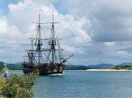
| Endeavour River | 14 June – 4 August | HM Bark Endeavour | 15°27′30″S 145°14′00″E / 15.45833°S 145.23333°E | Ship beached while repairs conducted, near modern-day Cooktown |
| Cape Bedford | 4 August | Probably after John Russell, 4th Duke of Bedford, who had been First Lord of the Admiralty, 1744–47 | 15°13′S 145°20′E / 15.217°S 145.333°E | |
| Cape Flattery | 10 August | "We now judged ourselves to be clear of all Danger, having, as we thought, a Clear, open Sea before us; but this we soon found otherwise" | 14°56′S 145°21′E / 14.933°S 145.350°E | |
| Islands of Direction | 10 August | 14°44′S 145°30′E / 14.733°S 145.500°E | South Direction Island and North Direction Island | |
| Point Lookout | 11 August | 14°49′S 145°13′E / 14.817°S 145.217°E | Not to be confused with the Point Lookout which Cook had earlier so named, being the north-eastern point of North Stradbroke Island. | |
| Lizard Island | 12 August | "only land Animals we saw here were Lizards, and these seem'd to be pretty Plenty" | 14°40′S 145°27′E / 14.667°S 145.450°E | Lizard Island still enjoys a substantial population of huge monitor lizards. |
| Eagle Island | 12 August | "We found on this Island a pretty number of Birds, the most of them sea Fowl, except Eagles; 2 of the Latter we shott and some of the others" | 14°41′S 145°22′E / 14.683°S 145.367°E | |
| Providential Channel | 17 August | providence | 12°36′S 143°49′E / 12.600°S 143.817°E | |
| Cape Weymouth | 17 August | Thomas Thynne, 1st Marquess of Bath, Viscount Weymouth was one of the Secretaries of State when the Endeavour sailed | 12°36′S 143°26′E / 12.600°S 143.433°E | |
| Weymouth Bay | 17 August | Thomas Thynne, 1st Marquess of Bath | 12°29′S 143°20′E / 12.483°S 143.333°E | |
| Forbes Islands | 19 August | Admiral John Forbes was a Commissioner of Longitude in 1768, and had been a Lord of the Admiralty 1756–63 | 12°17′S 143°24′E / 12.283°S 143.400°E | |
| Bolt Head | 19 August | 12°15′S 143°06′E / 12.250°S 143.100°E | ||
| Sir Charles Hardy's Isles | 18 August | 11°55′S 143°28′E / 11.917°S 143.467°E | ||
| Temple Bay | 19 August | Richard Grenville-Temple, 2nd Earl Temple, brother of George Grenville, was First Lord of the Admiralty in 1756 | 12°18′S 143°08′E / 12.300°S 143.133°E | |
| Cockburn Islands | 19 August | Admiral George Cockburn was a Commissioner of Longitude and Comptroller of the Navy when Cook left England. | 11°51′S 143°18′E / 11.850°S 143.300°E | |
| Cape Grenville | 19 August | George Grenville | 11°58′S 143°15′E / 11.967°S 143.250°E | |
| Shelburne Bay | 20 August | 11°49′S 142°58′E / 11.817°S 142.967°E | ||
| Orfordness | 20 August | 11°17′S 142°49′E / 11.283°S 142.817°E | ||
| New Castle Bay | 21 August | 10°53′S 142°36′E / 10.883°S 142.600°E | ||
| York Cape | 21 August | Prince Edward, Duke of York and Albany | 10°41′S 142°31′E / 10.683°S 142.517°E | Although Cook applied the name York Cape only to the northern tip, the name Cape York Peninsula is now applied to the entire promontory between the Gulf of Carpentaria and the Coral Sea (Pacific Ocean). |
| York Isles | 21 August | Prince Edward, Duke of York and Albany | 10°41′S 142°31′E / 10.683°S 142.517°E | |
| Possession Island | 22 August | "in the Name of His Majesty King George the Third took possession of the whole Eastern coast from the above Latitude [38°S] down to this place by the Name of New Wales1" | 10°43′36″S 142°23′49″E / 10.72667°S 142.39694°E | 1"The Admiralty copy, as well as that belonging to Her Majesty, calls it New South Wales." |
| Prince of Wales's Isles | 22 August | George Augustus Frederick, Prince of Wales | 10°41′02″S 142°11′06″E / 10.68389°S 142.18500°E | |
| Cape Cornwall | 22 August | 10°46′S 142°11′E / 10.767°S 142.183°E | SW point of Prince of Wales Island | |
| Wallis Isles | 23 August | probably after Captain Samuel Wallis, who made a voyage across the Pacific in the Dolphin in 1767, and discovered Tahiti | 10°52′S 141°57′E / 10.867°S 141.950°E | |
| Endeavours Strait | 23 August | HMB Endeavour | 10°49′S 142°06′E / 10.817°S 142.100°E | |
| Booby Island | 23 August | "mostly a barren rock frequented by Birds, such as Boobies" | 10°36′S 141°54′E / 10.600°S 141.900°E |
References
- ↑ Geoscience Australia, place name search
- ↑ A Chart of New South Wales, or the east coast of New Holland. Cook, James, 1728–1779
- ↑ Flinders, Matthew (1814), A Voyage to Terra Australis, London: G. and W. Nicol, entry for 3 February 1798
- ↑ Beaglehole, J.C., ed. (1968). The Journals of Captain James Cook on His Voyages of Discovery, vol. I:The Voyage of the Endeavour 1768–1771. Cambridge University Press. p. 329. OCLC 223185477.
- ↑ "Gazetteer". pages.quicksilver.net.nz. Retrieved 1 February 2011.
- The Endeavour journal (1) and The Endeavour journal (2), as kept by James Cook — digitised and held by the National Library of Australia
- Captain Cook's Journal During the First Voyage Round the World at Project Gutenberg
- Voyages of Captain Cook, 1st voyage
- The South Seas Project Maps and online editions of the Journals of James Cook's First Pacific Voyage, 1768–71. Includes full text of journals kept by Cook, Joseph Banks and Sydney Parkinson, as well as the complete text of John Hawkesworth's 1773 Account of Cook's first voyage.
This article is issued from Wikipedia - version of the 11/7/2016. The text is available under the Creative Commons Attribution/Share Alike but additional terms may apply for the media files.