Aulnay-sur-Mauldre
| Aulnay-sur-Mauldre | |
|---|---|
|
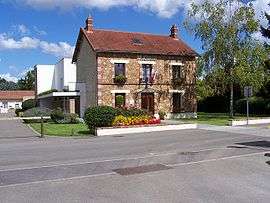
Town hall | |
 Aulnay-sur-Mauldre | |
|
Location within Île-de-France region  Aulnay-sur-Mauldre | |
| Coordinates: 48°55′44″N 1°50′28″E / 48.929°N 1.841°ECoordinates: 48°55′44″N 1°50′28″E / 48.929°N 1.841°E | |
| Country | France |
| Region | Île-de-France |
| Department | Yvelines |
| Arrondissement | Mantes-la-Jolie |
| Canton | Aubergenville |
| Intercommunality | Seine Mauldre |
| Government | |
| • Mayor (2008–2014) | Catherine Delaunay |
| Area1 | 2.23 km2 (0.86 sq mi) |
| Population (2008)2 | 1,157 |
| • Density | 520/km2 (1,300/sq mi) |
| Time zone | CET (UTC+1) |
| • Summer (DST) | CEST (UTC+2) |
| INSEE/Postal code | 78033 / 78126 |
| Elevation |
22–126 m (72–413 ft) (avg. 35 m or 115 ft) |
|
1 French Land Register data, which excludes lakes, ponds, glaciers > 1 km² (0.386 sq mi or 247 acres) and river estuaries. 2 Population without double counting: residents of multiple communes (e.g., students and military personnel) only counted once. | |

Saint-Étienne

Saint-Étienne
Aulnay-sur-Mauldre is a commune in the Yvelines department in north-central France.
Population
| Historical population | ||
|---|---|---|
| Year | Pop. | ±% |
| 1793 | 314 | — |
| 1800 | 318 | +1.3% |
| 1806 | 365 | +14.8% |
| 1821 | 340 | −6.8% |
| 1831 | 299 | −12.1% |
| 1836 | 321 | +7.4% |
| 1841 | 322 | +0.3% |
| 1846 | 307 | −4.7% |
| 1851 | 312 | +1.6% |
| 1856 | 280 | −10.3% |
| 1861 | 300 | +7.1% |
| 1866 | 289 | −3.7% |
| 1872 | 308 | +6.6% |
| 1876 | 285 | −7.5% |
| 1881 | 307 | +7.7% |
| 1886 | 308 | +0.3% |
| 1891 | 292 | −5.2% |
| 1896 | 334 | +14.4% |
| 1901 | 379 | +13.5% |
| 1906 | 385 | +1.6% |
| 1911 | 362 | −6.0% |
| 1921 | 341 | −5.8% |
| 1926 | 483 | +41.6% |
| 1931 | 412 | −14.7% |
| 1936 | 383 | −7.0% |
| 1946 | 363 | −5.2% |
| 1954 | 396 | +9.1% |
| 1962 | 541 | +36.6% |
| 1968 | 521 | −3.7% |
| 1975 | 585 | +12.3% |
| 1982 | 959 | +63.9% |
| 1990 | 1,026 | +7.0% |
| 1999 | 1,107 | +7.9% |
| 2008 | 1,157 | +4.5% |
See also
References
| Wikimedia Commons has media related to Aulnay-sur-Mauldre. |
This article is issued from Wikipedia - version of the 9/16/2015. The text is available under the Creative Commons Attribution/Share Alike but additional terms may apply for the media files.