Aughton, Lancashire
| Aughton | |
 Holt Green, Aughton |
|
 Aughton |
|
| Population | 8,342 (2001 Census)[1] |
|---|---|
| OS grid reference | SD395055 |
| Civil parish | Aughton |
| District | West Lancashire |
| Shire county | Lancashire |
| Region | North West |
| Country | England |
| Sovereign state | United Kingdom |
| Post town | ORMSKIRK |
| Postcode district | L39 |
| Dialling code | 01695 |
| Police | Lancashire |
| Fire | Lancashire |
| Ambulance | North West |
| EU Parliament | North West England |
| UK Parliament | West Lancashire |
|
|
Coordinates: 53°32′31″N 2°54′43″W / 53.542°N 2.912°W
Aughton is a village and civil parish in the West Lancashire district of Lancashire, England, between Ormskirk and Maghull. It is a residential area with tree lined roads being found in all parts of the parish[2] and an area of 1,658 hectares.[3] The northern part is known as Aughton village, the south-west as Holt Green and the south-east as Town Green.
Demographics and politics
At the 2001 Census, Aughton had a population of 8,342,[1] reducing to 8,068 at the 2011 Census.[4] The parish includes Aughton village itself, and part of the Aughton Park estate, which is a southern suburb of Ormskirk, along with Town Green in the south-east and Holt Green in the south-west.
Aughton has its own parish council, is part of the Aughton and Downholland electoral ward for West Lancashire District Council elections and the West Lancashire constituency for the House of Commons elections.
Communications
Aughton is bounded on the west by the A59 Liverpool to Preston road and bisected to the east by the B5197 Ormskirk to Kirkby road that runs north-south through the village.
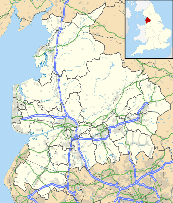
The parish has two railway stations, Town Green and Aughton Park, both on the Northern Line of the Merseyrail network, and part of the former Liverpool, Ormskirk and Preston Railway.
Facilities
Aughton has two shopping areas; on Moss Delph Lane and Town Green Lane. Also, there are playing fields and a park next to the fields and other open spaces totalling 36 acres (150,000 m2).[2] There is a community centre, the Aughton Village Hall. The hall was opened in 1971 on land donated to the District Council. It is a registered charity and managed by a voluntary committee.
Having moved from premises in Holt Green, the official opening of the new Aughton police station on 3 March 2003 saw it occupy the old waiting room and general outbuildings of Town Green railway station. At that time, this police station was the first in the Lancashire Constabulary to have the enquiry counter staffed exclusively by volunteers.
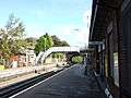
There are two notable churches, Christ Church, a late Victorian building situated at one of the higher points in West Lancashire, and St Michael's Parish Church.[2] St Michael's has been designated by English Heritage as a Grade I listed building.[5] Moor Hall, on Prescot Road, is a Grade II* listed manor house built around 1600.[6]
Notable connections
- Donald Boumphrey, soldier and cricketer. Lived in the village, where he died in 1971.[7]
- Barry Cowan, tennis player, former member of Aughton Tennis Club.[8]
- Roy Evans, former Liverpool FC player and manager.
- John Grindrod 1919-2009, Anglican Primate of Australia, was born in Aughton on 14 December 1919.[9]
- Colin Harvey, footballer, lives in Aughton.[10]
- Alan Kennedy, former footballer, lives in Aughton.[11]
- David Unsworth, coach and former footballer, lives in Aughton.
Gallery
-
Town Green station
-

Aughton Park station
-
St Michael's Parish Church
-

St Michael's Parish Church
-

Aughton Village Hall
-

The Stanley Arms Pub
See also
- Listed buildings in Aughton, Lancashire
- Argleton, a non-existent town which appeared on Google Maps within the boundaries of Aughton civil parish
References
- 1 2 "2001 Census: Aughton". Office for National Statistics. Retrieved 26 May 2008.
- 1 2 3 "Parish Council Details: Aughton". Lancashire Parish Portal. Archived from the original on 20 July 2007. Retrieved 30 June 2007.
- ↑ "Aughton Village". Edge Hill University. Archived from the original on 24 June 2007. Retrieved 1 July 2007.
- ↑ "Civil Parish population 2011". Retrieved 16 January 2016.
- ↑ Historic England. "Church of St Michael, Aughton (1361837)". National Heritage List for England. Retrieved 15 June 2012.
- ↑ "Moor Hall, Aughton". britishlistedbuildings.co.uk. Retrieved 11 November 2013.
- ↑ The London Gazette: no. 37085. p. 2605. 1945-05-18.
- ↑ "Barry's gunning for 'Pistol' Pete", Paddy Shennan, Liverpool Echo, 26 June 2001.
- ↑ "The Most Reverend John Grindrod ", The Daily Telegraph, 27 Jan 2009.
- ↑ "When Mersey footballers' weddings were a simpler affair", Greg O'Keeffe, Liverpool Echo, 13 June 2008.
- ↑ "Edited Electoral Roll". The Electoral Commission.
External links
| Wikimedia Commons has media related to Aughton, West Lancashire. |