Auffargis
| Auffargis | |
|---|---|
|
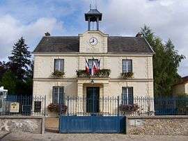
Town hall | |
 Auffargis | |
|
Location within Île-de-France region  Auffargis | |
| Coordinates: 48°42′00″N 1°53′17″E / 48.700°N 1.888°ECoordinates: 48°42′00″N 1°53′17″E / 48.700°N 1.888°E | |
| Country | France |
| Region | Île-de-France |
| Department | Yvelines |
| Arrondissement | Rambouillet |
| Canton | Rambouillet |
| Intercommunality | Étangs |
| Government | |
| • Mayor (2008–2014) | Daniel Bonte |
| Area1 | 17.14 km2 (6.62 sq mi) |
| Population (2008)2 | 1,963 |
| • Density | 110/km2 (300/sq mi) |
| Time zone | CET (UTC+1) |
| • Summer (DST) | CEST (UTC+2) |
| INSEE/Postal code | 78030 / 78610 |
| Elevation |
120–177 m (394–581 ft) (avg. 150 m or 490 ft) |
|
1 French Land Register data, which excludes lakes, ponds, glaciers > 1 km² (0.386 sq mi or 247 acres) and river estuaries. 2 Population without double counting: residents of multiple communes (e.g., students and military personnel) only counted once. | |

Saint-André
Auffargis is a commune in the Yvelines department in north-central France.
Population
| Historical population | ||
|---|---|---|
| Year | Pop. | ±% |
| 1793 | 533 | — |
| 1800 | 455 | −14.6% |
| 1806 | 537 | +18.0% |
| 1821 | 494 | −8.0% |
| 1831 | 527 | +6.7% |
| 1836 | 518 | −1.7% |
| 1841 | 517 | −0.2% |
| 1846 | 507 | −1.9% |
| 1851 | 540 | +6.5% |
| 1856 | 512 | −5.2% |
| 1861 | 516 | +0.8% |
| 1866 | 510 | −1.2% |
| 1872 | 477 | −6.5% |
| 1876 | 504 | +5.7% |
| 1881 | 531 | +5.4% |
| 1886 | 604 | +13.7% |
| 1891 | 554 | −8.3% |
| 1896 | 654 | +18.1% |
| 1901 | 721 | +10.2% |
| 1906 | 740 | +2.6% |
| 1911 | 733 | −0.9% |
| 1921 | 696 | −5.0% |
| 1926 | 666 | −4.3% |
| 1931 | 839 | +26.0% |
| 1936 | 525 | −37.4% |
| 1946 | 641 | +22.1% |
| 1954 | 552 | −13.9% |
| 1962 | 622 | +12.7% |
| 1968 | 750 | +20.6% |
| 1975 | 1,544 | +105.9% |
| 1982 | 1,729 | +12.0% |
| 1990 | 1,925 | +11.3% |
| 1999 | 1,862 | −3.3% |
| 2008 | 1,963 | +5.4% |
See also
References
| Wikimedia Commons has media related to Auffargis. |
This article is issued from Wikipedia - version of the 7/21/2016. The text is available under the Creative Commons Attribution/Share Alike but additional terms may apply for the media files.