Auburndale, Florida
| Auburndale, Florida | |
|---|---|
| City | |
| Nickname(s): A-Dale / 6 side / Polk Street | |
 Location in Polk County and the state of Florida | |
| Coordinates: 28°4′1″N 81°47′43″W / 28.06694°N 81.79528°WCoordinates: 28°4′1″N 81°47′43″W / 28.06694°N 81.79528°W | |
| Country | United States |
| State | Florida |
| County | Polk |
| Incorporated | 1911[1] |
| Area | |
| • Total | 9.3 sq mi (24.1 km2) |
| • Land | 5.2 sq mi (13.5 km2) |
| • Water | 4.1 sq mi (10.6 km2) |
| Elevation | 164 ft (50 m) |
| Population (2000) | |
| • Total | 11,032 |
| • Density | 1,186.2/sq mi (457.8/km2) |
| Time zone | Eastern (EST) (UTC-5) |
| • Summer (DST) | EDT (UTC-4) |
| ZIP code | 33823 |
| Area code(s) | 863 |
| FIPS code | 12-02550[2] |
| GNIS feature ID | 0277991[3] |
| Website | http://www.auburndalefl.com |
Auburndale is a city in Polk County, Florida, United States. The population was 11,032 at the 2000 census. According to the U.S Census estimates of 2005, the city had a population of 12,381.[4] It is part of the Lakeland–Winter Haven Metropolitan Statistical Area.
History
Auburndale was founded in 1880 by Frank Fuller seeking refuge from chilly winters in the Northeast United States.[5] The place was originally named Sanatoria, from a hotel located there. When the railroad arrived, it was renamed Auburndale at the suggestion of settlers from Auburndale, Massachusetts,[6] which itself took its name from the opening line of the poem The Deserted Village by Oliver Goldsmith.[7] Early on, the city became a refuge for many of America's most prominent artists.[5]
Geography and climate
Auburndale is located at 28°04′01″N 81°47′43″W / 28.066969°N 81.795252°W.[8] The city is located 40 miles (64 km) northeast of Tampa[9] and 59 miles (95 km) southwest of Orlando.[9] Auburndale is located within the Central Florida Highlands area of the Atlantic coastal plain with a terrain consisting of flatland interspersed with gently rolling hills.[10]
According to the United States Census Bureau, the city has a total area of 9.3 square miles (24 km2), of which 5.2 square miles (13 km2) is land and 4.1 square miles (11 km2) (43.87%) is water.
Auburndale is located in the humid subtropical zone, as designated by (Köppen climate classification: Cfa).[11]
Government
There are five commissioners on the city commission. The mayor is elected from the commissioners by the voters.[12] The city budget is $27 million.[12]
Demographics
| Historical population | |||
|---|---|---|---|
| Census | Pop. | %± | |
| 1920 | 715 | — | |
| 1930 | 1,849 | 158.6% | |
| 1940 | 2,723 | 47.3% | |
| 1950 | 3,763 | 38.2% | |
| 1960 | 5,595 | 48.7% | |
| 1970 | 5,386 | −3.7% | |
| 1980 | 6,501 | 20.7% | |
| 1990 | 8,858 | 36.3% | |
| 2000 | 11,032 | 24.5% | |
| 2010 | 13,507 | 22.4% | |
| Est. 2015 | 15,035 | [13] | 11.3% |
As of the census[2] of 2000, there were 11,032 people, 4,119 households, and 3,002 families residing in the city. The population density was 2,113.5 inhabitants per square mile (816.0/km²). There were 4,547 housing units at an average density of 871.1 per square mile (336.3/km²). The racial makeup of the city was 81.13% White, 12.26% African American, 0.26% Native American, 0.88% Asian, 0.05% Pacific Islander, 3.46% from other races, and 1.96% from two or more races. Hispanic or Latino of any race were 8.10% of the population.
There were 4,119 households out of which 35.3% had children under the age of 18 living with them, 52.1% were married couples living together, 15.7% had a female householder with no husband present, and 27.1% were non-families. 21.7% of all households were made up of individuals and 9.8% had someone living alone who was 65 years of age or older. The average household size was 2.63 and the average family size was 3.02.
In the city the population was spread out with 27.2% under the age of 18, 9.0% from 18 to 24, 27.8% from 25 to 44, 20.8% from 45 to 64, and 15.3% who were 65 years of age or older. The median age was 36 years. For every 100 females there were 92.2 males. For every 100 females age 18 and over, there were 89.6 males.
The median income for a household in the city was $34,184, and the median income for a family was $36,303. Males had a median income of $30,468 versus $21,232 for females. The per capita income for the city was $15,510. About 13.4% of families and 17.3% of the population were below the poverty line, including 28.3% of those under age 18 and 7.6% of those age 65 or over.
In 2010 Auburndale had a population of 13,507. There were 4,933 households with 99.1% of the population living in households. The racial and ethnic composition of the population was 71.7% non-Hispaic white, 12.8% black or African American, 0.4% Native American, 0.4% Asian Indian, 0.2% Chinese, 0.1% Japanese, 0.1% Korean, 0.1% Vietnamese, 0.1% other Asian, 0.1% non-Hispanic reporting some other race, 2.2% from two or more races and 13.1% Hispanic or Latino. The largest number of Hispanics, at 7.1% were Mexicans, with 3.2% of the population being Puerto Ricans, 0.7% being Cubans and the remaining 2.1% being classified as "other Hispanic".[15]
Transportation
The important freeways and highways in the Auburndale area are:
- Interstate 4 - Just north of town, this is the main interstate highway in central Florida, leading westward to Lakeland and Tampa, and eastward to Orlando and Daytona Beach.
- SR 570 (Polk Parkway) - This toll road provides Auburndale with quick access to I-4 to the north, and leads westward to southern Lakeland.
- US 92 - This divided highway leads westward to Lakeland and eastward to Lake Alfred.
- SR 544 - Traverses from eastern Auburndale to Winter Haven, hence its name Havendale Boulevard.
- SR 559 - This road leads to Polk City and I-4.
Mass transit
Auburndale is served by Winter Haven Area Transit's #12 & #50 routes.[16]
Media
Auburndale is part of the Tampa/St. Pete television market, the 13th largest in the country and part of the local Lakeland/Winter Haven radio market, which is the 94th largest in the country.[17][18]
Education
The public schools in Auburndale are operated by the Polk County School Board. There are five elementary schools, Berkley Elementary (a charter school ), Auburndale Central Elementary, Lena Vista Elementary, Boswell Elementary and Caldwell Elementary, which feed into Stambaugh Middle School. Students from Berkley Elementary are admitted into Berkley Accelerated Middle School (another charter school), while other students wishing to apply are put on a waiting list. Auburndale High School is the only high school in Auburndale, although nearby Tenoroc High School serves students in both Auburndale and Lakeland.
Southern Technical College operates a campus in Auburndale.
References
- ↑ "Guide to Polk, Auburndale". The Ledger. Retrieved 2010-09-17.
- 1 2 "American FactFinder". United States Census Bureau. Archived from the original on September 11, 2013. Retrieved 2008-01-31.
- ↑ "US Board on Geographic Names". United States Geological Survey. 2007-10-25. Retrieved 2008-01-31.
- ↑ "Archived copy". Archived from the original on July 10, 2009. Retrieved February 26, 2011.
- 1 2 "History of Auburndale" (PDF). Polk County Historical Association. December 1976. p. 2. Retrieved 2010-09-17.
- ↑ Morris, Allen (1995). Florida Place Names. p. 15. ISBN 978 1 56164 084 3.
- ↑ Whitehead, Bill (14 August 1960). "First Polk Settlers Had to Build Towns, Then Name Them". Lakeland Ledger. pp. 7–A. Retrieved 22 April 2015.
- ↑ "US Gazetteer files: 2010, 2000, and 1990". United States Census Bureau. 2011-02-12. Retrieved 2011-04-23.
- 1 2 "The distance between auburndale, florida and tampa". geobytes.com. 2010-09-24.
- ↑ "Florida's Geological History". University of Florida. Retrieved 2010-10-14.
- ↑ "World Map of the Köppen-Geiger climate classification updated". University of Veterinary Medicine Vienna. 2008-11-06. Archived from the original on 6 September 2010. Retrieved 2010-09-10.
- 1 2 "Guide to Polk". Polk County Sheriff's Office. Retrieved 2010-09-17.
- ↑ "Annual Estimates of the Resident Population for Incorporated Places: April 1, 2010 to July 1, 2015". Retrieved July 2, 2016.
- ↑ "Census of Population and Housing". Census.gov. Archived from the original on May 11, 2015. Retrieved June 4, 2015.
- ↑ 2010 general demographic report for Auburndale
- ↑ http://www.polk-county.net/subpage.aspx?menu_id=56&id=5178
- ↑ "Top Nielsen Markets". TV By the Numbers. Retrieved 2010-10-19.
- ↑ "Arbitron Markets". Arbitron. Archived from the original on 16 October 2010. Retrieved 2010-10-19.
External links
| Wikivoyage has a travel guide for Auburndale, Florida. |
Municipalities and communities of Polk County, Florida, United States | ||
|---|---|---|
| Cities | 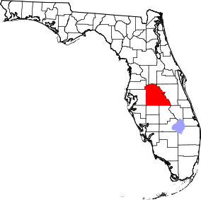 | |
| Towns | ||
| Village | ||
| CDPs | ||
| Unincorporated communities | ||
| Ghost town | ||
| Footnotes | ‡This populated place also has portions in an adjacent county or counties | |