Atwood, Kansas
| Atwood, Kansas | |
|---|---|
| City | |
|
Rawlins County Courthouse (2010) | |
| Motto: "Pride of the Prairie" | |
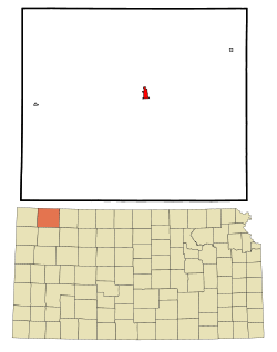 Location within Rawlins County and Kansas | |
 KDOT map of Rawlins County (legend) | |
| Coordinates: 39°48′32″N 101°2′29″W / 39.80889°N 101.04139°WCoordinates: 39°48′32″N 101°2′29″W / 39.80889°N 101.04139°W | |
| Country | United States |
| State | Kansas |
| County | Rawlins |
| Area[1] | |
| • Total | 1.10 sq mi (2.85 km2) |
| • Land | 1.04 sq mi (2.69 km2) |
| • Water | 0.06 sq mi (0.16 km2) |
| Elevation | 2,858 ft (871 m) |
| Population (2010)[2] | |
| • Total | 1,194 |
| • Estimate (2015)[3] | 1,187 |
| • Density | 1,100/sq mi (420/km2) |
| Time zone | Central (CST) (UTC-6) |
| • Summer (DST) | CDT (UTC-5) |
| ZIP code | 67730 |
| Area code(s) | 785 |
| FIPS code | 20-03150 [4] |
| GNIS feature ID | 0470991 [5] |
| Website | AtwoodKansas.com |

Atwood is a city in and the county seat of Rawlins County, Kansas, United States.[6] As of the 2010 census, the city population was 1,194.[7]
History
In 1875, T.A. Andrews and J.M. Matheny traveled to Rawlins County and started a town site about two miles east of the current city. The city of Attwood (with two t's) was named after Attwood Matheny, the 14-year-old son who accompanied his father on the journey. In 1882, the U.S. Post Office requested permission to drop one "t" thus becoming Atwood. In 1881, Atwood became the county seat of Rawlins County.[8][9]
Geography
Atwood is located at 39°48′32″N 101°2′29″W / 39.80889°N 101.04139°W (39.808971, -101.041370).[10] According to the United States Census Bureau, the city has a total area of 1.10 square miles (2.85 km2), of which 1.04 square miles (2.69 km2) is land and 0.06 square miles (0.16 km2) is water.[1]
Climate
According to the Köppen Climate Classification system, Atwood has a semi-arid climate, abbreviated "BSk" on climate maps.[11]
Area attractions
- Rawlins County Historical Museum, 308 State Street.
- Shirley Opera House (NRHP), 503 Main Street.
Area events
- Rawlins County Fair, held in July.
- Beaver Creek Festival, held annually in October.
- Annual Rod Run, held annually in May.
Demographics
| Historical population | |||
|---|---|---|---|
| Census | Pop. | %± | |
| 1890 | 450 | — | |
| 1900 | 486 | 8.0% | |
| 1910 | 680 | 39.9% | |
| 1920 | 919 | 35.1% | |
| 1930 | 1,106 | 20.3% | |
| 1940 | 1,408 | 27.3% | |
| 1950 | 1,613 | 14.6% | |
| 1960 | 1,906 | 18.2% | |
| 1970 | 1,658 | −13.0% | |
| 1980 | 1,665 | 0.4% | |
| 1990 | 1,388 | −16.6% | |
| 2000 | 1,279 | −7.9% | |
| 2010 | 1,194 | −6.6% | |
| Est. 2015 | 1,187 | [3] | −0.6% |
| U.S. Decennial Census | |||
2010 census
As of the census[2] of 2010, there were 1,194 people, 568 households, and 299 families residing in the city. The population density was 1,148.1 inhabitants per square mile (443.3/km2). There were 666 housing units at an average density of 640.4 per square mile (247.3/km2). The racial makeup of the city was 97.2% White, 0.2% African American, 0.3% Native American, 0.1% Asian, 1.0% from other races, and 1.3% from two or more races. Hispanic or Latino of any race were 2.9% of the population.
There were 568 households of which 20.2% had children under the age of 18 living with them, 43.0% were married couples living together, 6.2% had a female householder with no husband present, 3.5% had a male householder with no wife present, and 47.4% were non-families. 44.7% of all households were made up of individuals and 23.2% had someone living alone who was 65 years of age or older. The average household size was 2.03 and the average family size was 2.84.
The median age in the city was 50.9 years. 20.3% of residents were under the age of 18; 4.7% were between the ages of 18 and 24; 17% were from 25 to 44; 29.5% were from 45 to 64; and 28.6% were 65 years of age or older. The gender makeup of the city was 47.4% male and 52.6% female.
2000 census
As of the census[4] of 2000, there were 1,279 people, 577 households, and 347 families residing in the city. The population density was 1,229.7 people per square mile (474.8/km²). There were 708 housing units at an average density of 680.7 per square mile (262.8/km²). The racial makeup of the city was 98.67% White, 0.16% African American, 0.23% Native American, and 0.94% from two or more races. Hispanic or Latino of any race were 0.39% of the population.
There were 577 households out of which 23.4% had children under the age of 18 living with them, 52.0% were married couples living together, 6.6% had a female householder with no husband present, and 39.7% were non-families. 36.9% of all households were made up of individuals and 20.3% had someone living alone who was 65 years of age or older. The average household size was 2.12 and the average family size was 2.78.
In the city the population was spread out with 21.7% under the age of 18, 3.5% from 18 to 24, 21.7% from 25 to 44, 23.5% from 45 to 64, and 29.6% who were 65 years of age or older. The median age was 48 years. For every 100 females there were 89.8 males. For every 100 females age 18 and over, there were 84.2 males.
As of 2000 the median income for a household in the city was $30,221, and the median income for a family was $39,375. Males had a median income of $27,768 versus $19,063 for females. The per capita income for the city was $16,161. About 4.5% of families and 10.7% of the population were below the poverty line, including 10.8% of those under age 18 and 10.7% of those age 65 or over.
Education
Primary and secondary education
Atwood is part of Unified School District 105.[12] The district has two schools in Atwood:
- Rawlins County Junior/Senior High School
- Rawlins County Elementary School
Infrastructure
Transportation
Highway
US-36 and K-25 highways cross in Atwood.
Rail
Nebraska Kansas Colorado Railway passes through Atwood.
Airport
Notable people
- Mike Hayden, 41st Governor of Kansas 1987-1990.
- Ted Uhlaender, Major League Baseball outfielder for the Minnesota Twins, Cleveland Indians and Cincinnati Reds from 1965–1972.[13]
See also
References
- 1 2 "US Gazetteer files 2010". United States Census Bureau. Archived from the original on January 24, 2012. Retrieved 2012-07-06.
- 1 2 "American FactFinder". United States Census Bureau. Retrieved 2012-07-06.
- 1 2 "Annual Estimates of the Resident Population for Incorporated Places: April 1, 2010 to July 1, 2015". Retrieved July 2, 2016.
- 1 2 "American FactFinder". United States Census Bureau. Archived from the original on September 11, 2013. Retrieved 2008-01-31.
- ↑ "US Board on Geographic Names". United States Geological Survey. 2007-10-25. Retrieved 2008-01-31.
- ↑ "Find a County". National Association of Counties. Archived from the original on May 31, 2011. Retrieved 2011-06-07.
- ↑ "2010 City Population and Housing Occupancy Status". U.S. Census Bureau. Archived from the original on July 21, 2011. Retrieved March 27, 2011.
- ↑ Atwood history Archived November 7, 2011, at the Wayback Machine.
- ↑ Blackmar, Frank Wilson (1912). Kansas: A Cyclopedia of State History, Embracing Events, Institutions, Industries, Counties, Cities, Towns, Prominent Persons, Etc. Standard Publishing Company. p. 118.
- ↑ "US Gazetteer files: 2010, 2000, and 1990". United States Census Bureau. 2011-02-12. Retrieved 2011-04-23.
- ↑ Climate Summary for Atwood, Kansas
- ↑ USD 105 Archived September 26, 2011, at the Wayback Machine.
- ↑ Moss, Irv. "Uhlaender, big-league outfielder and scout, dies," The Denver Post, Friday, February 13, 2009. Archived May 24, 2011, at the Wayback Machine.
Further reading
- History of the State of Kansas; William G. Cutler; A.T. Andreas Publisher; 1883. (Online HTML eBook)
- Kansas : A Cyclopedia of State History, Embracing Events, Institutions, Industries, Counties, Cities, Towns, Prominent Persons, Etc; 3 Volumes; Frank W. Blackmar; Standard Publishing Co; 944 / 955 / 824 pages; 1912. (Volume1 - Download 54MB PDF eBook),(Volume2 - Download 53MB PDF eBook), (Volume3 - Download 33MB PDF eBook)
External links
| Wikimedia Commons has media related to Atwood, Kansas. |
- City
- County
- Schools
- USD 105, local school district
- Newspapers
- Photos and Videos
- Historic city photograph
- KWCH 'One of a Kind' Kansas road trip in 2011: Photos, Video 1, Video 2, Video 3, Video 4, Video 5. Towns included were Coldwater, Sterling, Atwood, Lucas, Marion.
- Maps
- Atwood City Map, KDOT
Municipalities and communities of Rawlins County, Kansas, United States | ||
|---|---|---|
| Cities | 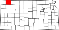 | |
| Unincorporated communities | ||
| Ghost town | ||