Attala County, Mississippi
| Attala County, Mississippi | |
|---|---|
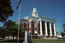 Attala County courthouse in Kosciusko | |
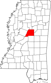 Location in the U.S. state of Mississippi | |
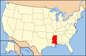 Mississippi's location in the U.S. | |
| Founded | 1833 |
| Seat | Kosciusko |
| Largest city | Kosciusko |
| Area | |
| • Total | 737 sq mi (1,909 km2) |
| • Land | 735 sq mi (1,904 km2) |
| • Water | 1.7 sq mi (4 km2), 0.2% |
| Population | |
| • (2010) | 19,564 |
| • Density | 27/sq mi (10/km²) |
| Congressional district | 2nd |
| Time zone | Central: UTC-6/-5 |
| Website |
www |
Attala County /ˈætələ/ is a county located in the U.S. state of Mississippi. As of the 2010 census, the population was 19,564.[1] Its county seat is Kosciusko.[2] Attala County is named for Atala, a fictional Native American heroine from an early-19th-century novel of the same name by François-René de Chateaubriand.
The historian of the American Civil War, John D. Winters, was born in Attala County in 1917.
Myrtis Methvin, mayor of Castor in Bienville Parish, Louisiana, from 1933 to 1945, and the second woman mayor in Louisiana, was born in Attala County in 1895.[3]
Geography
According to the U.S. Census Bureau, the county has a total area of 737 square miles (1,910 km2), of which 735 square miles (1,900 km2) is land and 1.7 square miles (4.4 km2) (0.2%) is water.[4]
Major Roads
 Mississippi Highway 12
 Mississippi Highway 14
 Mississippi Highway 19
 Mississippi Highway 35
 Mississippi Highway 43
- Natchez Trace Parkway
Adjacent counties
- Montgomery County (north)
- Choctaw County (northeast)
- Winston County (east)
- Leake County (south)
- Madison County (southwest)
- Holmes County (west)
- Carroll County (northwest)
National protected area
- Natchez Trace Parkway (part)
Demographics
| Historical population | |||
|---|---|---|---|
| Census | Pop. | %± | |
| 1840 | 4,303 | — | |
| 1850 | 10,991 | 155.4% | |
| 1860 | 14,169 | 28.9% | |
| 1870 | 14,776 | 4.3% | |
| 1880 | 19,988 | 35.3% | |
| 1890 | 22,213 | 11.1% | |
| 1900 | 26,248 | 18.2% | |
| 1910 | 28,851 | 9.9% | |
| 1920 | 24,831 | −13.9% | |
| 1930 | 26,035 | 4.8% | |
| 1940 | 30,227 | 16.1% | |
| 1950 | 26,652 | −11.8% | |
| 1960 | 21,335 | −19.9% | |
| 1970 | 19,570 | −8.3% | |
| 1980 | 19,865 | 1.5% | |
| 1990 | 18,481 | −7.0% | |
| 2000 | 19,661 | 6.4% | |
| 2010 | 19,564 | −0.5% | |
| Est. 2015 | 19,043 | [5] | −2.7% |
| U.S. Decennial Census[6] 1790-1960[7] 1900-1990[8] 1990-2000[9] 2010-2013[1] | |||
As of the 2010 United States Census, there were 19,564 people residing in the county. 56.2% were White, 42.0% Black or African American, 0.3% Asian, 0.2% Native American, 0.7% of some other race and 0.6% of two or more races. 1.7% were Hispanic or Latino (of any race).
As of the census[10] of 2000, there were 19,661 people, 7,567 households, and 5,380 families residing in the county. The population density was 27 people per square mile (10/km²). There were 8,639 housing units at an average density of 12 per square mile (5/km²). The racial makeup of the county was 58.34% White, 40.00% Black or African American, 0.17% Native American, 0.27% Asian, 0.65% from other races, and 0.57% from two or more races. 1.42% of the population were Hispanic or Latino of any race.
There were 7,567 households out of which 32.10% had children under the age of 18 living with them, 50.30% were married couples living together, 16.70% had a female householder with no husband present, and 28.90% were non-families. 26.40% of all households were made up of individuals and 14.50% had someone living alone who was 65 years of age or older. The average household size was 2.55 and the average family size was 3.07.
In the county the population was spread out with 25.90% under the age of 18, 9.20% from 18 to 24, 25.20% from 25 to 44, 22.40% from 45 to 64, and 17.30% who were 65 years of age or older. The median age was 37 years. For every 100 females there were 91.50 males. For every 100 females age 18 and over, there were 86.70 males.
The median income for a household in the county was $24,794, and the median income for a family was $30,796. Males had a median income of $26,180 versus $17,394 for females. The per capita income for the county was $13,782. About 18.30% of families and 21.80% of the population were below the poverty line, including 28.60% of those under age 18 and 21.40% of those age 65 or over.
Communities
Cities
- Kosciusko (county seat)
Towns
Unincorporated communities
See also
References
- 1 2 "State & County QuickFacts". United States Census Bureau. Retrieved September 2, 2013.
- ↑ "Find a County". National Association of Counties. Archived from the original on May 31, 2011. Retrieved 2011-06-07.
- ↑ Mildred Methvin. "Myrtis Lucille Gregory Methvin". Lafayette, Louisiana: genealogy.com. Retrieved October 6, 2014.
- ↑ "2010 Census Gazetteer Files". United States Census Bureau. August 22, 2012. Retrieved November 2, 2014.
- ↑ "County Totals Dataset: Population, Population Change and Estimated Components of Population Change: April 1, 2010 to July 1, 2015". Retrieved July 2, 2016.
- ↑ "U.S. Decennial Census". United States Census Bureau. Archived from the original on May 11, 2015. Retrieved November 2, 2014.
- ↑ "Historical Census Browser". University of Virginia Library. Retrieved November 2, 2014.
- ↑ "Population of Counties by Decennial Census: 1900 to 1990". United States Census Bureau. Retrieved November 2, 2014.
- ↑ "Census 2000 PHC-T-4. Ranking Tables for Counties: 1990 and 2000" (PDF). United States Census Bureau. Retrieved November 2, 2014.
- ↑ "American FactFinder". United States Census Bureau. Archived from the original on September 11, 2013. Retrieved 2008-01-31.
External links
Coordinates: 33°05′N 89°35′W / 33.09°N 89.58°W
 |
Carroll County | Montgomery County | Choctaw County | |
| Holmes County | |
Winston County | ||
| ||||
| | ||||
| Madison County | Leake County |
Municipalities and communities of Attala County, Mississippi, United States | ||
|---|---|---|
| Cities | | |
| Towns | ||
| Unincorporated communities | ||
| Ghost town | ||
.svg.png)