Atsimo-Atsinanana
| Atsimo-Atsinanana Region | |
|---|---|
| Region | |
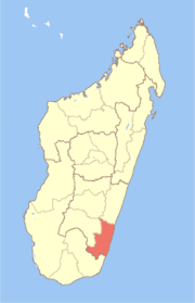 Location in Madagascar | |
| Country |
|
| Capital | Farafangana |
| Area | |
| • Total | 18,863 km2 (7,283 sq mi) |
| Population (2014) | |
| • Total | 923,068 |
| • Density | 49/km2 (130/sq mi) |
| Time zone | EAT (UTC3) |
Atsimo-Atsinanana (South East) is a region in Madagascar. Its capital is Farafangana. The region used to be part of the Fianarantsoa Province.
The region extends along the southern part of the east coast of Madagascar. It is bordered by Vatovavy-Fitovinany and Haute Matsiatra (North), Ihorombe (West) and Anosy (South).
The estimated population in the region as of 2004 was 621,200,[1] but had grown to an estimate of 851,545 by 2011.[2] It is among the poorest regions in the country, with a poverty rate of 83.9% according to a 2005 government report.[3]
Administrative divisions
Atsimo-Atsinanana region is divided into five districts, which are sub-divided into 90 communes.[4]
- Befotaka Sud District (chief city: Befotaka)
- Farafangana District (Farafangana)
- Midongy-Atsimo District
- Vangaindrano District (Vangaindrano)
- Vondrozo District (Vondrozo)
Nature
References
- ↑ "Madagascar: Profil des marchés pour les évaluations d'urgence de la sécurité alimentaire" (PDF) (in French). Archived from the original (PDF) on 2007-09-26. Retrieved 2008-02-24.
- ↑ Geohive, population data from INSTAT, Retrieved 18 August 2014
- ↑ Republic of Madagascar: Poverty Reduction Strategy Paper Annual Progress Report, International Monetary Fund (August 2006) (IMF Country Report No. 06/303) (poverty data is from 2005 Periodic Household Survey conducted by the Institut National de la Statistique de Madagascar (INSTAT))
- ↑ Rapport de mise en oeuvre des Priorites Regionales - Region Atsimo Atsinanana (2010) (pdf includes district and commune map)
Coordinates: 22°49′08″S 47°49′48″E / 22.819°S 47.83°E
This article is issued from Wikipedia - version of the 10/21/2016. The text is available under the Creative Commons Attribution/Share Alike but additional terms may apply for the media files.