Atlas, California
| Atlas | |
|---|---|
| unincorporated community | |
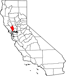
 Atlas  Atlas Location in California | |
| Coordinates: 38°25′45″N 122°14′53″W / 38.42917°N 122.24806°WCoordinates: 38°25′45″N 122°14′53″W / 38.42917°N 122.24806°W | |
| Country |
|
| State |
|
| County | Napa County |
| Elevation[1] | 1,719 ft (524 m) |
Atlas is an unincorporated community in Napa County, California.[1] It lies at an elevation of 1719 feet (524 m).[1] Atlas is located 8 miles (13 km) north-northwest of Mount Vaca and 1.5 miles (2.4 km) south-southeast of Atlas Peak.[2]
Atlas, named for nearby Atlas Peak, was founded as a resort community.[2] The Atlas post office opened in 1893, moved in 1894, and closed in 1934.[2]
References
This article is issued from Wikipedia - version of the 7/5/2016. The text is available under the Creative Commons Attribution/Share Alike but additional terms may apply for the media files.