Atlanta, Missouri
| Atlanta, Missouri | |
|---|---|
| City | |
 Location of Atlanta, Missouri | |
| Coordinates: 39°53′57″N 92°28′49″W / 39.89917°N 92.48028°WCoordinates: 39°53′57″N 92°28′49″W / 39.89917°N 92.48028°W | |
| Country | United States |
| State | Missouri |
| County | Macon |
| Area[1] | |
| • Total | 0.34 sq mi (0.88 km2) |
| • Land | 0.34 sq mi (0.88 km2) |
| • Water | 0 sq mi (0 km2) |
| Elevation | 902 ft (275 m) |
| Population (2010)[2] | |
| • Total | 385 |
| • Estimate (2012[3]) | 382 |
| • Density | 1,132.4/sq mi (437.2/km2) |
| Time zone | Central (CST) (UTC-6) |
| • Summer (DST) | CDT (UTC-5) |
| ZIP code | 63530 |
| Area code(s) | 660 |
| FIPS code | 29-02422[4] |
| GNIS feature ID | 0713468[5] |
Atlanta is a city in Macon County, Missouri, United States. The population was 385 at the 2010 census.
History
Atlanta was platted in 1858.[6] The community was named after Atlanta, Georgia.[7] A post office called Atlanta has been in operation since 1868.[8]
On May 6, 1935 a TWA airlines DC-2 en route from Los Angeles, California, to Washington, D.C., became lost in heavy fog near Atlanta. Running out of fuel, the pilot attempted an emergency landing but crashed, which killed four and injured several others. Among the dead was United States Senator Bronson Cutting (R-New Mexico). The crash made national headlines and prompted Congress to commission the Copeland Committee report on air traffic safety.[9]
Geography
Atlanta is located at 39°53′57″N 92°28′49″W / 39.89917°N 92.48028°W (39.899177, -92.480161).[10] According to the United States Census Bureau, the city has a total area of 0.34 square miles (0.88 km2), all of it land.[1]
Demographics
| Historical population | |||
|---|---|---|---|
| Census | Pop. | %± | |
| 1910 | 523 | — | |
| 1920 | 536 | 2.5% | |
| 1930 | 497 | −7.3% | |
| 1940 | 507 | 2.0% | |
| 1950 | 438 | −13.6% | |
| 1960 | 386 | −11.9% | |
| 1970 | 377 | −2.3% | |
| 1980 | 441 | 17.0% | |
| 1990 | 411 | −6.8% | |
| 2000 | 450 | 9.5% | |
| 2010 | 385 | −14.4% | |
| Est. 2015 | 374 | [11] | −2.9% |
2010 census
As of the census[2] of 2010, there were 385 people, 157 households, and 104 families residing in the city. The population density was 1,132.4 inhabitants per square mile (437.2/km2). There were 189 housing units at an average density of 555.9 per square mile (214.6/km2). The racial makeup of the city was 97.1% White, 0.3% African American, 0.5% Native American, and 2.1% from two or more races. Hispanic or Latino of any race were 0.3% of the population.
There were 157 households of which 38.2% had children under the age of 18 living with them, 45.2% were married couples living together, 14.6% had a female householder with no husband present, 6.4% had a male householder with no wife present, and 33.8% were non-families. 30.6% of all households were made up of individuals and 14.7% had someone living alone who was 65 years of age or older. The average household size was 2.45 and the average family size was 2.99.
The median age in the city was 37.9 years. 28.1% of residents were under the age of 18; 5.1% were between the ages of 18 and 24; 28.6% were from 25 to 44; 22.1% were from 45 to 64; and 16.1% were 65 years of age or older. The gender makeup of the city was 47.3% male and 52.7% female.
2000 census
As of the census[4] of 2000, there were 450 people, 173 households, and 129 families residing in the city. The population density was 1,314.2 people per square mile (511.0/km²). There were 199 housing units at an average density of 581.2/sq mi (226.0/km²). The racial makeup of the city was 99.11% White, 0.22% Native American, and 0.67% from two or more races.
There were 173 households out of which 39.3% had children under the age of 18 living with them, 56.1% were married couples living together, 15.6% had a female householder with no husband present, and 25.4% were non-families. 23.1% of all households were made up of individuals and 8.7% had someone living alone who was 65 years of age or older. The average household size was 2.60 and the average family size was 3.03.
In the city the population was spread out with 30.7% under the age of 18, 7.8% from 18 to 24, 30.7% from 25 to 44, 18.9% from 45 to 64, and 12.0% who were 65 years of age or older. The median age was 31 years. For every 100 females there were 90.7 males. For every 100 females age 18 and over, there were 84.6 males.
The median income for a household in the city was $33,571, and the median income for a family was $39,271. Males had a median income of $25,673 versus $16,875 for females. The per capita income for the city was $14,940. About 7.3% of families and 9.1% of the population were below the poverty line, including 8.5% of those under age 18 and 11.5% of those age 65 or over.
Churches
The Atlanta community is home to several churches including: The Atlanta First Baptist Church, Atlanta Christian Church, Atlanta United Methodist Church, and Church WithOut Walls, a non-denominational ministry based in the community. Three rural churches are also a part of the Atlanta community: Mt. Zion East United Methodist Church, and Southern Baptist congregations at Chariton Ridge and Mt. Tabor.
Annual events
The community hosts the "Atlanta Homecoming" every June in the town center, Atterberry Park.
Education
The local school district, Atlanta C-3 school district averages about 200 students, K-12, annually.
Recreation
Visitors to the area include hunters seeking whitetail deer and turkey. Hotels are available in Macon, Missouri, La Plata, Missouri and Kirksville, Missouri as well.
Notable residents
- Andrew Taylor Still, considered the founder of Osteopathic Medicine, lived in the Atlanta area (rural Barnesville) as a young adult and local teacher. Barnesville is in the Atlanta, MO zip code and school district.
- Milton Romjue, Democrat, served in the United States Congress from 1917-1921 and again 1923-1943. He attended local schools and lived east of the Love Lake area, now in the Atlanta, MO zip code and school district. Romjue was a postal service reformer and supporter of President Franklin D. Roosevelt's New Deal legislation - especially Social Security, help for farmers, and wounded military veterans. The congressman also worked closely with other Missouri politicians to secure for the state military bases like Fort Leonard Wood and Camp Crowder as America geared up for World War II. Romjue also served as a county judge.
- Samuel W. "Wat" Arnold, Republican, served in the United States Congress from 1943-1949. Arnold served as a Superintendent at Atlanta Schools and later returned to the area in 1905 to start a fifty-plus year career as a lumberman. He later moved "Arnold Lumber Company" to Kirksville, MO, seeking a larger customer base. He defeated Atlanta area native Rep. Milton Romjue in the general election of 1942.
External links
- City of Atlanta
- Historic Sanborn Map of Atlanta (1918) from University of Missouri Digital Library
References
- 1 2 "US Gazetteer files 2010". United States Census Bureau. Archived from the original on 2012-01-24. Retrieved 2012-07-08.
- 1 2 "American FactFinder". United States Census Bureau. Retrieved 2012-07-08.
- ↑ "Population Estimates". United States Census Bureau. Archived from the original on 2013-06-17. Retrieved 2013-05-30.
- 1 2 "American FactFinder". United States Census Bureau. Archived from the original on 2013-09-11. Retrieved 2008-01-31.
- ↑ "US Board on Geographic Names". United States Geological Survey. 2007-10-25. Retrieved 2008-01-31.
- ↑ "Macon County Place Names, 1928–1945". The State Historical Society of Missouri. Archived from the original on June 24, 2016. Retrieved October 30, 2016.
- ↑ Eaton, David Wolfe (1916). How Missouri Counties, Towns and Streams Were Named. The State Historical Society of Missouri. p. 191.
- ↑ "Post Offices". Jim Forte Postal History. Retrieved 30 October 2016.
- ↑ "Transport: Ceiling Zero". Time Magazine. May 13, 1935. Retrieved September 27, 2009.
- ↑ "US Gazetteer files: 2010, 2000, and 1990". United States Census Bureau. 2011-02-12. Retrieved 2011-04-23.
- ↑ "Annual Estimates of the Resident Population for Incorporated Places: April 1, 2010 to July 1, 2015". Retrieved July 2, 2016.
- ↑ "Census of Population and Housing". Census.gov. Archived from the original on May 11, 2015. Retrieved June 4, 2015.
Municipalities and communities of Macon County, Missouri, United States | ||
|---|---|---|
| Cities | 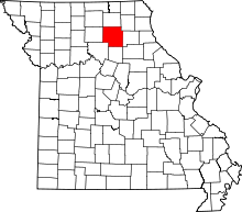 | |
| Townships | ||
| CDP | ||
| Other unincorporated communities | ||
| Ghost towns | ||