Athabasca Sand Dunes Provincial Park
| Athabasca Sand Dunes Provincial Park | |
|---|---|
|
IUCN category Ib (wilderness area) | |
|
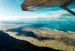
Flyover of the sand dunes | |
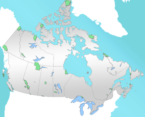 Location of Athabasca Sand Dunes Provincial Park in Canada | |
| Location |
|
| Nearest city | Uranium City |
| Coordinates | 59°03′47″N 108°57′44″W / 59.06306°N 108.96222°WCoordinates: 59°03′47″N 108°57′44″W / 59.06306°N 108.96222°W |
| Area | 1,925 square kilometres (743 sq mi) |
| Established | October 1988 |
| Governing body | Saskatchewan Parks |
The Athabasca Sand Dunes Provincial Park was created to protect the Athabasca sand dunes, a unique geophysical land feature in the boreal shield ecosystem of the province of Saskatchewan.[1] The Athabasca Sand Dunes are the most northerly active sand dune formation on Earth.[2]
It first came to attention that it should be a protected area in 1969,[1] finally becoming the Athabasca Sand Dunes Provincial Wilderness Park on August 24, 1992.
The park extends for 100 kilometres along the southern edge of Lake Athabasca. The sand dunes are 400 to 1,500 metres long, and their maximum height is approximately 30 metres[2] The park is accessible by float plane or boat only.[3]
The William River flows through the western section of the park ending in a large river delta. The McFarlane River flows through the far eastern section of the park. The park goes around the Fond du Lac 231 (First Nations Reserve) located on the McFarlane River. The First Nations village of Fond du Lac is located 44 km (27 miles) by air from the park's eastern boundary.[4]
Geology
The Athabasca Sand Dunes are estimated to be approximately 8,000 years old, formed near the end of the last glacial period.[2] As glaciers receded, meltwater washed enormous quantities of sand, silt and sediment from local sandstone into Lake Athabasca, whose water level was at the time much higher than currently. As the lake level declined to its modern depth, the large sand deposits were revealed.[2] The sand dunes are quite unstable, being constantly shifted by winds, which push the dunes at the edges of the area into the surrounding forest. Evidence also suggests that fires have greatly influenced the winds shaping the dunes.[5] Unlike the dunes closer to the lake, the southern dunes are in fact quite stable relative to other areas in the region.[5]
Geological features that can be found in the region include eskers and beach ridges.[2] In addition, portions of the Williams River in the region flow through braided channels in the sand. Some of the dune field is covered with desert pavement.
The dunes are generally parabolic in shape. The sand almost completely covers the underlying sandstone deposits; the bedrock is around 20 metres below ground on average.[5] The entire sandy region, including areas south of the dunes, serves as an enormous aquifer, which as a result significantly affects plant life and dune development.
Endemic flora
This area is home to rare and endemic plant species not found anywhere else. Some of the plants which may be found in this area are field chickweed (Cerastium arvense), felt-leaved willow (Salix silicicola), Mackenzie hairgrass (Deschampsia mackenzieana), Tyrrell’s willow (Salix planifolia tyrrellii), and floccose tansy (Tanacetum huronense var. floccosum).[2]
See also
Maps
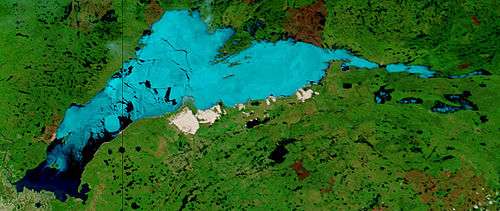 Lake Athabasca (data date June 9, 2002):[6] the ice is light blue, dark blue is open water and the sand dunes located within the park on the south shore are white. |
- Mouth of the William River 59°8′48.16″N 109°18′28.02″W / 59.1467111°N 109.3077833°W
- Mouth of the McFarlane River 59°12′38.21″N 107°57′44.75″W / 59.2106139°N 107.9624306°W
- Map
References
- 1 2 "Athabasca Sand Dunes". Canadian Parks and Wilderness Society. Archived from the original on November 29, 2011. Retrieved 2013-07-25.
- 1 2 3 4 5 6 Stewart, Iain (2006). "Athabasca Sand Dunes". Encyclopedia of Saskatchewan. Canadian Plains Research Centre, University of Regina. Retrieved 2011-11-10.
- ↑ "Saskatchewan 2011-2012 Provincial Parks Guide" (PDF). Saskatchewan Ministry of Tourism, Parks, Culture and Sport. 2006: 43. Retrieved 2011-11-10.
- ↑ Jones, Art (2006). "Saskatchewan's Athabasca Sand Dunes". Western Canadian Online Outdoors News. Ya'Gotta Communications & Marketing. Retrieved 2011-11-10.
- 1 2 3 The Ecoregions of Saskatchewan. Regina: University of Regina Press. 1998. p. 54. ISBN 0889770972.
- ↑ "GREAT SLAVE LAKE AND LAKE ATHABASCA, CANADA". Retrieved 2013-01-25.